|
        |
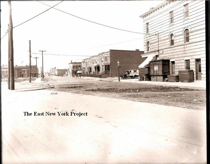
Ashford StreetSouth of Atlantic Avenue. For north of Atlantic Avenue look under Zone 2. |
||
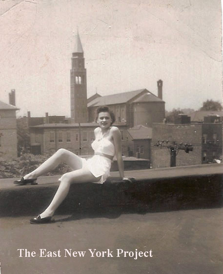 |
Courtesy of Joey "Roni" Perrone this shot from the 1940s was taken from a rooftop looking west towards St. Michael's. The picture is of his mother Bea and Roni recalls they lived on Cleveland Street near Liberty, but my guess is that it was taken on a roof on the east side of Ashford Street near Liberty. The angles and proximity of St. Michael's is not consistent with a shot from Cleveland Street, a block further away. | |
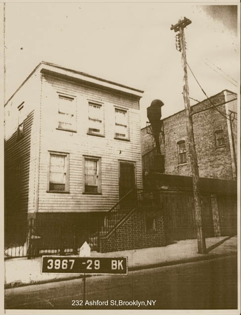 |
Joann Montgomery supplied a tax photo of 232 Ashford, between Atlantic and Liberty. There was a factory next door that we know from research was once "Twinem Aprons" back in the 1920s. Joann checked with her relatives and it was the Empire Can Company for many years. There was a coat factory on the top floor as well, and her cousin recalls getting free coats from the factory! | |
 |
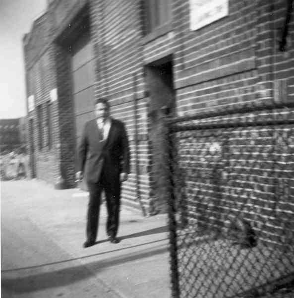 |
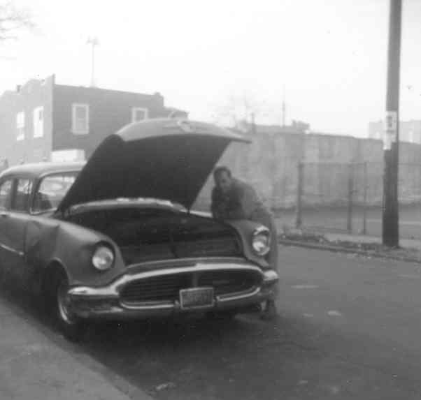
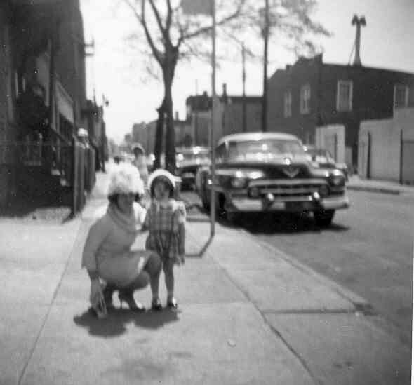
Kudos to Linda Amato who is the first non family member to contribute old family photos to the site! The first shot is circa 1963, a shot of her dad by the family car. That is St. Michael's playground on the right. The second shot is from 1962, looking north up towards Liberty Ave. on Ashford St. |
 |
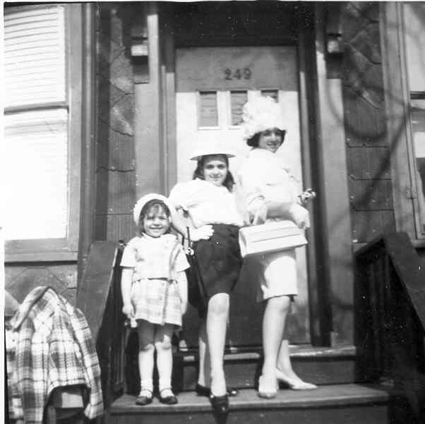 |
Completing Linda's set, this is a view looking south down Ashford, and a view of 249 Ashford. |
 |
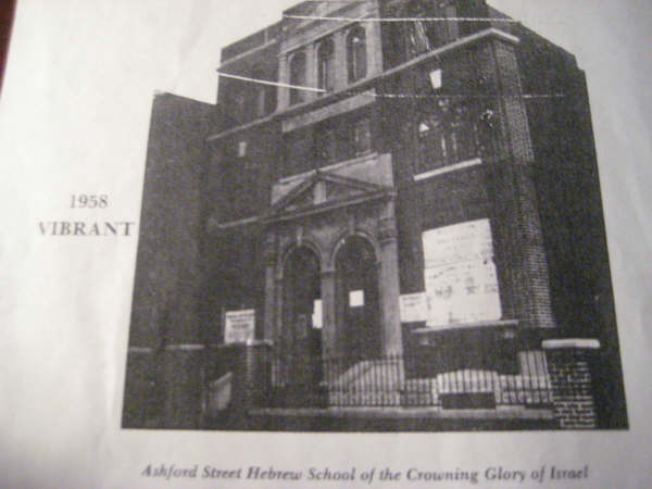 |
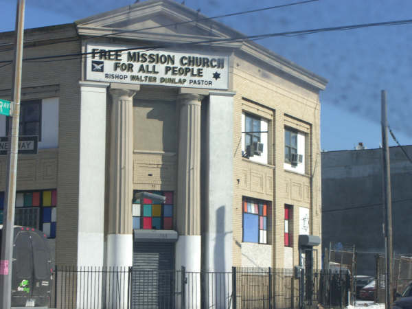
Demetrius Pestun and I continue our quest to ID every synagogue. Pictured on the left at 336 Ashford (near Pitkin) was Chevre Chayei Adam. The structure was built by the Tabor Lutheran Congregation for the Swedish immigrants in the area, somewhere around 1900. The building still stands, now a church again, for the East New York Westley congregation. On the right, an image of the Crowning Glory of Israel's Talmud Torah, located at 479 Ashford and now gone.To see a picture of the synagogue, visit the Lost Synagogues page |
 |
 |
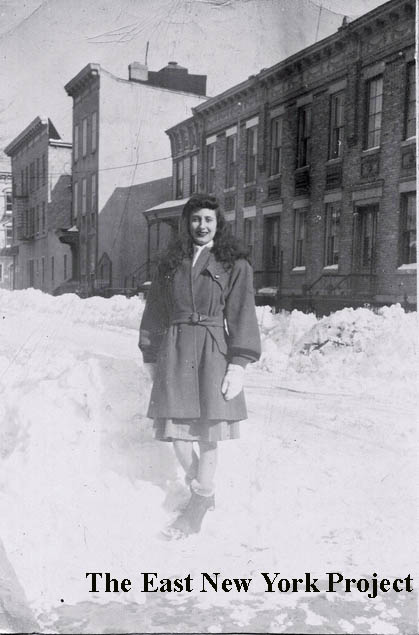
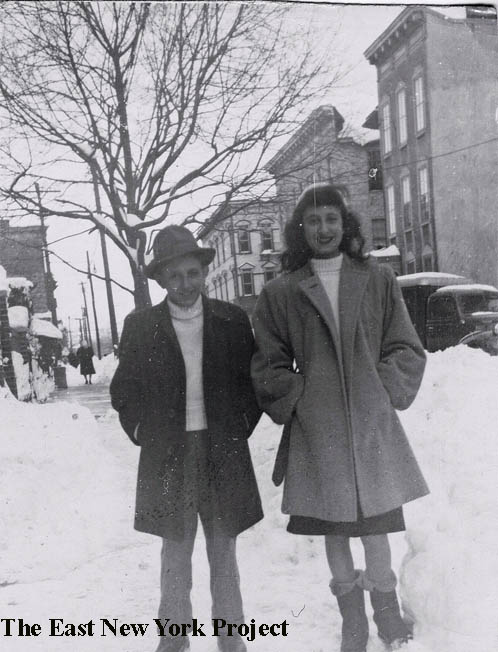
Ronnie Amerise lived right next door, at 338 Ashford (now gone). These two shots are the same angle, looking north to what was then the synagogue. That's his sister and Dad after the blizzard of 1947, and his sister on the right in 1954. Notice the changes in the building; that was not brick, but the faux-brick shingle popular during that time. |
 |
 |
Another shot from Ronnie of his sister after the 1947 blizzard, looking north up the east side of the block towards Glenmore Avenue. The building on the corner is gone, but I used a Google Maps image to show the other buildings are still there and in good shape. |
 |
 |
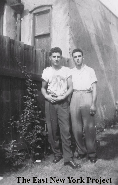
On the left, Ronnie and his friend Tony DiNapoli in front of 338 Ashford in 1947, with a partial view of the house now gone. On the right, Ronnie and his sister Rosemany in 1947, another view north towards Glenmore Avenue. |
 |
 |
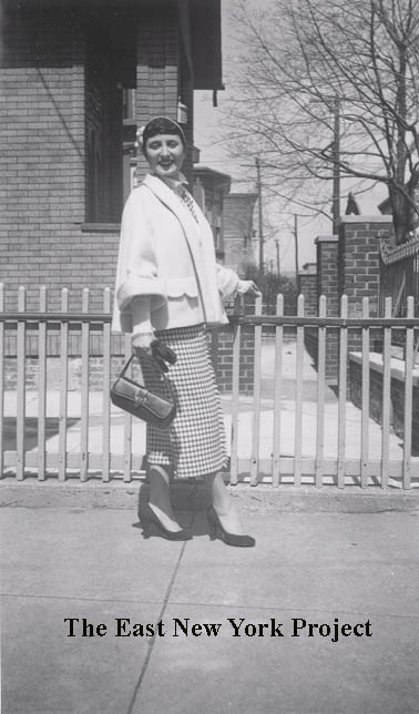
Ronnie also sent one view looking south down the east side of Ashford towards Pitkin Avenue (note the el in the background). That's his sister Rosemary posing next to an unusual planter by a house across from 338 Ashford Street. On the right, Ronnie and his buddy Guy DeMarco in the rear yard of 338 Ashford with the synagogue in the background, circa 1950. |
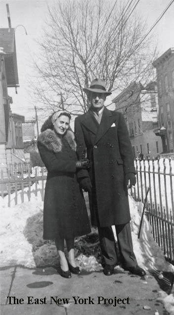 |
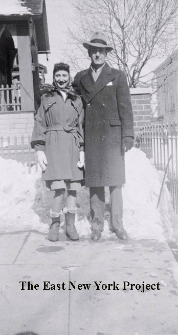
Completing the series, Ronnie's mom and dad in front of 338 Ashford in 1947. Ronnie adds a story about his mother. |
|
 |
Rod maggio supplied this shot of Ashford looking north to Pitkin around 1952, with friends Bob Velez and Sal "Moose" Russo.. | |
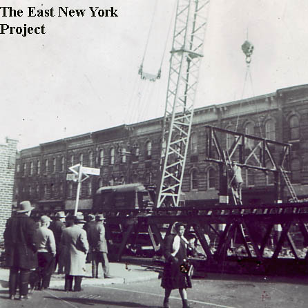 |
Fulton El removal, 1958 Ronnie Amerise informed me this view is looking south at the corner of Ashford and Pitkin. This portion of the line became obsolete when the IND line out to Euclid (opened 1948) was connected to this elevated line out near the city line in 1956. We're guessing on the year; Mike O'Leary noted el ermoval started in January of 1958 and thos could even be 1959. |
|
 |
Ronnie himself was born at 381 Ashford in 1935 - the brick building on the right with the 'star'. An interesting architectural touch I will need to research. Ronnie supplied the photo from 2007. | |
 |
 |
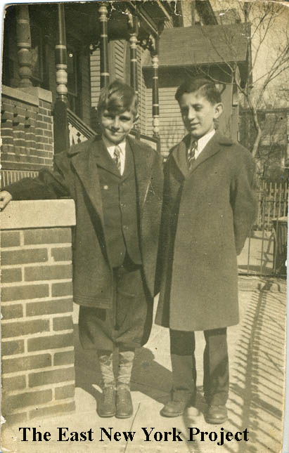
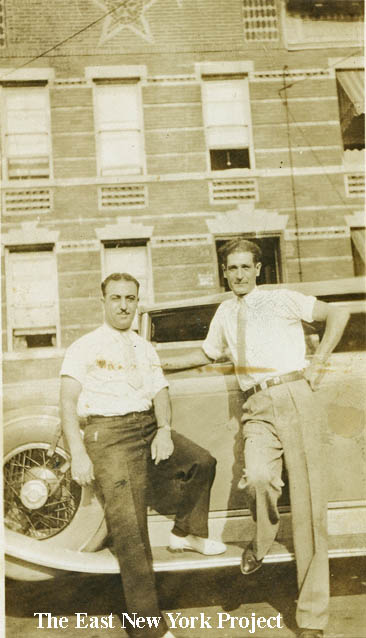
Ronnie helps the research by supplying two shots taken in 1935, when he was born. On the left is his Dad and Godfather, and on the right, Ronnie and hos Godparents. The building I believe dates to 1901. I wonder if there are other examples of this brickwork still around. |
 |
 |
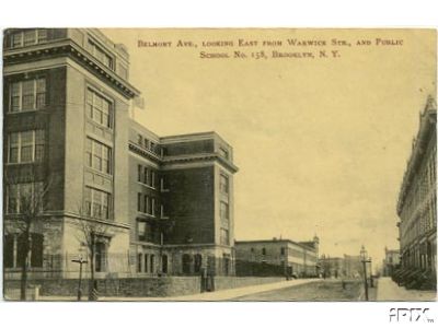
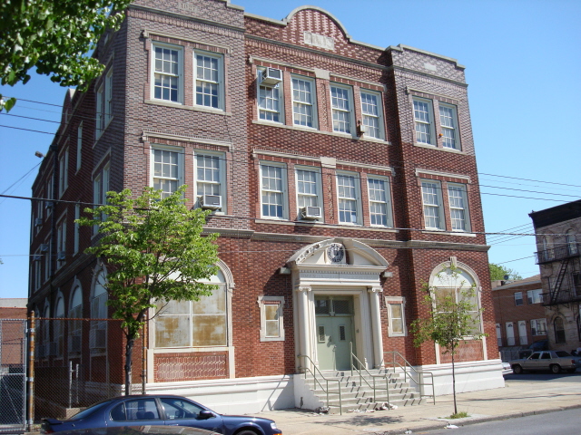
Belmont Ave, Looking East from Warwick St. and P.S. 158 Dated: 1911 Maker: Wm. Fick Status: Need Public School 158, Belmont Ave. and Warwick Street Maker: Wm. Fick Dated: Unk Status: Own(BG) Located on Belmont between Warwick and Ashford, the official address is 400 Ashford. Construction began in 1907, and the school opened Sep. 14, 1908. It is still in use today as an elementary school for 564 students. |
 |
 |
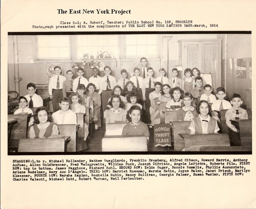
P.S. 158 Thrift Honor Class, 1954 Phyllis (Annunziatta) Esposito sent in this 1954 shot of Mr. Scharf's class 5-1. Bob Reddington attended PS 158 and this picture was taken in front of the school during a festival circa 1950. |
 |
 |
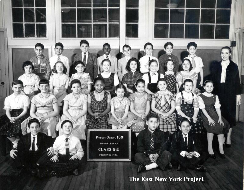
P.S. 158 Class 5-2, 6-2, 1956 Angela (Crescimanno) Affisco sends over her 1956 class picture; she supplies a partial key and even IDs site fan Dan Bivona. On the right, Angela Stein sends her class picture from 1956 as well.  |
 |
P.S. 158 Class 6-4, 1956 Amazingly, we have another 1956 class picture. his come courtesy of Vincent Anello, who is seated in the first rown on the far left. Vincent found fellow classmate Carl Catalano (top row, second from left) in our directory. Vincent points out the Boy Scout troop was no. 311, and they met in the basement of Trinity Episcopal Church on Arlington and Schenck. |
|
 |
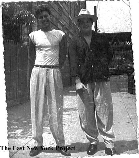
"Stylin'", 1952 This shot is less about location (s/e corner Belmont and Ashford, Carl's candy store)than it is about fashion and where to shop in 1952. That's Pete Chiappone and Rod Maggio- from Rod; "In this 1952 pic , Pete was wearing rust pants, white belt, white shirt I'm wearing the Aqua pants, brown belt, chocolate brown and aqua shirt, brown featherweights (shoes) featherweights and french toe shoes were the most "coveted" style then you got them @ Thom McCann, AS Beck, and Kellers on s/side of Liberty Ave Warwick-Jerome; many called them Kellers Kardboards, but they were real leather too, later on you may have progressed to Stadler/Florsheim irregulars/slightly damaged (shoes) coulda been got on Orchard St for 1/2 the price J & G Clothes (custom and ready made) I hadda pair of wool gabardine Aqua pants made there for $16.00 with a 2 inch hi-rise, crossloops(for belt), 26 inch knee, 16 inch peg (cuff) saddle stitch down leg seam, and pistol shaped pocket flaps (rear) Popular colors back then were, purple, canary yellow, electric blue, rust/copper, chocolate brown, chartruese(kinda light lime), powder blue, black, maroon (burgundy/wine) fire engine red, and kelly green and of course different colored belts to match some guys had different color combo's for loops, pockets and stitching.........the girls wore tight fitting sweaters of same colors "shocking pink" then, was later called "hot pink" |
|
 |
 |
Synagogues Demetrius also sent in this one of a former Talmud Torah, located at Ashford and Sutter. Built for the Bank of the U.S., which went bust, Zevi Isseroff informed me it was a Prudential Life Insurance branch in the 1960s. On the right, not a temple but a school, Yeshiva Toras Chaim. Built in 1927 on the northwest corner of Belmont and Jerome, now owned by the Board of Education and is the Community School for Comprehensive Education. Rod Maggio recalls they used to turn the lights on for Yeshiva on Friday nights, and sometimes crashed the weddings held in the basement ballroom! |
 |
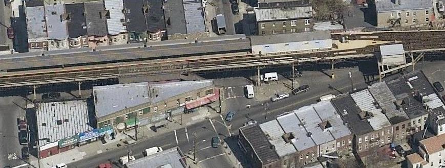 |
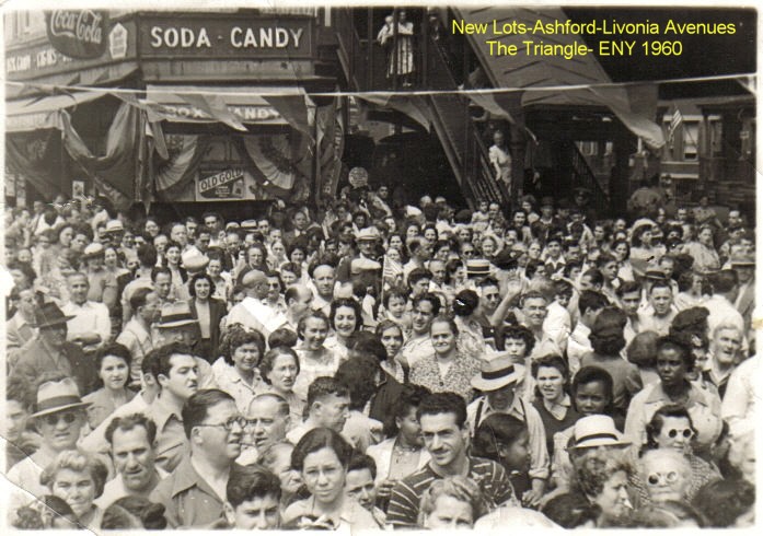
The "Triangle" The area where Livonia Avenue comes in to meet New Lots Avenue, right around Ashford Street, is known as the 'Triangle' for obvious reasons. Jack Magat sent this great photo of the intersection in 1960. It's a bit of a mystery on why it is so crowded, other than being at the foot of the train station. Harold Moskowitz recognized some relatives in the image and believes this was taken much earlier, in the 1940s, and the attire and hairstyles seem consistent with that. We have speculated there could have been some form of War rally taking place. The Local Live image on the right shows the triangle from above in 2006. |
 |
 |
The "Triangle" The 1917 image on the right shows the triangle before the elevated line is constructed. The view is west from New Lots, and recently built homes occupy the area. On the right is the William Hopkins house, which sat in this area back when it was all his farm. As a a reminder we have a series of historical views along New Lots thanks to Peter Rapalje who submitted this image along with a number of others which can be seen on the New Lots pages in Zones 5 and 6. |
 |
 |
Ashford off Linden Boulevard, 1934 These two views were taken the same day by P.L. Sperr. Both views are looking east; the first is more northeast, toward the IRT yards and I believe the roof of P.S. 202 is visible in the distance. Then the camera is turned right and we can see Linden Boulevard on the left. A vegetable garden is fenced off as houses encroach all around. |