        |
Elderts LaneOnce known as Enfield Street, short for "End Field" because it was the end of the fields for New Lots. Named after Johannes Eldert, who owned the farmland that bordered the road. His farm was part of "Lot#1" of the original 47 Lots granted in the 1677 charter which created the "New Lotts of Midwout". Elderts Lane is unique in that the west side of the street is in Brooklyn while the east side is in Queens.Click on thumbnails to enlarge |
||

|
Going to the Trot Maker: Currier&Ives Dated: 1869 Two early landmarks sat on the north side of Jamica Plank Road by Elderts Lane. Snedekers Roadhouse and Woodruff's stables were both tied to the Union Race Course in what is now Woodhaven. Currier and Ives did 2 lithographs of this spot in 1869. "Going to the Trot" was an idealized view of this location featuring trotting fans heading to the Course. The hotel was no longer known as Snedekers by 1869 but it was the most well known roadhouse in those times. The original lithographs are worth thousands. | |
|
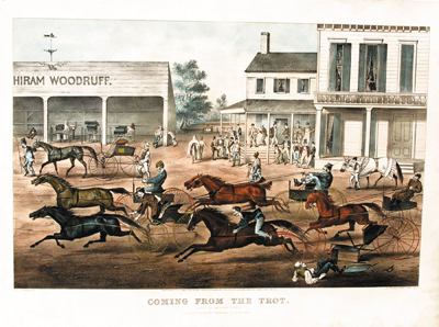
Coming From the Trot Maker: Currier&Ives Dated: 1869 The second lithograph depicts the location just east of the Brooklyn-Queens border on the north side of Jamaica Avenue, next to Snedeker's. Hiram Woodruff was a world famous trainer and racer of trotters. Hiram died in 1867 and was buried in Cypress Hills Cemetery. His most famous trotter was Dexter, and the grounds here became the location of Dexter Park in 1880. | |

|
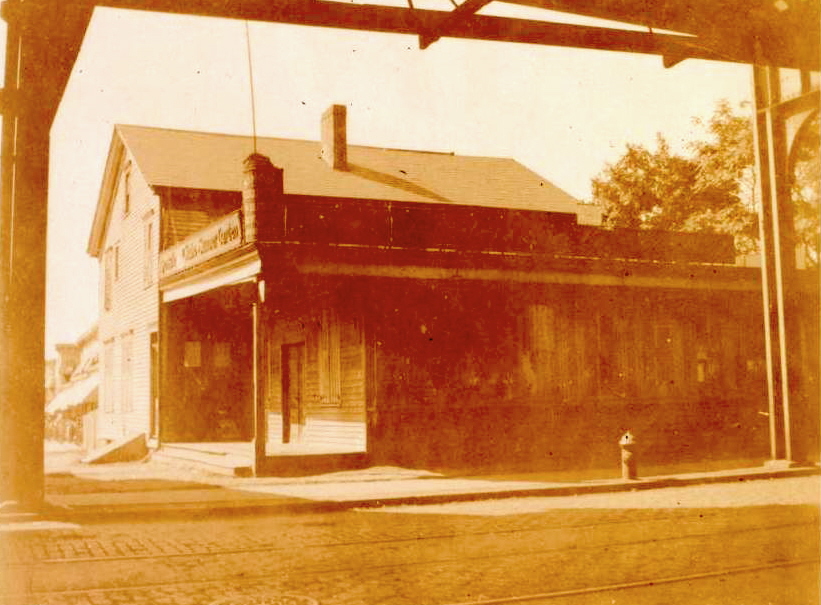
Snedeker's Roadhouse Maker: Brooklyn Eagle Undated Status: Own: (BG) Snedeker's roadhouse, a combination tavern, restaurant and hotel, was very popular in its day. Run by John R. Snedeker since 1812, then by his son John I., it was a popular destination for 'sleighing parties'. It was said that the Brooklyn/Queens border ran right through the barroom. I found a New York Times reference to the famous racetrack Union Course being refered to as 'Snediker's Union Course' back in 1854.  | |
|
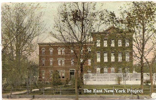
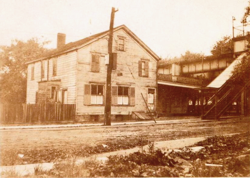
Old Truant Home Maker:American News Co. Co. Dated:1911 Status: Own(RG) The city bought the roadhouse in 1869, and these is some conflicting stories about the demise of the building. Some sources say the roadhouse came down in 1870 after the city built this brick structure. But a story in Harper's from 1880 describes a visit to the home that includes a description of Snedeker's as an adjunct building for the school. The brick structure was built in 1870. Some interesting details; the address is given as Long Island. The border in those days tended to shift around a bit. Note no presence of the el, which was not extended along Jamaica Ave until 1918. It is also a color card, rare for those days. The structure was badly damaged in a fire on Dec. 1, 1924 leading to its replacement by the Franklin K. Lane High School. Although I am grateful for the great photo, who sends postcards of Truant Homes? >
| |
|
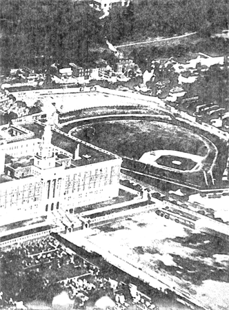
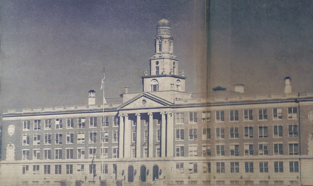
| Franklin K Lane High School,1950 After considering several locations, including the site of the House of the Good Shepherd, the city builds Franklin K. Lane High School in this location in 1937. The school's property actually spans the Brooklyn-Queens border. We have page devoted to Franklin K. Lane here.That's Dexter Park next to it in the 1951 photo. |
|
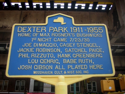
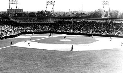
| Dexter Park Technically Dexter Park sits across the border in Queens. Visit the Dexter Park page for more pictures and its colorful history. |
|
|
This structure on the southwest corner of Jamaica and Elderts Lane was Cobbs Store, dating back to the 1850s, with the Snedeker Roadhouse across the road. These shots date to 1923 shortly before it was demolished. |
|
|
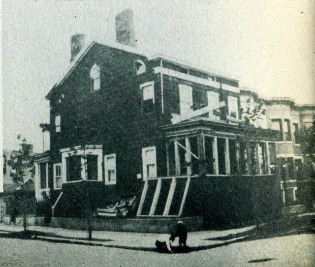
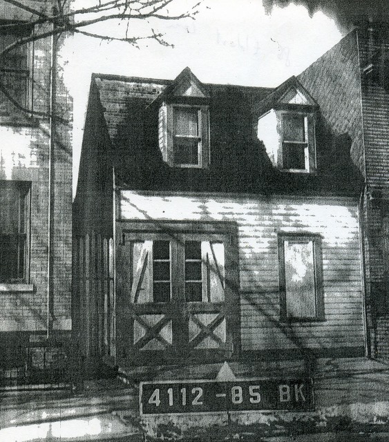
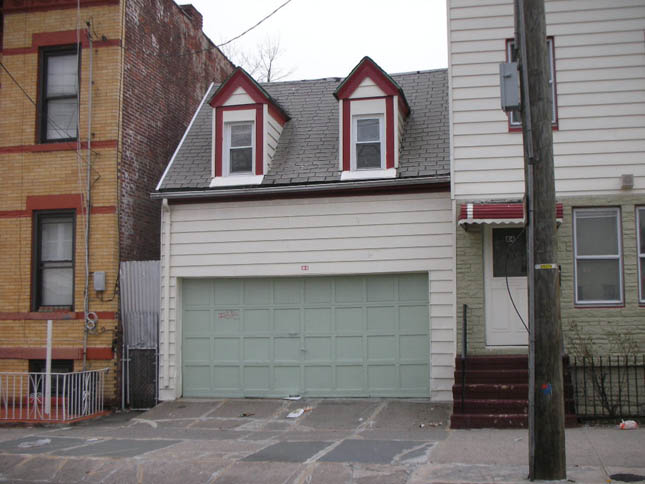
Shaw Hotel In 1838 Bill Shaw erected a hotel on the southeast corner of Jamaica Plank Road and Elderts Lane, across from Snedeker's hotel. In 1909 the structure was sawn in half, with one half being placed on the southwest corner of Hemlock Street and Danforth, and the other half place at the other end of Danforth on the southeast corner of Crescent and Danforth. Apparently the hotel had an eight foot hallway running down the middle which made the separation easier. These shots are of the houses in 1940. |
 |
|
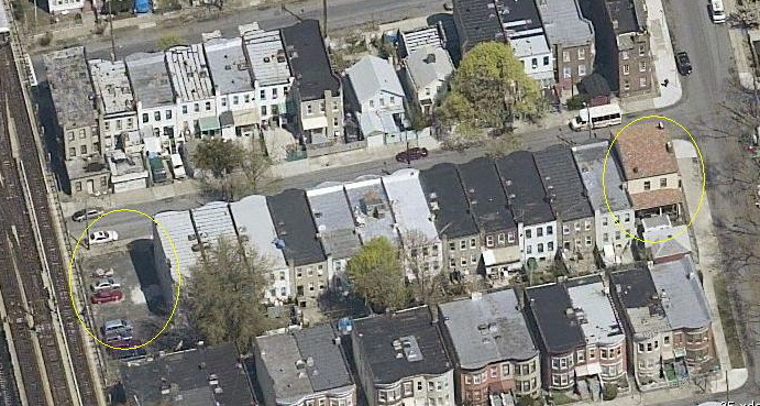
28 Danforth, on the corner of Hemlock, is still standing today, making it perhaps the second oldest home in East New York. In the aerial image on the right, you can see the other house is gone. I do not have a date yet as to when it was removed. |
|
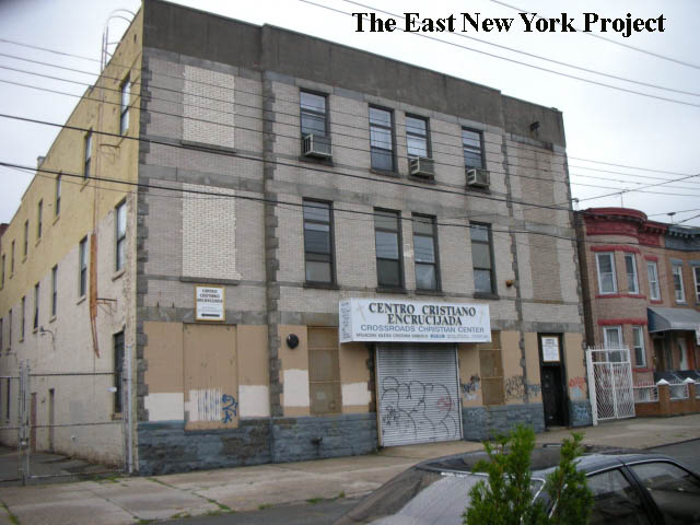
This large brick structure stands at 72 Elderts, and started life as a an Abraham&Strauss department store, or perhaps warehouse (I have not found any evidence yet that it ever served as retail space). Yvonne Temann recalls it was a moving and storage warehouse in the 1960s. 1929 records listed the location as Stewart Storage. | |
 |
|
I stumbled on this image while researching tax photos. It looks like an early carraige barn. Much to my surprise the structure is still standing as seen in the image on the right. Something to investigate. |
 |
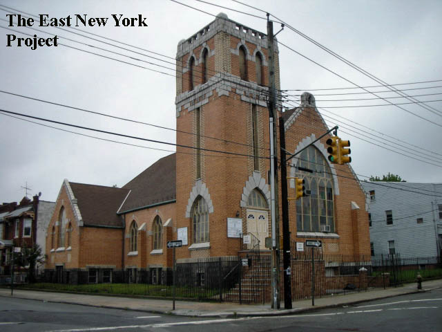 |
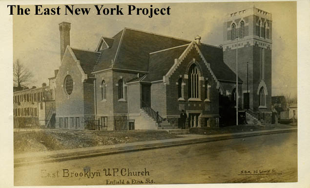
First United Presbyterian Church of East Brooklyn Maker: Unk Dated: Unk Status:Own (RG) Located on the northwest corner of Etna Street and Elderts Lane. The congregation was formed in 1902 and for the first six months services were held in a tent. A wood structure was built in this location and served the congregation until 1911 when this building was erected. I've added a 1905 Eagle article with some early historical facts under the 'history' button. 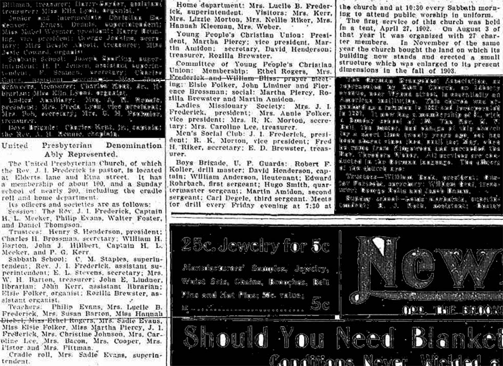
|
|
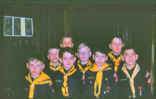
| Cub Pack 179 Roger Gapinski sends over a shot of a den from Cub Pack 179 (from Ray Tuthill), which used to meet at this church. "Front row (l to r) Danny Le Porin,,John Volz,,Clinton Fraser,,Alan Minor. Back Row (l to r) Me, Ray Tuthill,,Eugene Linlau,,Gerry Gapinski,,Richie Volz." "scout meetings were held in the basement. Camped occasionally on the side yard. Scouting in the city!!!" That's not ENY on the right, but Lake Orbach in Camp Pouch, Staten Island where the Scout Troop used to visit. " My son Thomas Gapinski was shocked when I told him we took the EL, then the ferry, then a bus, and finally marched to camp." |
|  |
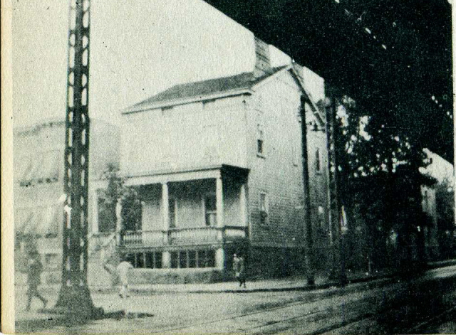
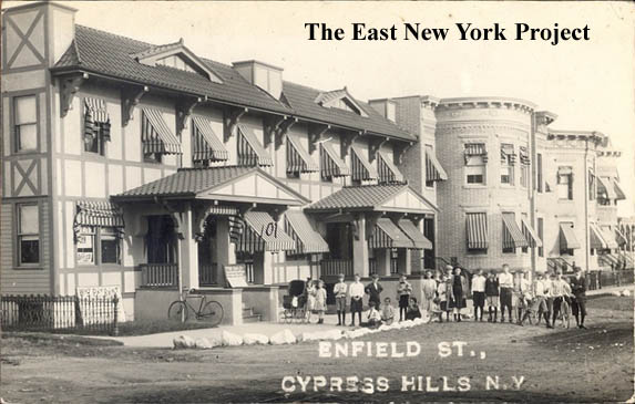
Enfield St., Cypress Hills NY Maker: Unk Dated: 1912 Status:need The view is catty-corner across from the church, making it the southeast corner of Elderts Lane and Etna Street. Laurie Marino corrected me, in that this is the Queens side of Elderts Lane and thus the cross Street is 88th Road. The houses are still there but the Tudor details are gone. |
| 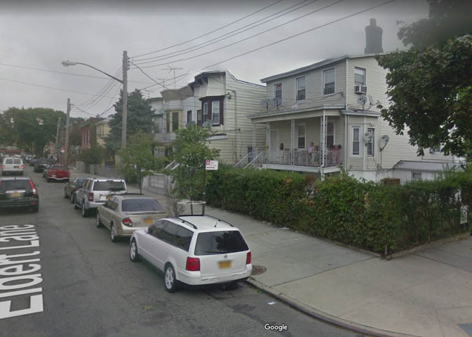 |
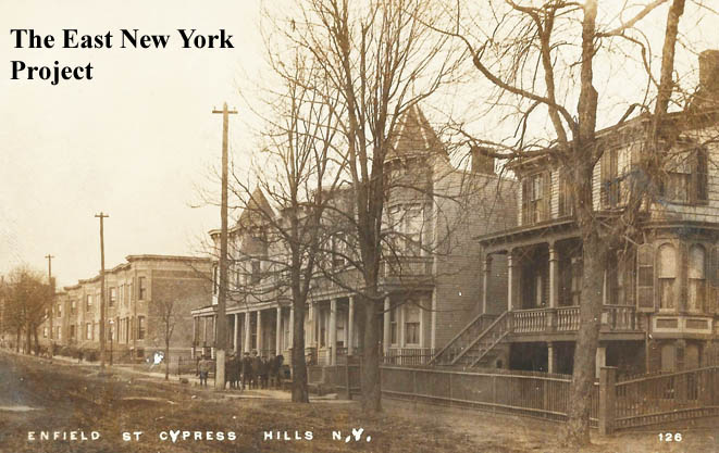
Enfield St., Cypress Hills NY Maker: RPPC Dated: 1910 Status:own This is also the Queens (east side) of the border. The view is north of 88th Avenue, and they are still standing today as seen in the 2018 view on the right. |

|

|
"Anfield Street", Cypress Hills A typo; Elderts Lane was known as "Enfield Street" at the time. The view is north to Ridgewood Ave. In the distance the spire of First United is visible. Oddly, neither Google or Bing Streetviews cover this block, so the update view is looking west. |
|
|
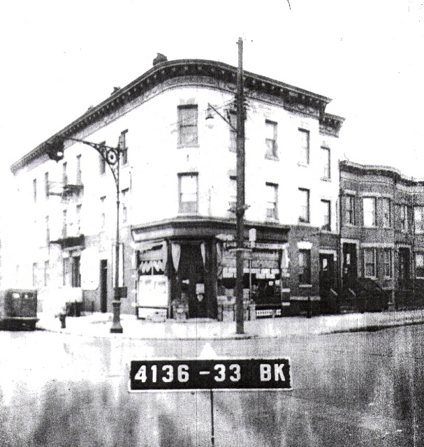
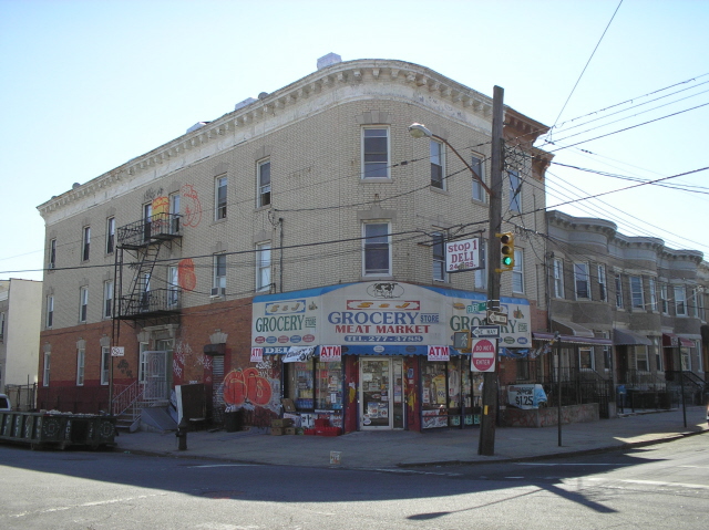
Ridgewood Ave and Elderts Lane 1939 tax photo and 2006 shot of the southwest corner courtesy of Neil Sullivan. |

|
John Eldert House, 1895. I have to include at least one Eldert house. Located on the east side of what we now call Elderts Lane, it was built in 1770. Removed some time in the 1920s. | |