|
        |
Jamaica AvenueThough I have placed many pictures of Jamaica Avenue on the various street pages, I have often received requests to have a dedicated page. I have tried to balance duplicating those images with new material.
|
|||
 |
Jamaica Avenue, looking southwest toward Broadway, 1941 We start at the westernmost point of Jamaica Avenue, right where it turns from Broadway. I am immediately confronted by a mystery. Just to the left of center, behind the parked cars, appears to be lot with two formal posts and a gate surrounding it What could it have been?. |
||
 |
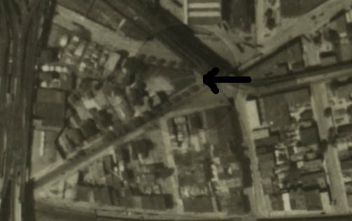 |
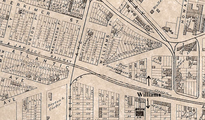
The answer lies in knowing the history of that lot. It belonged to James Williams, and the 1873 map on the left shows the location of his house. The house is eventually moved to the southwest corner of the lot and serves as Trinity Hospital. In the 1924 aerial on the right, we can still see the landscaped walkway that would have led up to the house, and I believe those posts were the entrance to his property. For more on Trinity Hospital, visit the Trinity Hospital page. | |
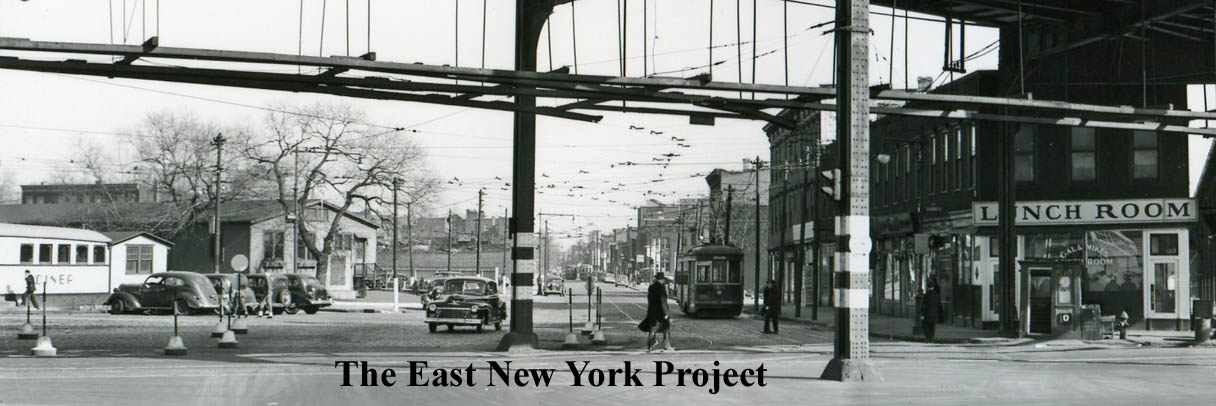 |
Flipping the view, we are now looking down Jamaica Avenue from Broadway in the 1940s. | ||
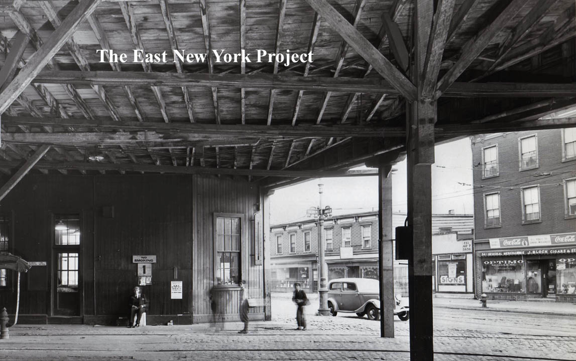 |
The wooden trolley barns occupied the area by Jamaica Avenue and Fanchon Place prior to the current bus depot. This view shows the wooden support structure with a view out onto the south side of Jamaica Avenue in 1939. | ||
 |
 |
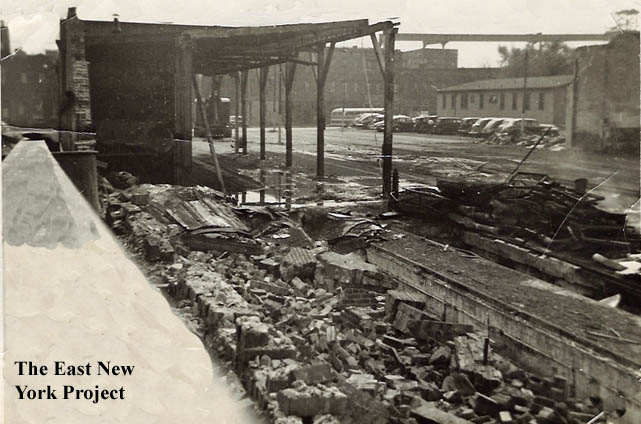
Destruction of trolley barns, Jamaica Avenue This shot comes from Jack Auld. Jamaica Avenue is in the background and the path on the right is part of the yard. On the opposite side of that building on the right is the defunct Gillen Place, which was removed for the transit garage. The Brian Merlis archive photo on the right is a view west down Jamaica from Sheffield Avenue in 1939, and I used that building on the right to help with the orientation. |
|
 |
>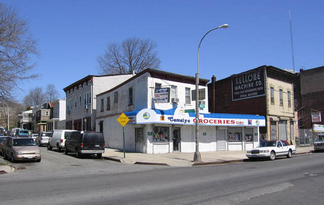 |
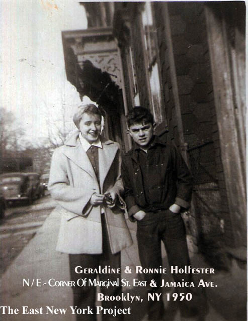
Marginal Street East. Jack also sends a closer look at Marginal Street East, and also an update view of that corner, looking north across Jamaica Avenue from New Jersey Avenue. That "Kellobe Machine Co." sign appears on a few websites that specialize in finding the old faded ads on the sides of buildings. |
|
 |
 |
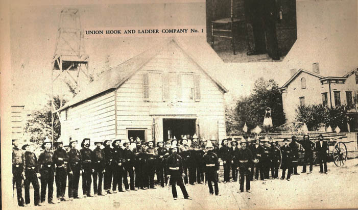
Pennsylvania and Jamaica Ave. Union Hook and Ladder#1 was formed in 1862 and the firehouse was located on Plank Road (Jamaica Ave). In this 1870's image we can see the Altenbrand house on the right. Louis Altenbrand was a civic leader and supporter of the volunteer firefighters, and the firehouse was on his land. The firehouse was replaced around 1900 by Kloster's brewery, which became the L. Brietkopf hotel and Brewery in 1912. The view on the right is north up Pennsylvania towards Jamaica from Fulton Street in 1929. By then the brewery was closed. The City demolished it to create access to the new Interboro Parkway. |
|
 |
 |
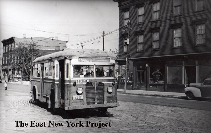
Jamaica Avenue, 1940s Looking toward the south side of Jamaica Avenue by Georgia Avenue in 1948, that 3 story wood frame building housing the Georgia Tavern is long gone. On the right is an earlier image from the 1940s when the trolleys were still running. It's hard to see, but at the bottom of the Interboro Parkway sign it reads; "Use Parking Lights Only" |
|
 |
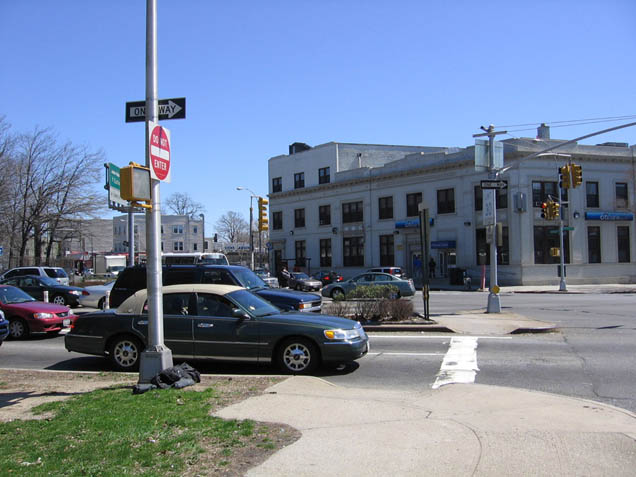 |
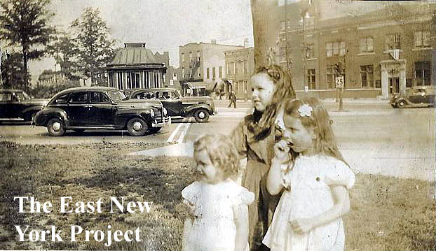
Pennsylvania and Jamaica Ave. On the left, Jack Auld supplies a photo of the intersection from the late 1930s. The view is southeast. The small building at the entrance served as a parkway police booth. The girls in white are Geraldine and June Theurer, the third girl is unidentified. In the background, the building with the fire escape is 94 Jamaica Ave., Jack's residence. The Citizen's Bank is visible on the right. On the right, Jack supplies an updated view from the same angle. |
|
 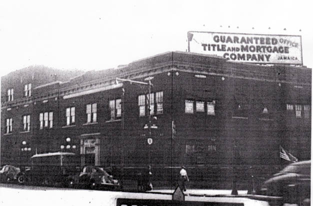 |
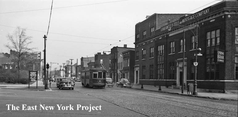
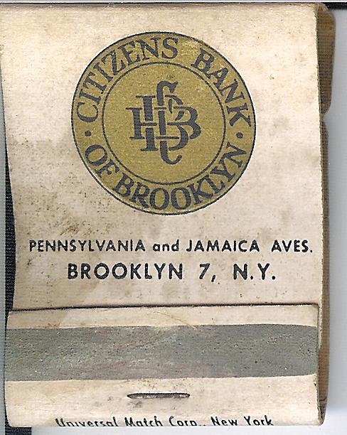 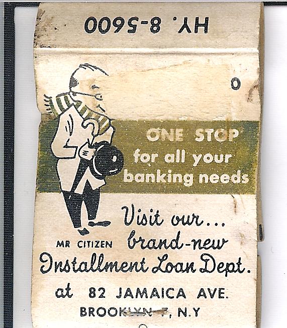 Citizen's Bank of Brooklyn Citizen's Bank of BrooklynI don't have much history on the bank, located on the southeast corner of Jamaica and Pennsylvania Avenues. Frederick Heidenreich, author of Old Days and Old Ways in East New York, was president of the bank. In the 1923 Brian Merlis archive image on the left, you can see Heidenreich's name at the bottom of the sign. Thanks to Joanne Montgomery for the 1941 tax photo. My brother Lou supplied the matchbooks (1960s?) and we know today Citibank has a branch in this building. |
||
 |
A book outtake; a view looking west down Jamaica Avenue from Vermont Street in 1923. | ||
 |
This 1980s view is of 113 Jamaica Avenue, the north side between Marginal Street and Vermont. Rich Nowak tipped me off that Tony Danza used to own this car wash at one time. "When we walked by there as kids there was always water and detergent on the sidewalk!". | ||
 |
 |
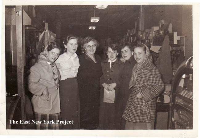
Candy Store, 1950 From Joann Montgomery, these shots were taken in a candy store on Jamaica Avenue between Hendrix and Schenck circa 1950. Known as "Angermeirs". On the left , "Mary,Alice, Mrs Angermeir,Joan,Nancy, Josephine aka ' Bunny' ". On the right, Mr and Mrs. Angermeir.Gerry Livreri reminisces; "I had gotten very close to Mr and Mrs A when I lived there (Hendrix Street). I delivered groceries for the deli that was next door and every Saturday morning me and Billy who worked for the butcher on the other side of A's would have breakfast with Mr A first thing in the morning." |
|
 |
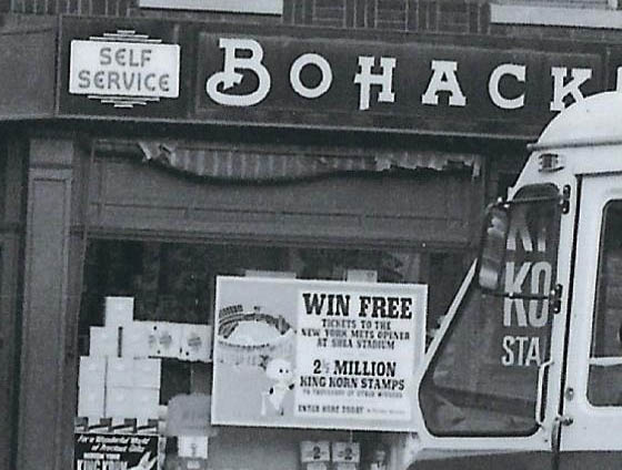 |
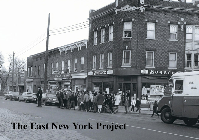
Jamaica and Hendrix Street, 1964 The view is looking southeast. Angermeir's Candy Store is visible on the left. In the window of Bohack's is a bit of baseball history; a poster advertising tickets for the first regular-season game to be played at the new Shea Stadium. Closeup on the right. |
|
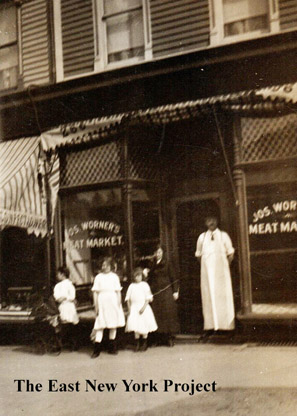 |
" width="180" /> | Joseph Worner's Meat Market, 266 Jamaica Avenue, 1912 The butcher shop to the right of Angermeiers is a business that goes back to at least 1912 as seen in this real photo post card. It appears the storefront is the only entrance to the building attached on both sides, implying you had to enter the store to access the second floor. By the time of the 1940 tax photos the front was altered to add a doorway to the second floor on the left . |
|
 |
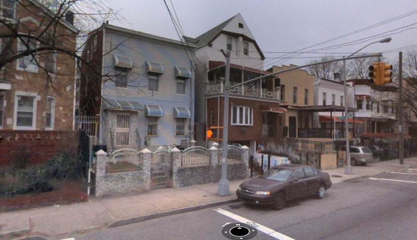 |
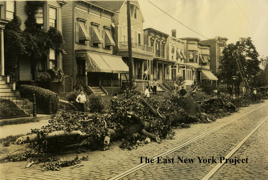
The 1923 image on the left is of the north side of Jamaica Avenue by Jerome Street after a hurricane struck. On the right is an update photo from 2013 of the same houses. | |
 |
 |
Jamaica and Warwick, 1917 A classic view, we not only see the cobblestones and trolley tracks we also see "evidence" of horse drawn vehicles as well. A bit of trivia; the triangular space created by the start of Ridgewood Avenue was once considered for the location of the "Dawn of Glory" statue now in Highland Park. |
|
 |
 |
Warwick Street entrance, Highland Park The 1895 picture on the left is not an entrance to the park; in 1895 the land was still private and the property belonged to the Schenck family. The strip of park on the left of the entrance path, seen in the 2005 photo, was a favorite spot of ours for playing pick-up baseball games. |
|
 |
Schenck Farm This early view of the Schenck farm from the 1880s couldn't be taken today; even the south side of Jamaica Avenue hasn't been developed at this point. The property is sold to the city by Schenck's heirs after 1900, but the house remained for another 50 years. We have a Schenk House page with more pictures and history. |
||
 |
We have an entire zone devoted to Highland Park so I am not going to repeat that much here- but in this 1956 shot from my aunt we can see the Stootholf house in the background. As far as we know, it is the oldest standing residence in ENY until it was demolished in 2022, dating to the early 1800's. | ||
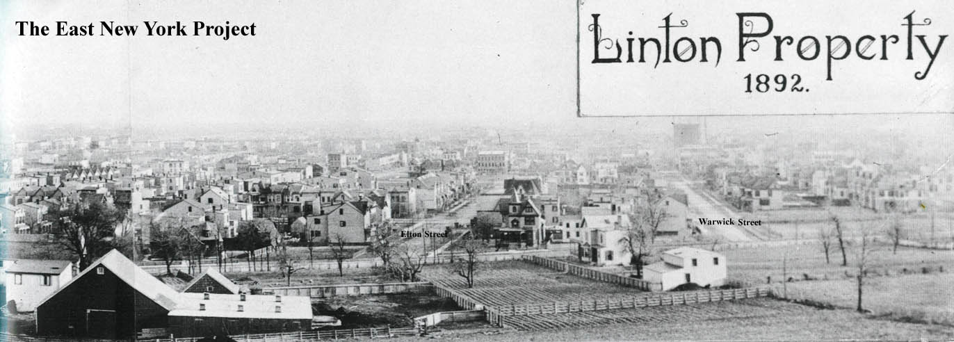 |
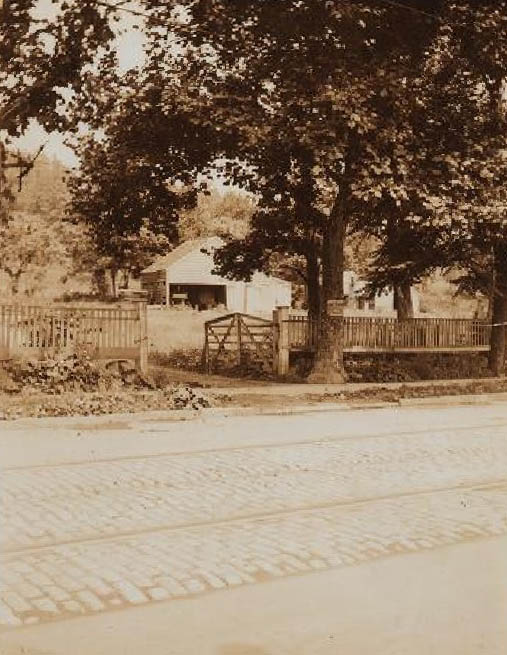
Jamaica Plank Road, 1892 Rick Constant sent this great panoramic view showing Lower Highland Park when it was still farms and Jamaica Ave. Ed Linton was a property developer who lived in the Stoothoff house at one time. The farm in view here belonged to Isaac Snediker and his descendants. |
||
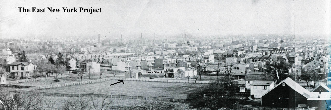 |
Jamaica Plank Road, 1892 Continuing the panoramic view, the arrow points to the Essex Street tollbooth which burned down in 1894. |
||
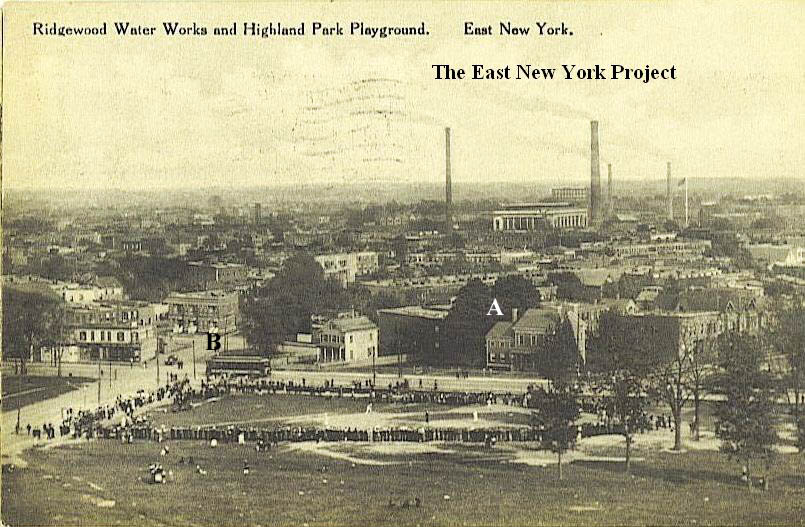 |
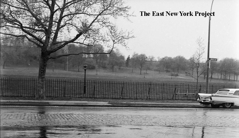
A real favorite of mine, this circa 1910 view has a few historic markers, including the water works towering in the background. I labeled (A) the Van Siclen house, on the corner of Shepherd Avenue, which would be torn down for the YMCA. I also labeled (B), and electric trolley car on Jamaica Avenue. Aside from an experimental run in Virginia, Jamaica Avenue was the United States' first electrified trolley route. Transportation was always key along the Avenue; not only was it the route out to Jamaica, but visiting cemeteries was a significant pastime and thus the routes to the cemeteries were in big demand. | ||
 |
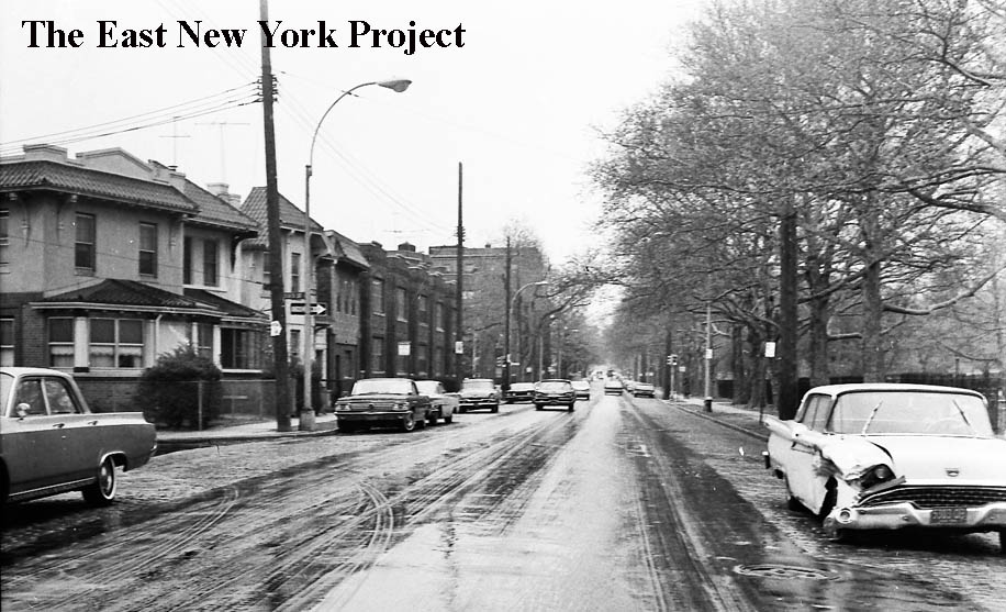 |
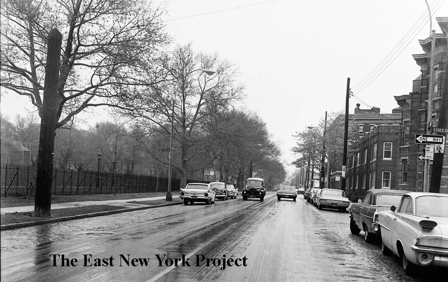
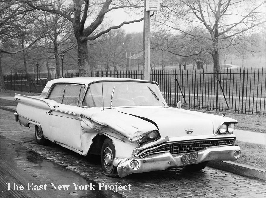
Jamaica Avenue and Essex Street, 1966 From our "acidents" series. On the left the view is east toward the YMCA, on the right the view is the opposite direction west. Highland Park’s ballfields are visible in the background. |
|
 |
 |
These shots from the same accident evoke specific memories of the exposed cobblestone (and in some places, exposed trolley tracks) that presented a real danger to bike-riding 10 year olds (me!) at that time. Those stones, by the way, were later removed. The slope up to Highland Park made errant throws on the ballfield an adventure, and also represented the last drop for sleigh riders coming down from the top. | |
 |
 |
YMCA We have a YMCA page with lots of pictures, this one here is a color slide from the 1940s sent in by great contributor Peter Stango. On the right is a view of the outdoor facility next door on Jamaica and Highland Place in 1975. |
|
 |
A quaint view looking down Force Tube Avenue from Jamaica Avenue in 1923. Force Tube Avenue was named for the "Force Tubes" or pipes, beneath the roadway which led from the pumping stations up to the reservoir. | ||
 |
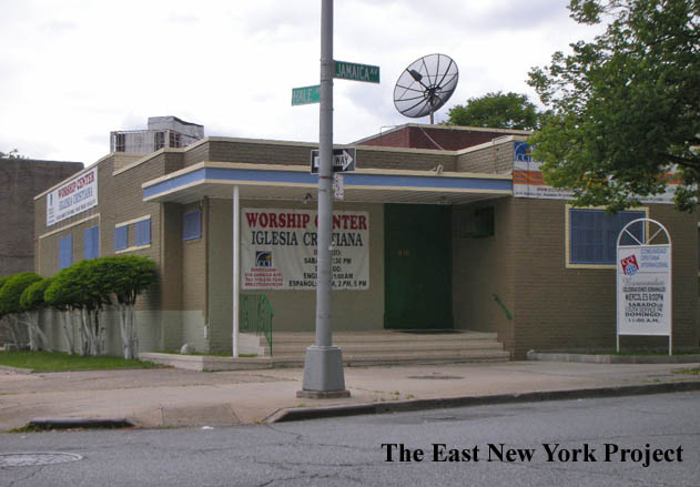 |
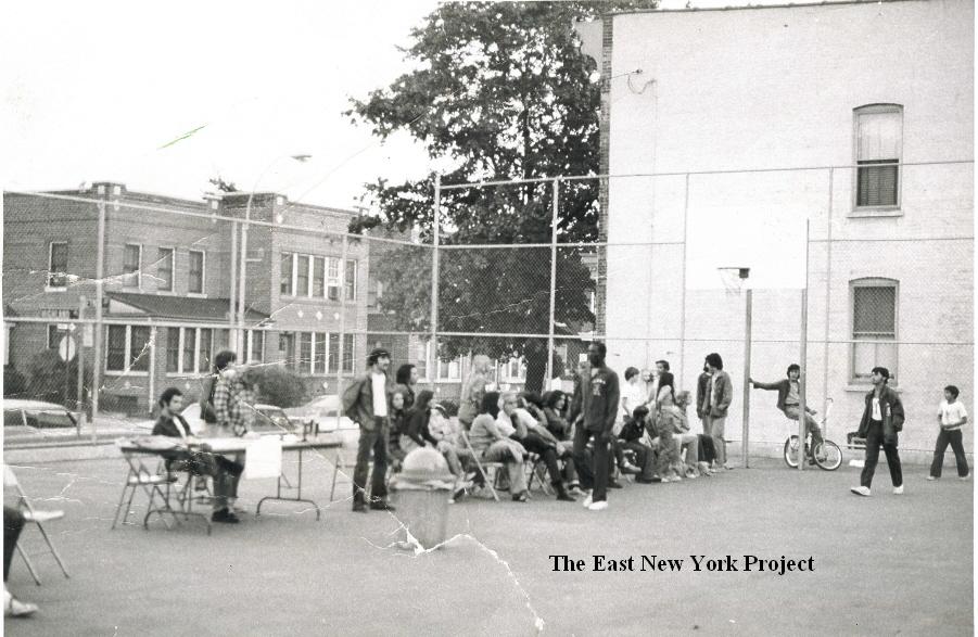
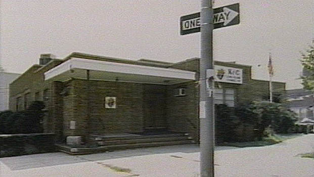
Knights of Columbus, Hale and Jamaica Peter Stango reminded me that the Knights of Columbus Long Island Council 197 resided on the southwest corner of Hale and Jamaica Avenues. The council dates to 1896, and for a long time was headquartered at 231 Jamaica Avenue (by Van Siclen) before it was destroyed by fire in October 1951. This building was constructed by the Knights of Columbus in 1954, and was sold in 1993 to a Spanish Pentecostal group. The picture on the left is from the 1980s. More pictures and a history of what existed before this building can be found on the Hale Avenue page. |
|
 |
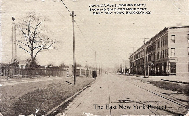 |
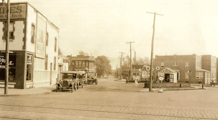
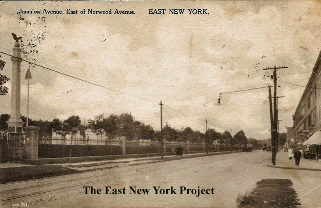
Jamaica Ave, East of Norwood Avenue Dated: 1908 Maker:P. Miller Status: Own (BG) Jamaica Ave, East of Norwood Avenue Dated: Unk Maker:Unk Status: Own (BG) These early postcard views of Jamaica Avenue east from Logan are a reminder of the cemeteries which line the north side of Jamaica Avenue. The tall monument on the left sits in Salem Fields Cemetery. |
|
 |
 |
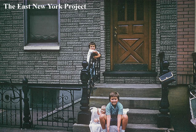
Joanne Kirk sends over a picture of 666 Jamaica Avenue which sits between Norwood and Logan. That's Joanne and her sister in front of the house in 1961. Joanne recalls the Brodzinski family were tenants on the third floor. Her grandmother bought the house in 1923 for $4,000. Her grandmother told her the house was the model home back in 1904 for the new construction on the block. On the right, Gerry Carter provided this view looking east in 1962 along Jamaica Avenue between Norwood and Logan. Gerry noted the swing out windows for ventilation and the iron gates; " They were easy to remove. Good trick on Halloween. Neighbors use to go nuts. We use to stack all the gates in one of the residence's vestibule. It made it hard for them to open the door the next morning." | |
 |
 |
Tommy Gallagher, 670 Jamaica Avenue, 1959 Golden Gloves Gerry Carter also sent reminders of a Jamaica Avenue resident, Tommy Gallagher, who won the 147-pound Golden Gloves division in 1959. |
|
 |
 |
676 Jamaica Avenue West of Logan Street on Jamaica Avenue is 676 Jamaica. On the right is a view from 1906 from the Brian Merlis archives. Its hard to tell what business it is, but the partially blocked sign on the lower right is for Horton's Ice Cream. I haven't identified when the buildings to the left were demolished. Robert Hensel dropped me a note to tell me those houses were burned down in February of 1982 and demolished shortly thereafter. Eileen Scarpello lived at 678 until 1951 and informed me the first floor housed a repair business for NCR machines. Tom Reilly lived nearby in the 60s and recalled the corner building had Joe Scuturo's barber supply store on the ground floor. |
|
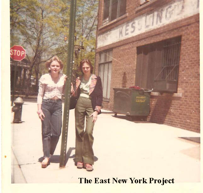 |
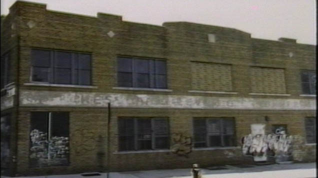
Jamaica and Logan, 1974 This classic 1974 shot was sent in by Debbie Brodzinski, on the left, with her friend Maryann Bury. Kesslings Thermometers can be seen on the right, the company dates to 1892. Peter Stango relays a memory; " I used to go up there as a kid and get bits of mercury out of the sidewalk cracks on Jamaica Avenue. Wouldn't be surprised to find out there is hazardous soil up there someplace" |
||
 |
 |
A 1980s view of the heavily graffitied building, and the building in use today as a hardware store. | |
 |
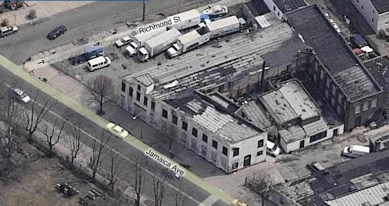 |
These aerial views are of the old Roberts Numbering Company complex on the corner of Richmond Street and Jamaica Avenue. A portion of this building dated to the 1890s, and there are more photos and history on the Richmond Street page. In 2007 the lot was cleared and a new school built, essentially a replacement for P.S. 65. | |
 |
Jamaica Avenue, looking east from Euclid Avenue, 1946 This stretch featured monument fabricators, used car businesses and barely visible Weismantel's across from Cypress Hills Cemetery. |
||
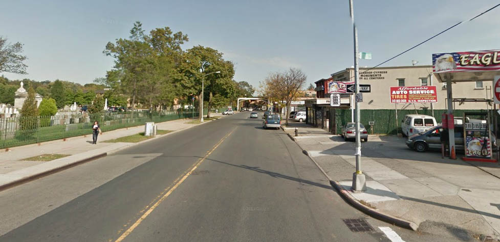 |
Jamaica Avenue, looking east from Euclid Avenue, 2013 It looks quite different today, but Hollander monuments continues in business in the same location. |
||
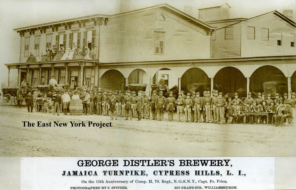 |
This great historic shot dates to 1877. George Distler's Hotel and Brewery was a pretty prominent place in early ENY history. Located between Euclid and Crescent Avenues, it would eventually make way for a venue more memorable to ENY baby-boomers. | ||
 |
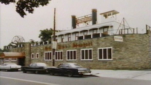 |
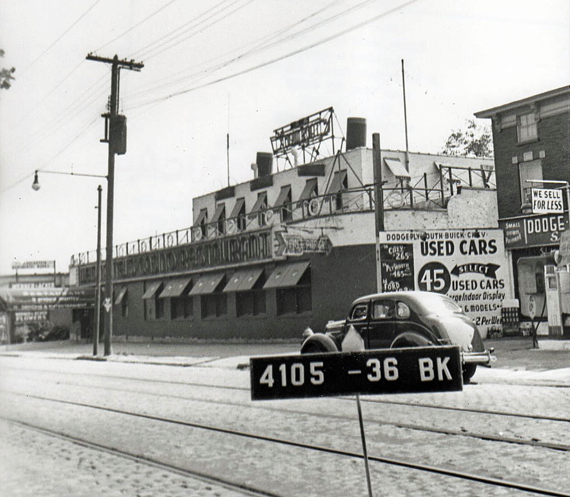
Weismantel's Showboat As seen in 1941, on the left, and in the 1980s, on the right the Showboat was the catering hall in ENY. We have a full Showboat page dedicated to the history of the hall. |
|
 |
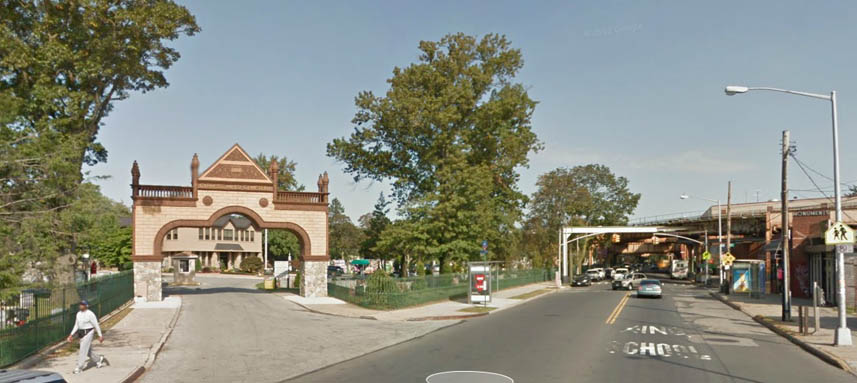 |
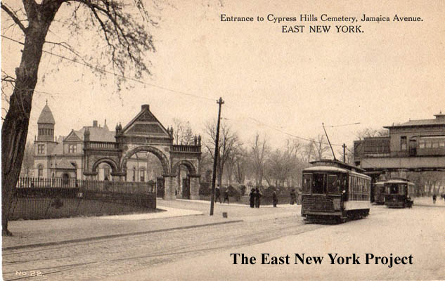
This classic postcard view shows the entrance to Cypress Hills Cemetery. I have never determined when the archway was removed, but recently it was brought back as seen in the 2013 image. We have a very detailed Cypress Hills Cemetery page. We can also see the end of the Jamaica Line, back in the days when the Cypress Hills stop was the last stop and the tracks did not turn east on Jamaica Avenue. | |
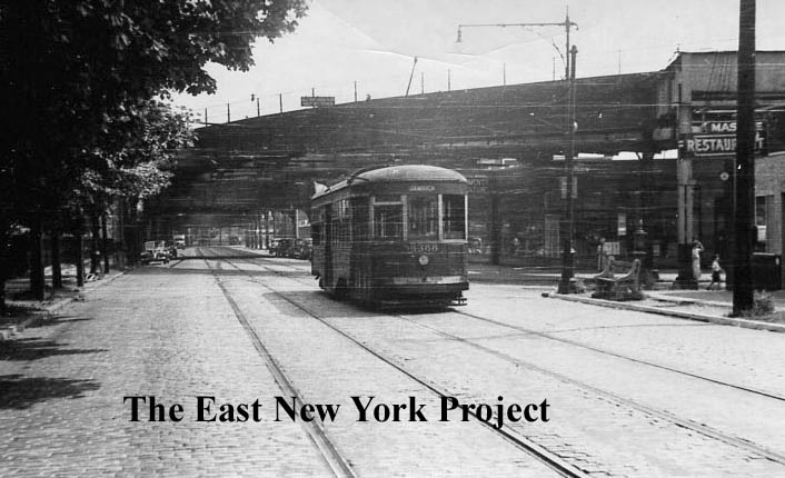 |
These 1947 images were taken to document the end of the trolleys, but they also show the supports for the original Cypress Hills station before the tracks turned east. | ||
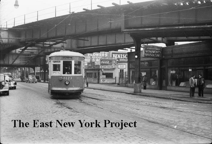 |
Another late 1940s shot, although the trolley blocks a view of the entrance to the Cypress Pool we can see the wall just to the left. | ||
 |
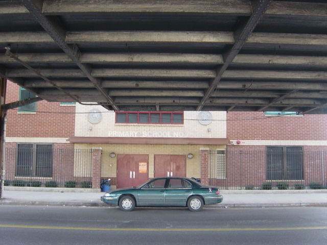 |
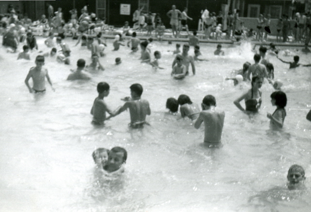
Of course where P.S. 7 sits today was the site of the Cypress Pool, one of the most memorable spots in the neighborhood. Cindy Rongione provided a number of shots which are featured on the Cypress Pool page. | |
 |
Right off the corner of Hemlock Street sat the final tollbooth before crossing the county line. It was torn down in 1897 after the road was taken back from private interests. | ||
 |
 |
The 1915 shot on the left is a view west down Jamaica Avenue toward Lincoln in 1915. The El has not been extended yet down Jamaica Avenue. On the left is Benisch Monuments, a longtime business in Cypress Hills. On the right is the Maimonides Cemetery building. It was originally built with two glass domes on the roof which are now long gone, though the building is still there as seen in the 2013 update photo. | |
 |
 |
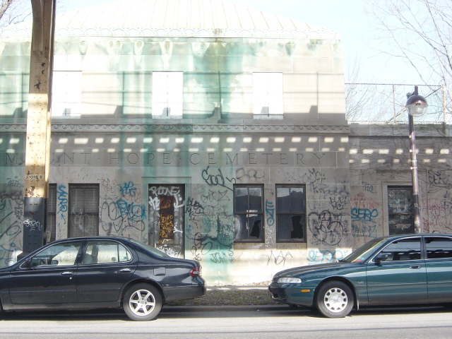
Cemeteries Moving further east down Jamaica Avenue we come to Mount Hope Cemetery. Kurt Eger contacted us, his father was a caretaker and they lived here from 1958 to 1970! The story gets better; his father fought for the German side during World War II and was a POW in Nebraska and Missouri after the war, yet became a caretaker for a Jewish cemetery! His sister, Ursula Trojcak "graduated from PS 171 and from Lane in 1969- she was the Queen of the Lane prom in 1969. She told my father that she would not get married while we still lived at Mount Hope- the thought of her walking out of the front door in a wedding dress to enter a waiting limousine was too much Munsters and Adams family for her to bear." That's Kurt and friend Dennis Friscia in 1985 on the right. |
|
 |
 |
Jamaica and Grant Avenues, March 25, 1965 This pair isn’t terribly exciting – the first view is the south side of Jamaica Avenue, looking west front Grant. On the right, the north side of Jamaica is visible in the background, a bit of the cemetery and Franklin K. Lane. |
|
 |
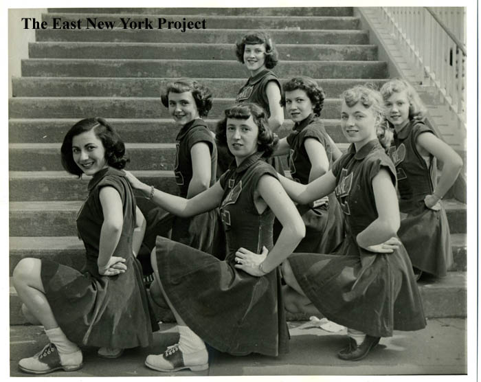 |
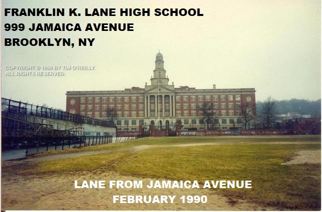
Franklin K. Lane High School I used Tim O'Reilly's 1990 picture, but we have an entire Franklin K. Lane page detailing not just the history of the school, but two other institutions which were in this location; Snedicker's Roadhouse and the Boys' Truant Home. The picture on the right is an outtake from our book we never used, Lane cheerleaders in the 1940s. |
|
 |
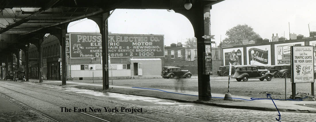 |
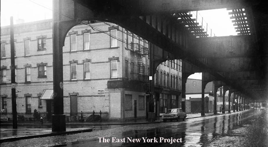
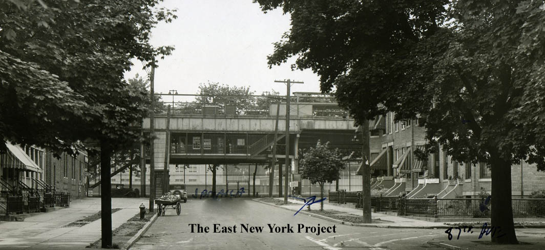
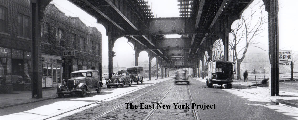
Two views from the 1940s. The first is looking north up Elderts Lane toward the train station; note the peddlers cart in the street. On the right the view is east from Elderts Lane. The parking lot served Dexter Park. | |
 |
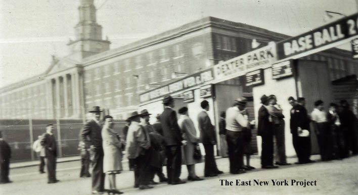 |
The first view is looking west back towards Elderts Lane and again we can see a parking sign for the ballpark. We have a full page devoted to Dexter Park, though technically it sat across the border in Woodhaven. | |