|
        |
Mysteries PageNot necessarily all mysteries, but images which have raised questions we have yet to answer. Drop a line (tapeshare@yahoo.com) if you have information.Most of these images appear elsewhere on the site. |
||
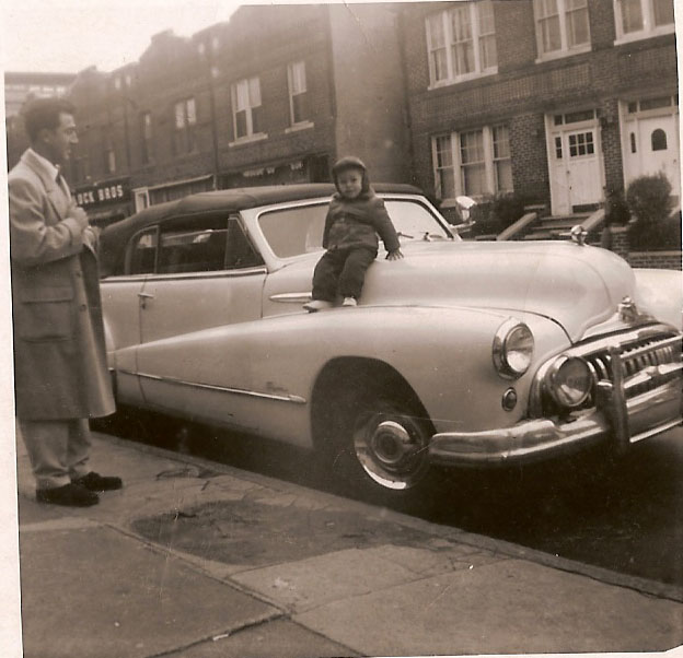 |
We're starting with a series of pictures where the location is in question. This was was sent by Joey Perrone, taken in the early 1950s. We see an elevated train station in the background, and the architecture of the buildings suggests they are near Pitkin Avenue. | |
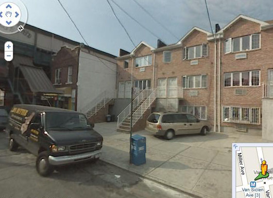 |
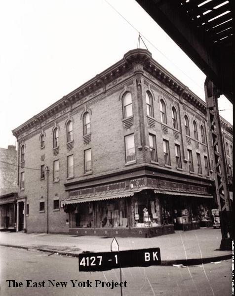
SOLVED! Rich Woitowitz nailed this one, when he recognized the Block Brothers grocery in the background. Rich recalls his dad going there on Sundays, and the location was the west side of Van Siclen Avenue, just north of Livonia Avenue. When I checked an aerial view, I confirmed one building with the original architecture was still standing on the corner, the rest are gone. A check of the 1929 insurance maps confirmed there used to 6 buildings in a row like the one of the corner, then a narrow alley, then a set of houses set just a bit further back, just like Joe's photo. |
|
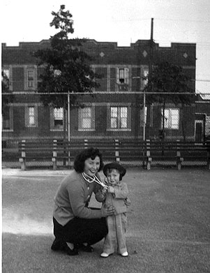 |
This one comes from Thom Henrickson. Thom is pictured with his mother in 1946. I suspect this is Liberty Park, with a view towards Elton Street, but those buildings are now gone so I have not been able to verify this. Rod Maggio recalls the buildings that used to line Elton Street, and does not believe this shot is Liberty Park. | |
 |
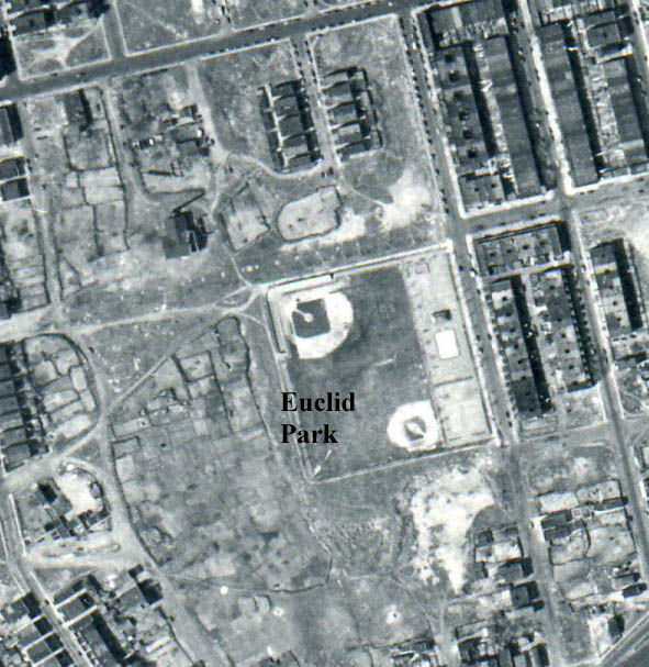 |
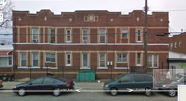
Solved! Rod Maggio correctly recalled the building in the background faced Euclid Avenue, and the shot was taken in Euclid Park, before the Cypress Hills Houses were built there. On the left is a Google 2010 image. The aerial image from 1951 shows the park and playground. |
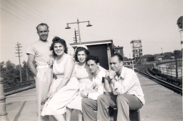 |
From Peter Stango, this shot from the 1940s appears to be taken at an LIRR station. What's tricky is that its hard to tell if this is a ground level platform or an elevated one. I was convinced it was ground level but that appears to be a staircase directly behind them heading down. Warwick Avenue was the only elevated LIRR station in ENY, the Autumn Ave station was ground level. (Both were eliminated when the LIRR was put underground.) It doesn't appear to be either of those. | |
 |
SOLVED? Rich Woitowitz thought he recognized the Floral Park station. Marylu Howell-Kelly disagrees however, noting that the Floral Park station was not elevated until 1960-62. "As I take the train from Floral Park everyday one might confuse this station with Floral Park as the Hempstead line does curve south, while the main line stay straight.. but I think this might (have been)be the Archer Avenue Station , where the Valley Stream Line goes south from there. " Tom Atanasio has ID'd this as the Valley Stream station; "Position signal 24L is that signal to the right and you can't see it, but pedestal signal 18L is behind the gentleman on the left in Mystery Photos.Also, you can see the top of VALLEY tower in the background along the the substation.I used to work for the LIRR and Valley Stream was one of my assignments...the tracks that curve off to the right go towards Far Rockaway and the tracks that are parallel and tangent to the platforms lead out towards Lynbrook." |
|
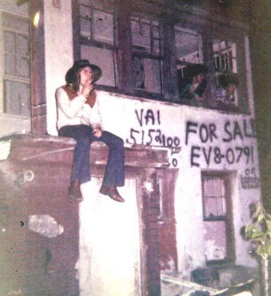 |
Richard Woitowitz sent this, he is pictured with band buddies Tony Rodriguez and Greg Muntez in the early 1970s. We know this is near Forbell and Drew, I am trying to pinpoint the exact location. | |
 |
From Tim O'Reilly, this picture was marked "Bushwick Avenue 1939". We suspect the low stone wall behind them was Evergreen Cemetery, but there is no wall that looks like that today. | |
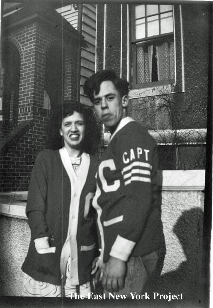 |
This one is my contribution. It's my aunt and uncle in the late 1940s. That "C" on the sweater stood for "Captains", the name of their punchball team. The family lived at several locations along Fulton Street near Jerome Street and Linwood Street so this could be anywhere near there. SOLVED Phil Mastriano, who knew my father's family, identified the location as the east side of Ashford Street just south of Fulton Street. "Right behind Buster and Sister is the first house after the Soviero driveway. Sam Perillo lived in the house on the left." | |
 |
Mystery wires Tim O'Reilly spotted these strange roof wires in this 1941 tax photo of the corner of Fulton and Richmond Streets. One of our star researchers, Anthony Messina, has found evidence that these were likely electrical wires. Overhead electrical wires were quite common in Brooklyn, and rooftops were often a path where elevated lines were in the way. |
|
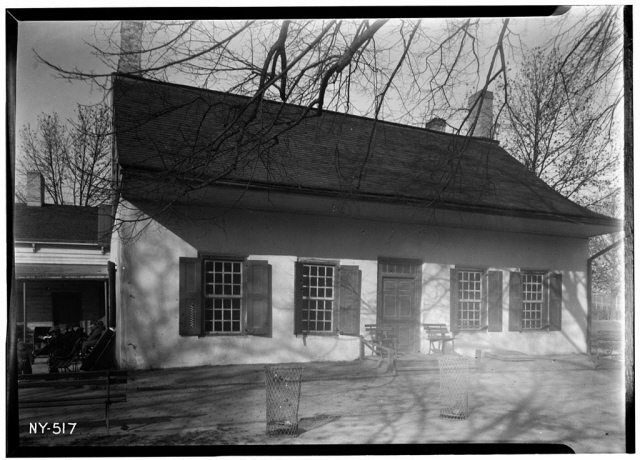 |
Whatever happened to the Schenck House? Many fans confuse this with the Jan Martense Schenck house, which was transferred to the Brooklyn Museum. Ron Rosenbaum has suggested it burned down in a fire in the late 1940s, after it had been inhabited by homeless people. I received a great deal of help from Art Pirozzi who determined there was a fire in 1947, but the structure remained standing into the early 1950s. We believe it came down between 1951 and 1954. One last great rumor came from the Gavin family who noted there used to be storage under the Vermont Viaduct and they recall seeing old windows and doorframes stored there- could it have been the remains of the house? |
|
 |
Whatever happened to the Reservoir Fence? The Ridgewood Reservoir had a beautiful fence constructed by the Hecla Iron Works. We once theorized it was removed for the war effort, but we have since received pictures with the fence gone pre-dating the war. There is a section still standing between the reservoir bays. |
|
 |
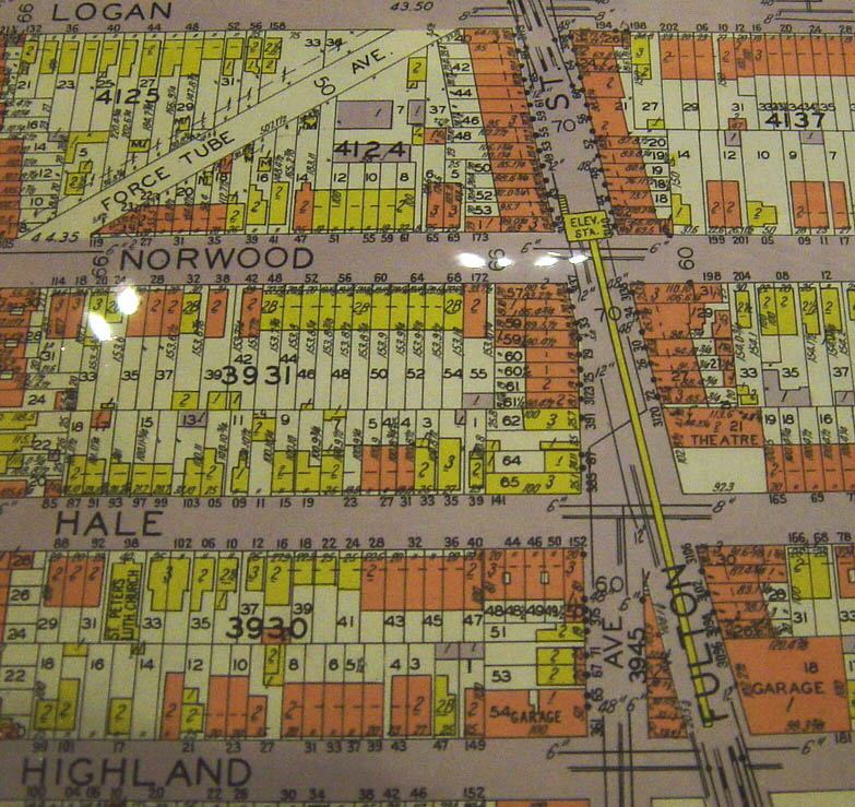 |
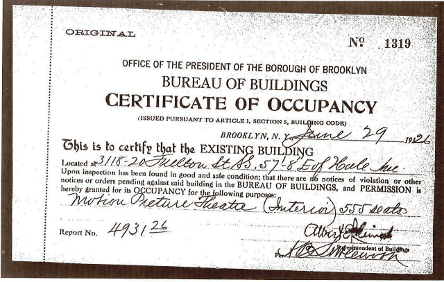
The Prior History of Hale Lanes While investigating Hale Lanes, I discovered the CO for the original building issued in 1926 was for a Movie Theater. I have no record of a theater there, and assumed the purpose of the building was changed after it was built. However, when I checked the 1929 plat maps, I discovered the building clearly marked as a theater, and the adjacent corner lot still undeveloped. Cinema historians have confirmed a Norwood Theater existed here from 1926 to 1932. Further investigation uncovered the fact that the corner lot was issued a CO for an 'Open Air' theater and in 1929 a CO for a one story skating rink. We have a lot of details missing on this history. |
 |
A couple of images sent in by 2 guys who have made nice contributions to the site. On the left is a photo sent in by Greg Goldstein, who sent in the great series found on the Jerome St. page. He believes this shot of his grandmother holding his mother in 1938 was taken in East New York, but we can't tell where. SOLVED Harold Moskowitz did some expert sleuthing and concluded this was taken on Ocean Avenue between Avenue O and Avenue P. | |
 |
Joe Sadauskas, who sent in the great Richmond St. series, has this photo which is clearly not ENY but cannot tell if it is Rockaway or Coney Island. Anyone recognize the spot? | |
 |
What purpose was this structure? Located near Indian Bridge in Upper Highland with no clear purpose. |
|
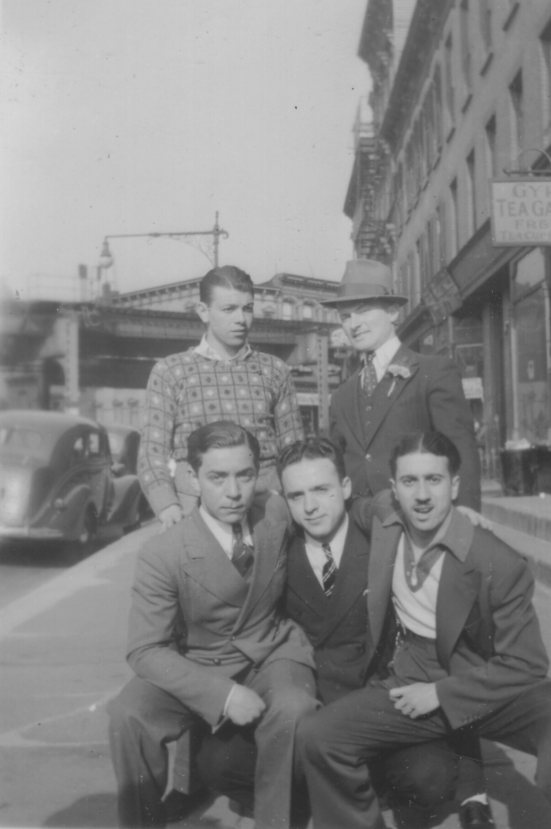 |
Where was this photo taken? A great 1938 photo from Rob Jefferson which we have not pinpointed. That Tea Garden business on the side might provide a clue. Michael Savchak has narrowed it down; "That photo was taken just to the west of Brooklyn Broadway, at a point west of Lexington Avenue. I say that by the el columns and the angle the street makes with Brooklyn Broadway. Back in the early 1970's I was an engineer for the NYCTA and was involved in a structural survey of the Broadway Jamaica line. The column configuration shown in the photo occurs west of where the Lexington Avenue el joined the Broadway structure. "SOLVED:Anthony Messina, one of our best site fan researchers, nailed the location when he found a want ad for a "teacup reader" for the Gypsy Tea Garden at 302 Ellery Street. So the camera is on the Bed-Stuy side looking north toward Broadway. I knew that sign would get us there someday. Thanks to Anthony for the work. |
|
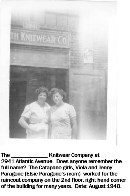 |
Not so much a mystery, but Elsie Anzalone sent in this photo and is trying to find the full name of the knitwear company in this shot from 1948. It is 2941 Atlantic Ave., on the northwest corner of Cleveland and Atlantic.UPDATE: In 1929, the location was Warwick Knitting Mills. However we can see the letter "th" in the sign so it must have changed by then. SOLVED: Anthony Messina also came through on this one, finding a listing for "Jenath Knitwear" in a 1949 New York State Business Directory at this address. | |