        |
New Lots Road This page is dedicated to Peter Rapelje, a descendant of the Rapelje family that owned several large farms in New Lots. Peter's grandfather took a number of photographs in 1913 of the houses which lined New Lots Road. Peter shared these photos and history with us and this page is an attempt to share this information by reconstructing what New Lots Road was like in the 1870's. Clicking on the census data will display the original handwritten census data for that house. The road west of Warwick appears in Zone 5. |
|||

|
|
|
|
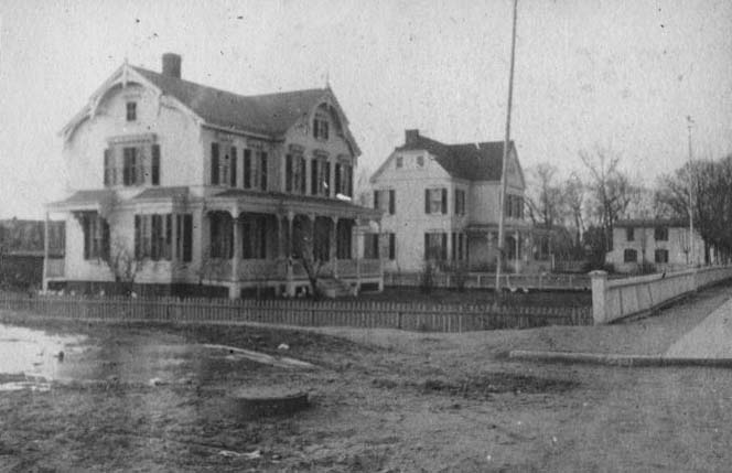
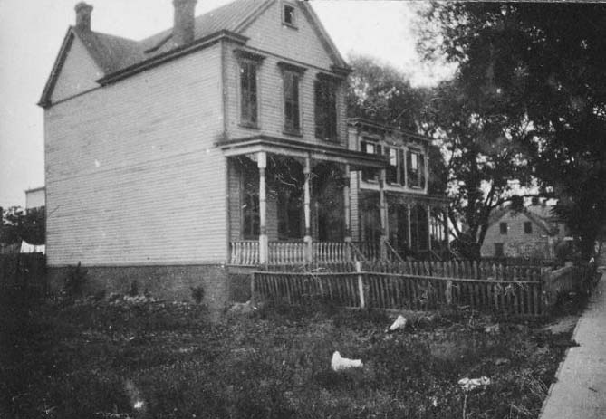
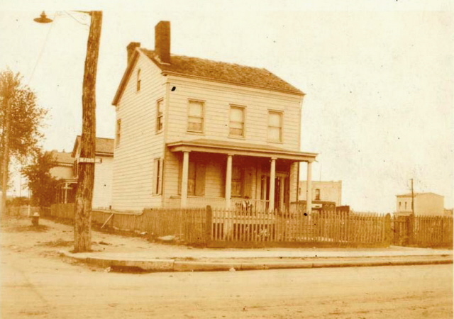
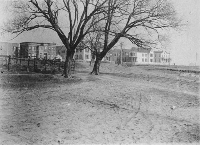
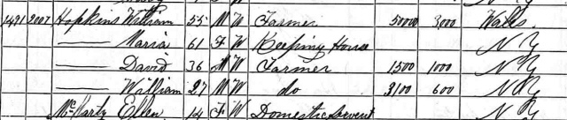
| William Hopkins House, 1913 The Hopkins house sat between Warwick and Ashford, though I believe the house actually sat a bit north of New Lots Road, close to Livonia. Harold Moskowitz tipped us off the granite stone cap was for a sewer catch basin-the street was about to be curbed and graded. Peter Rapelje collection. |
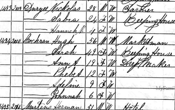
"Sabre" Duryea House, 1913 This is an educated guess, based on Peter's grandfather's label and the census data. Sabra Duryea was married to Nicholas Duryea. Nicholas Duryea's house was located on the south side of New Lots, near Cleveland St. If you look at the St. Gabriel's postcard, the two houses in the distance line up with the 1913 photo. |
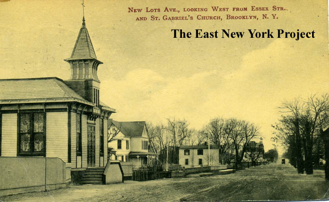
St. Gabriel's, 1910 Now a twist; St. Gabriel's was not on New Lots Road in the 1870's. The building starts life as P.S. 64 on the Hegeman farm property and is moved to New Lots and Linwood around 1900. |
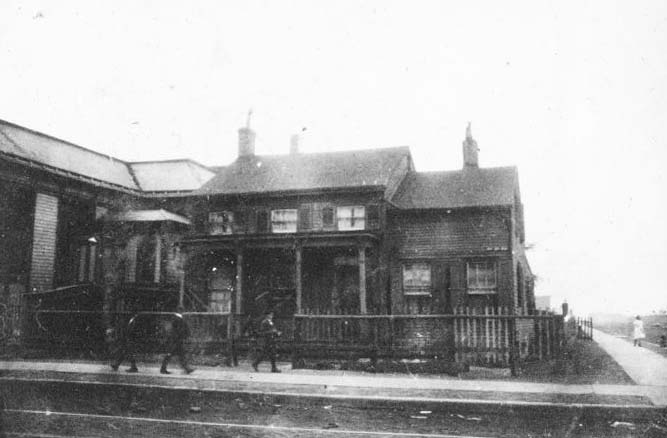
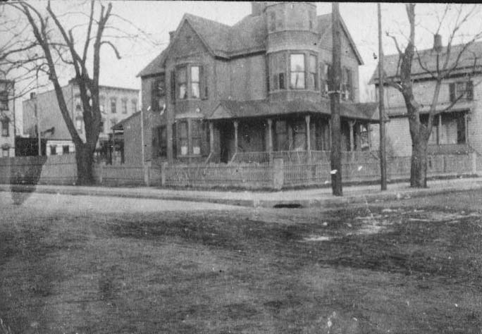
Will Hegeman House, 1913 I am assuming this is the southeast corner of Linwood and New Lots, as we can see St. Gabriel's right next door. I believe of the view of this house is obscured by the church in the postcard photo. From the Peter Rapelje collection. |
|
|
|
|
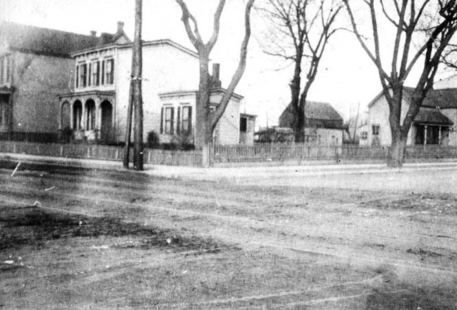
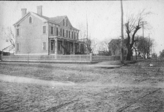
| Cochran House, 1913 A little detective work; Cochran is in the 1870 census between Duryea and Martens who ran a hotel on north side of New Lots between Elton and Linwood. Peter Rapelje collection. |
Rowland House, 1913 This appears to be the house in the background of the Cochran picture, so I believe it sat on the north side near Linwood. Peter Rapelje collection. |
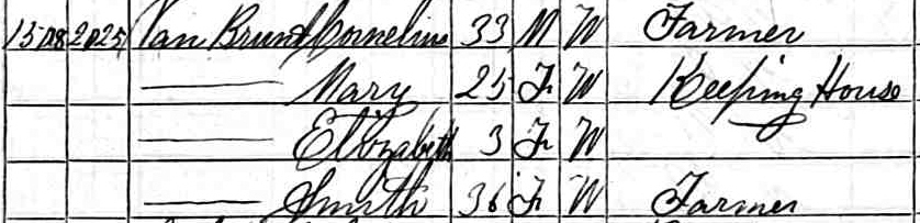
Van Brunt House, 1913 This was one of the oldest houses still standing by 1913, dating back to the 1730s. Located east of Shepherd Ave. on the north side of New Lots. By 1870 occupied by the Van Brunt family though the Boerum and Hopkins families also lived there. |
Coddington House, 1913 East of the Van Brunt House at 881 New Lots road was the Coddington house. From the Peter Rapelje collection. |
|
|
|
|
| Will Stoothoff, 1922 Located at 936 New Lots, on the southwest corner of Montauk and New Lots. Those are his descendants in the 1870 census. |
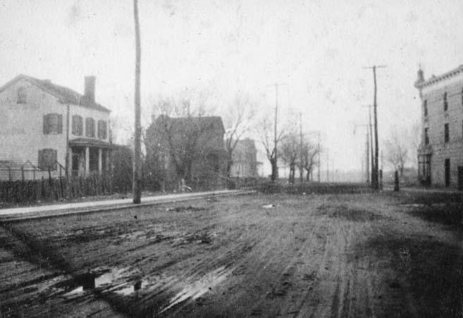
New Lots Road, 1913 The next two shots were taken by Peter's grandfather in 1913. The first is a view west from the Cosine house at Milford Street. |
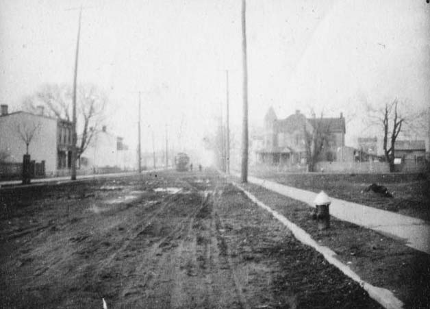
New Lots Road, 1913 The second is a view east from the same location. |
Jacob Cosine House, 1913 Located at 968 New Lots, on the south side off Milford Street. |
|
|
|
|
| |
|||
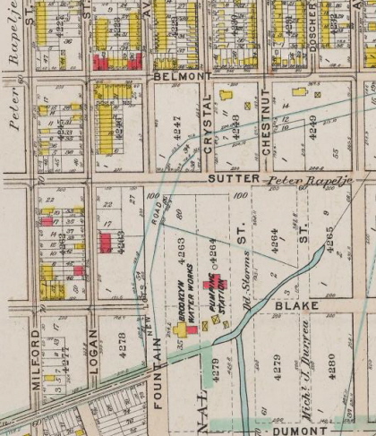
| New Lots Road, 1908 This 1908 map shows the outline of the original road. New Lots Road used to curve north at Fountain Avenue, and then bended east between Sutter and Belmont to Elderts Lane. Peter Rapelje's farm was located in this area. The uncle's house had to be moved once they eliminated this section of the road. |
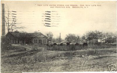
New Lots and Fountain, 1909 A postcard view of the pumping station seen in the map, part of the network feeding up to the main station at Logan and Atlantic. |
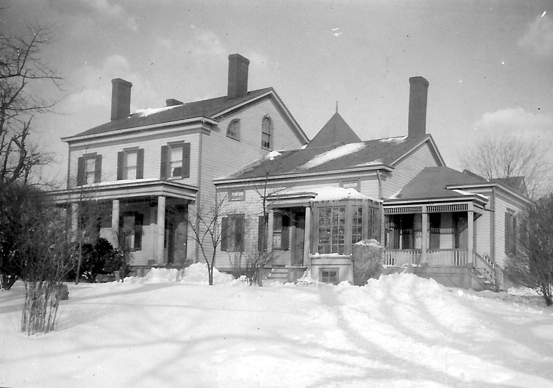
Peter Rapelje house, 1914 It was Peter Rapelje who took all these pictures in 1913 we are enjoying on the site. On New Lots road at the time, the location is close to what we know as Belmont Avenue today. If I have it right, its the house to the right of Chestnut on the map. Peter W. Rapalje adds that when they took away this part of New Lots Road, they added a front door to the side of the house facing Belmont Ave., effectively reversing it! |
|
|
|
|
|
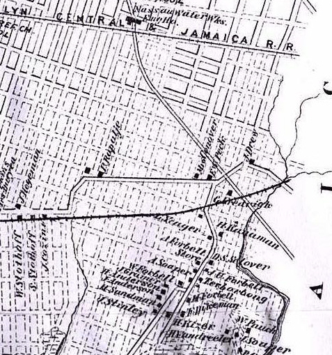
| New Lots Road, 1873 This section of map from the Brooklyn Genealogy site shows where New Lots Road used to end, at an intersection of Elderts Lane coming in from the northeast and Old Mill Road heading south. |
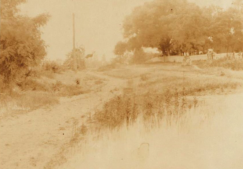
End of New Lots Road, 1901 In this Armbruster photo a very rural scene at this intersection in 1901. The fence on the right is part of Peter Rapelje's farm. |
Peck's corner, 1913 Peter's grandfather took this shot in 1913; I am assuming from the name and the map it is this intersection. |
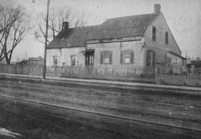
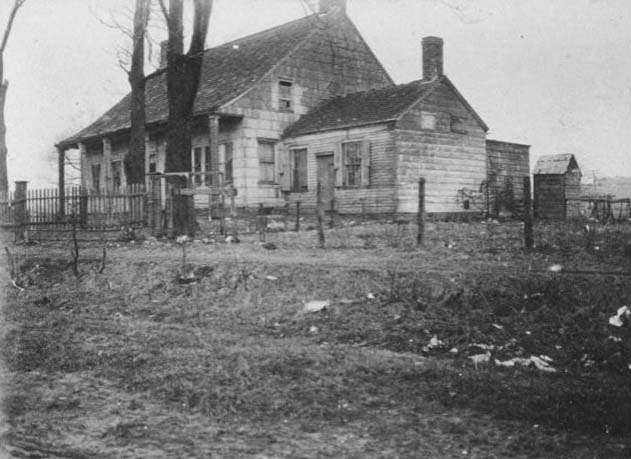
Peck's Home, 1913 Also from Peter's collection. |