|
        |
O'Brien PlaceThis odd 3-block street creates a narrow wedge with Ridgewood Avenue. A couple of photographs prompted me to research why this block exists and the origin of the name.
|
||
 |
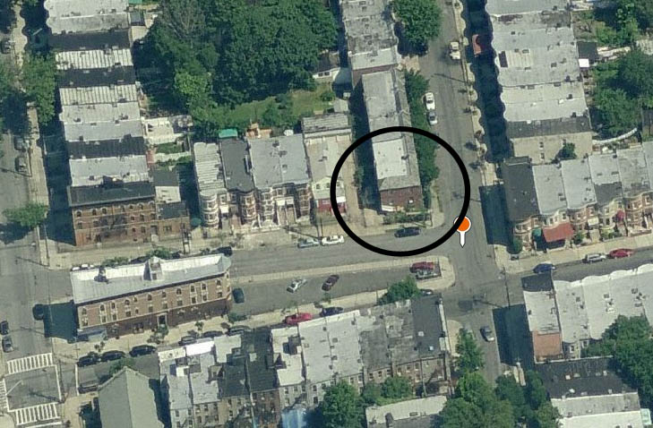
O'Brien Place 2011 For those not familiar with O'Brien Place, it is a short three-block stretch from Autumn to Grant Avenues. |
|
 |
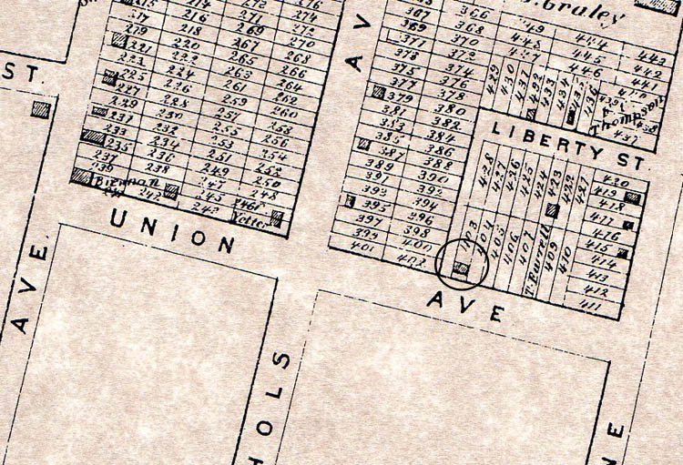 |
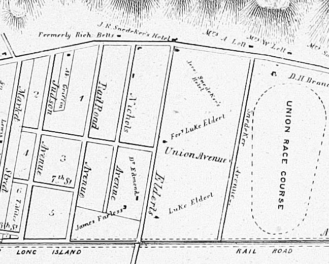
Early maps The first thing to note is that the original name of the street was Union Avenue, probably a reference to Union Place, the original name of the Cypress Hills area (a reference to the Union Course racetrack.) On the left is a closeup of one of John Pitkin's original 1838 maps. Union Avenue is already on the map. (Note: Judson became Crescent Street, Market became Euclid, Railroad became Autumn.) The first hint we have about why O'Brien Place exists is that these grids were a function of the farmlands purchased by Pitkin. Note Union Avenue does not reach Market (Euclid), because we know the western border of those lots ended at today's Pine Street. On the right is a map from 1873. Union Avenue has now been truncated to run from Autumn to Elderts Lane. Note the house I circled on this map, it comes up later. |
 |
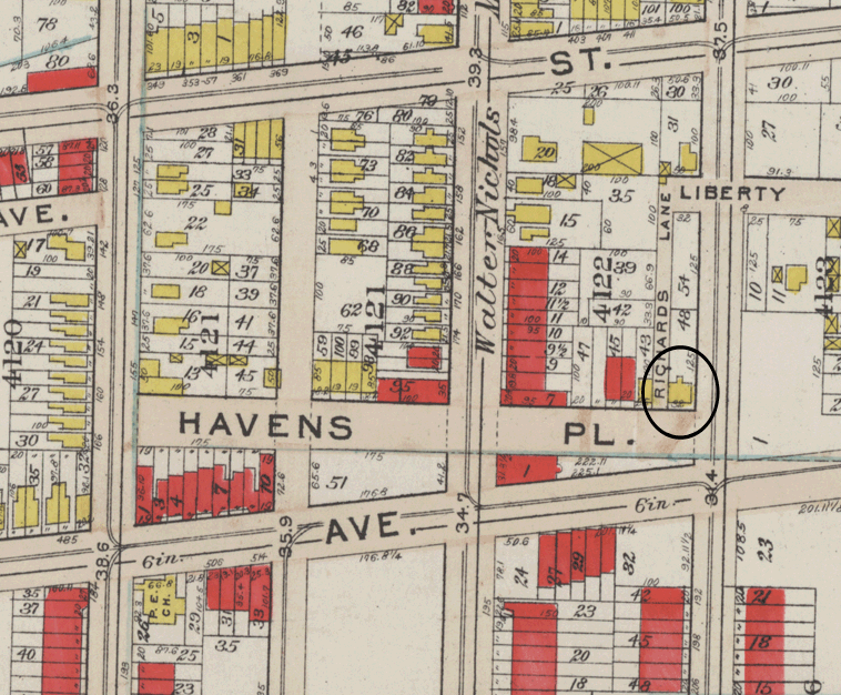 |
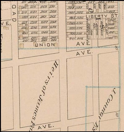
Early maps The map on the left dates from 1886 and confirms what I suspected. The farmland north of Union Avenue was owned by Walter Nichols (for whom I believe Nichols Ave. was named.) The land to the south was owned by James Farless. The existence of O'Brien Place was the result of the border between 2 farmlands, laid out by Pitkin. When Ridgewood Avenue was cut through as seen in the 1886 map, the wedge was created. In 1887, when the Township of New Lots was annexed by Brooklyn, many street names were changed becasue they duplicated names used elsewhere in Brooklyn. Union Avenue became Havens Place, as seen in the 1908 map on the right. |
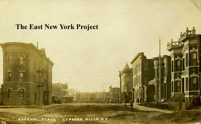 |
Havens Place Time for a real picture. This view comes courtesy of Bob Stonehill, taken sometime circa 1910. The view is west along Havens Place, and many of those buildings are still standing. This shot however is taken just past that house I circled in the 1873 maps. |
|
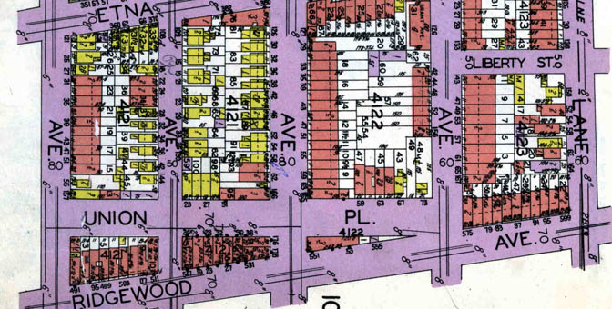 |
Union Place The choice of Havens Place for a name duplicated a street that existed in Brownsville, so it appears the name was changed to Union Place in a nod to its original name. This map from 1929 shows the new name, though I'm not sure when the name change took place. |
|
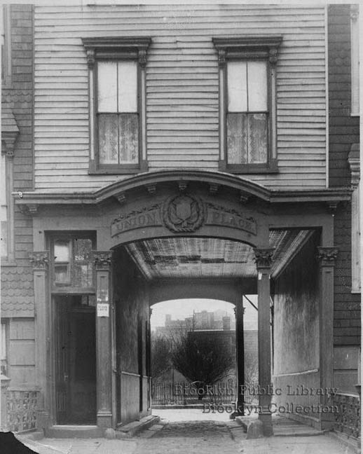 |
Union Place, misidentified It was this unusual shot that triggered my research. It is part of the Brooklyn Public Library's digital archives (thanks to Rich Woitowitz and Therese Panariello for spotting this.) I'm guessing someone looked up Union Place, and thought it was the one in Cypress Hills, so the BPL has it identified it as a Cypress Hills image. There are several other photos in the group, and I'm convinced it is misidentified. The images don't look like anything that could have existed on O'Brien Place, nor do they match the insurance maps. There was a Union Place near Prosepct Park, and the description of it (not a public road, but a private road to access other dwellings) fit the images well. |
|
 |
 |
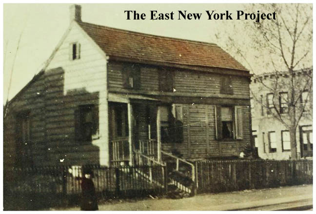
Union Place and Grant Avenue OK, I was disappointed in that goose chase, but I do have a gem that came to me courtesy of Rich Dieffenbach. Remember the house circled on the 1873 map? Rich, a site fan, contacted me because he had this picture but he could not identify the location. He did have some very good clues though, including Union Avenue as a possible location. The insurance maps, plus the buildings on the right which run along Grant Avenue, confirmed the location. The house belonged to his great-grandfather at the turn of the century. The house is still on the 1929 maps but was eventually replaced by brick housing facing Grant Avenue. |
 |
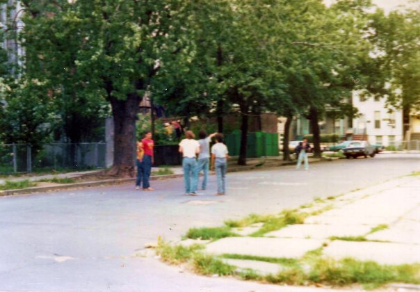 |
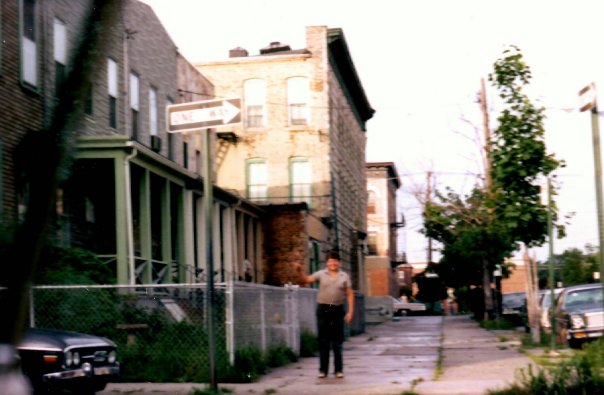
O'Brien Place, 1970s A quick jump forward in time courtesy of Rich Woitowitz, who sent these images from the mid-1970s. On the left the view is east with Christopher Terry in the picture. |
 |
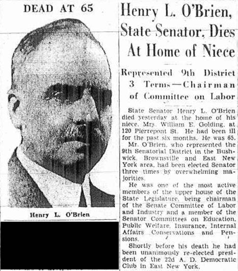 |
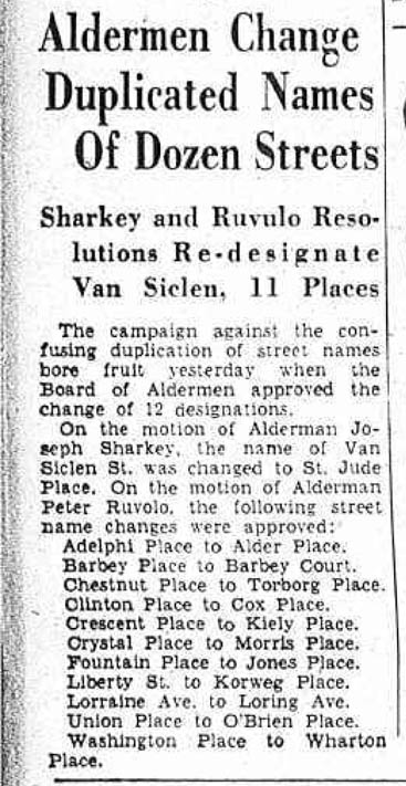
So where does O'Brien Place come from? Once again, the Board of Alderman were wrestling with duplicate street names, and in 1937 a series of changes were introduced. It turns out Henry L. O'Brien was a New York State Senator and President of East New York's 22nd Assembly District Democratic Club. (Of which Alderman Ruvolo was a member.) O' Brien resided at 237 Jamaica Avenue (the northeast corner of Jamaica Avenue and Barbey). He passed away in 1935 while still in office. So now you why O'Brien Place exists and for whom it was named. |