|
        |
Pennsylvania Avenue
|
||
 |
 |
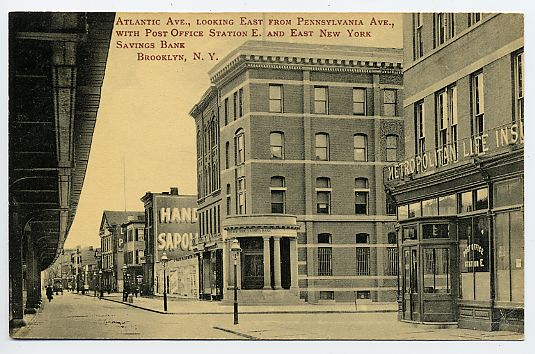
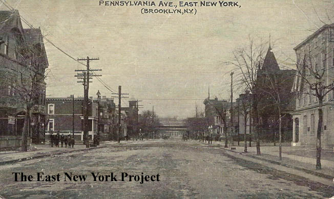
Pennsylvania Ave and Atlantic Ave. Two great early shots from the Brian Merlis collection. The first is a view north up Pennsylvania, with the Jamaica El visible in the distance running along Fulton. The second view is south. Both are from 1900. The building on the left is the East New York Savings Bank. The building on the right would become the Metropolitan Life Insurance building. I left the images large so you could enjoy the detail. A sharp eye can see the turret of St. Clements in the distance. |
 |
 |
Atlantic Ave.,Looking East from Pennsylvania Ave Undated circa 1910 Maker:Unk Status:Need Great postcard view, complemented by a 1938 shot of the East New York Savings Bank. The entrance to the bank building had been enhanced though we have not pinpointed the date. The new entrance was there as early as 1917.  |
 |
 |
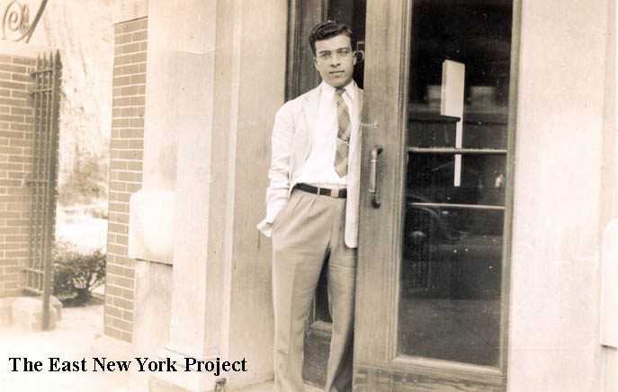
East New York Savings Bank Super site contributor Peter Stango noted his Uncle Ray worked for the bank and sent in this shot of his uncle in front of the bank in the 1940s. On the right, Peter's mother's ENY school savings bank book from P.S. 171. |
 |
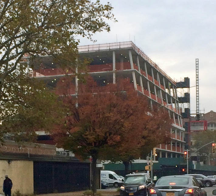 |
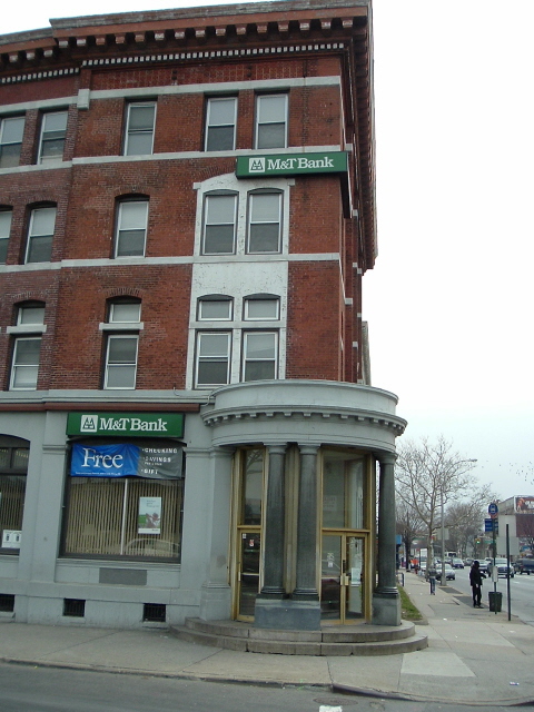
East New York Savings Bank, Coda Neil Sullivan provided the 2006 of the building, when it was M&T bank. It was torn down in 2016 and Tom Hammond provided a progress photo in November 2016 of the medical office building taking its place. |
 |
 |
Cor.Pennsylvania and Atlantic Avenues Dated: 1912 Maker:Wm. Fick Status:Own(BG) The southwest corner was the Metropolitan Life Insurance Co. You can see it in the right of the Shinske card above. Its the same building in the 1900 photo; the clock tower must have been added later. I'm not sure what the label "P.O. Station E" means.Neil Sullivan provided the 2006 view, which shows the clock tower has been removed. |
 |
 |
Pennsylvania and Atlantic This is the northeast corner in this 1930 photo. On the corner stood Joseph Schluchnter's Apollo Hall, a meeting hall and recreation area in the 1870s. Schluchnter owned the entire north side of Atlantic Avenue from Pennsylvania to New Jersey Avenue. The building was demolished in 1941 and the location was used as a parking lot until the Post Office was constructed there in 1961, seen brand new in the 1961 image on the right. |
 |
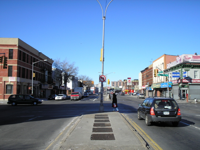 |
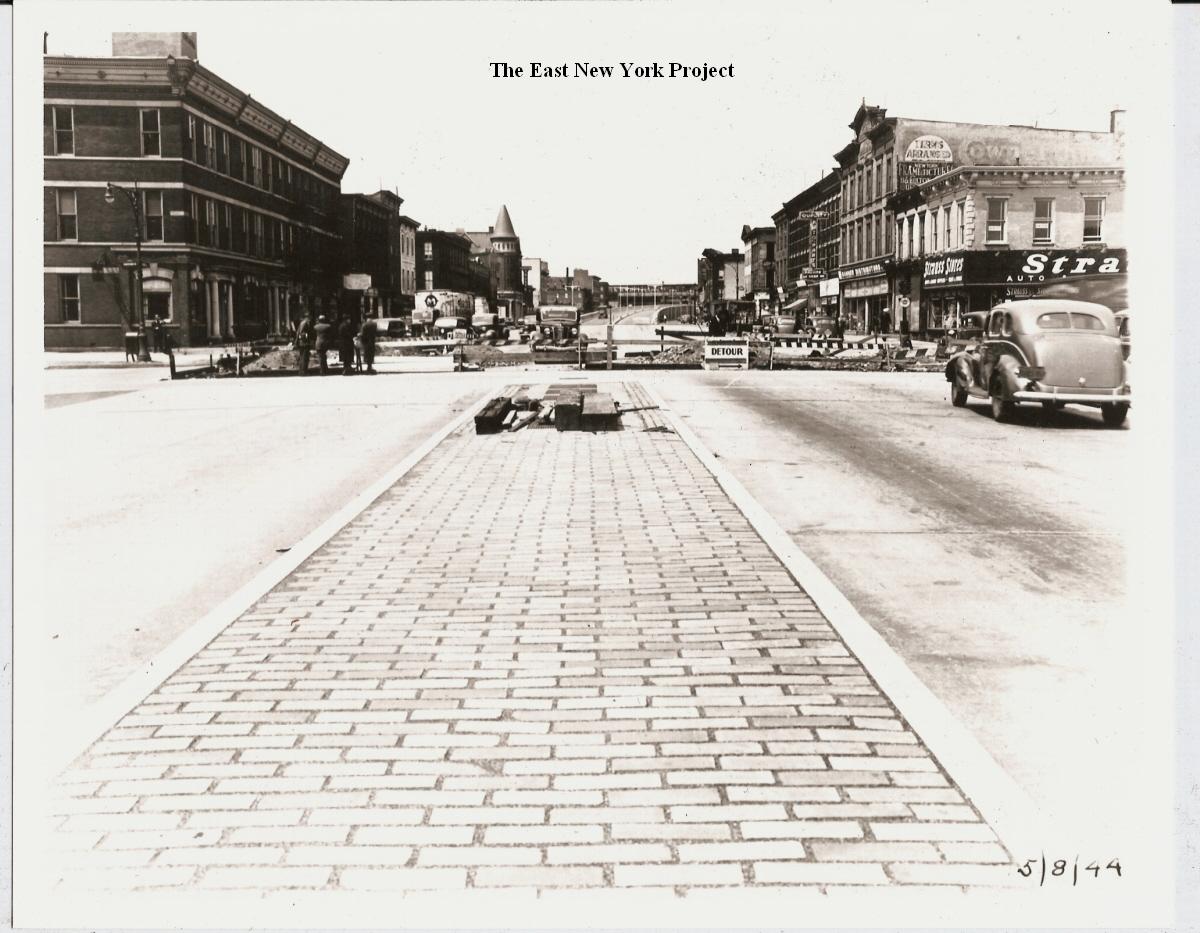
A few folks have now identified this 1944 photo as Pennsylvania and Atlantic; Neil supplies the 2006 view. It looks like the tower on the Metlife building is still there but cropped off in the 1944 photo. |
 |
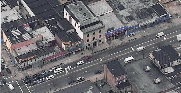 |
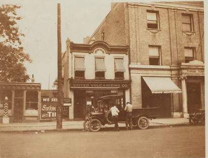
This 1929 shot from the NYPLD archives shows part of the Tyrian Temple and 74 Pennsylvania, which for some time served as the local post office. You can see in the 2006 aerial view from Local Live that both are still standing. |
 |
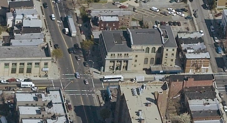 |
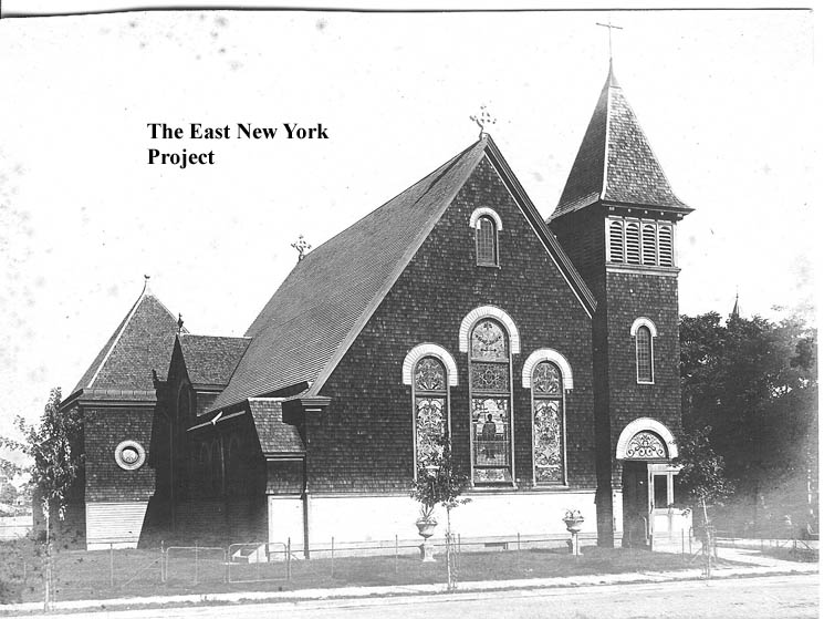
St. Clement's Protestant Episcopal Church Maker:Souvenir Post Card Co. Dated: 1907 Status: Own (BG) This congregation was formed around 1888 as an offshoot from Trinity Episcopal on Schenck and Arlington. They won a battle with Trinity to build this church (dedicated on September 21st, 1890) convincing Bishop Littlejohn that Trinity's exclusive rights within ENY were valuable in 1854 when it was a small village but were overprotective by 1890. The land it was built on was owned by John Pitkin's family. The congregation did not last long however, and the church was replaced by a courthouse in 1929. |
 |
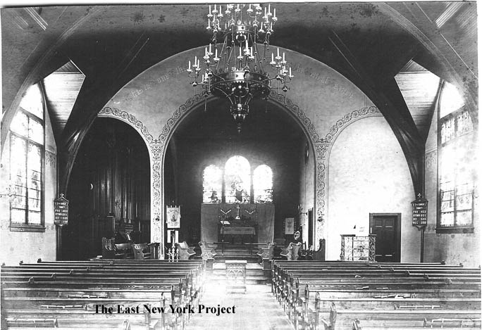 |
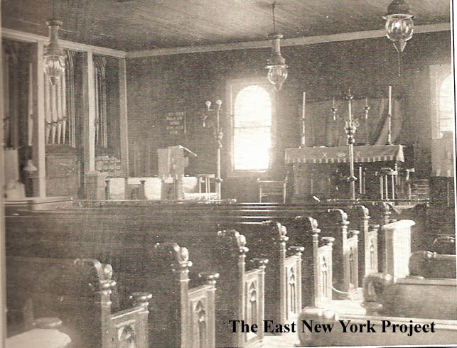
St. Clement's Protestant Episcopal Church and interior, 1903 Rick Constant's grandfather was a member of the congregation, and he found 2 1903 images taken by the family of the church with a great view of the stained glass windows facing Pennsylvania Avenue. |
 |
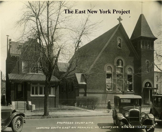 |
St. Clement's Protestant Episcopal Church On the left is a RPPC from 1906. On the right is an image taken in 1928, after the building sits in disrepair, having been sold to be replaced by the courthouse. From the Brian Merlis archives. |
 |
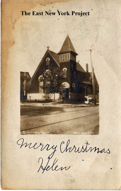
St. Clement's Protestant Episcopal Church Maker: Fick Year:1907 Status: Own(RG) One other Fick post card view from 1907. |
|
 |
 |
26th Ward Branch YMCA, southwest corner Liberty and Pennsylvania Dated:1907 Maker: Souvenir Post Card Co. Status: Own(RG) This was the original YMCA for the 26th Ward. It opened Nov. 6, 1893. It was still standing in a 1928 aerial image. By that time the new YMCA on Jamaica Ave. was under construction and this became the headquarters of the Polish Democratic Club of the 22nd Assembly, Brooklyn. Rod Maggio recalls the structure lasted into the 1950s as the Polish Falcon Club, often acting as a catering hall. Rod recalls a fire in the 1950s leading to its demolition, replaced by the "Burger Flame" restaurant. |
 |
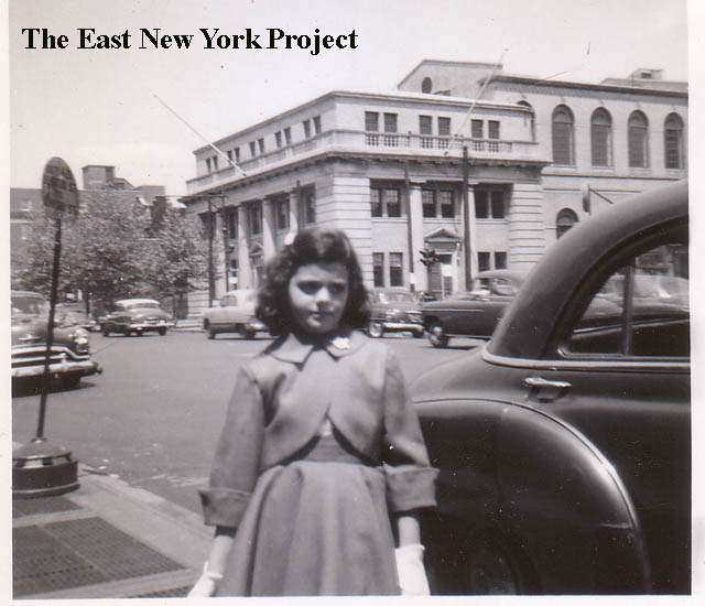 |
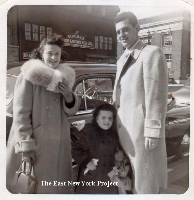
Pennsylvania Avenue, mid 1950s Rod's memory proves to be quite sharp. Judy (Rothstein) Zimmer sent in this photo looking across Pennsylvania Avenue from P.S. 173 in 1953. You can see the old YMCA in the background, then the Polish Falcon Nest. Judy recalls the fire; "We were right next door to the Polish Falcons Nest, and I recall the fire that Rod mentioned and evacuating. My parents were not unhappy about it--Saturday nights, the polka music would keep them up until the wee hours. We moved in 1956, so I'd say the fire took place sometime between 1954 and 1956." To the right in the background is the National City Bank. That's Judy with her parents by their 1949 Plymouth. On the right is an image from Judy circa 1956 showing the courthouse on the northeast corner of Pennsylvania and Liberty Avenues. |
 |
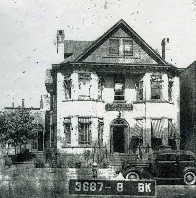 |
The bank in the background of Judy's shot sits on the northwest corner of Pennsylvania and Liberty, seen here in a crummy 1941 tax photo. It was built for the Homestead Bank in 1922, which was eventually taken over by National City Bank (Citibank). it was bought by Jehovah's Witness in 1977 and is currently used as a church. Under the 'History' button is an interesting Brooklyn Eagle article on the bank's opening. On the right, Empire Title as seen in the 1941 tax photo, was located on the east side of Pennsylvania between Liberty and Atlantic and is no longer standing. |
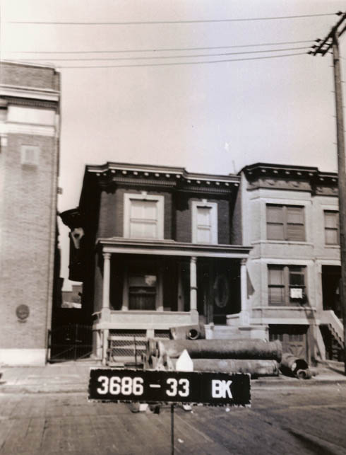 |
Rich Adazzio supplied this 1941 image of 132 Pennsylvania Avenue, right next to the bank. It was the onetime office of his family doctor, Louis Fisher. Richard makes an observation about Pennsylvania Avenue- "My grandfather died young in 1920 – but at the time of his death business was doing well enough that he had a car and a chauffer –my grandmother was a widow @ 28 with 5 children – didn’t speak English and until her death in 1952 – never had to work – supported herself and the children from the real estate properties that she held mortgages on up and down Pennsylvania Ave and from Olive Oil importing –. My mother used to go with grandma to collect the mtg payments from who they considered the ‘rich Jewish’ people who lived in the ‘fancy’ homes on Pennsylvania Ave – guess Pennsylvania Ave was a prestigious address at one time". | |
>  |
 |
Pennsylvania Avenue from Liberty Street Maker: Wm Fick Date: 1910 Status: Own (BG) "Liberty Street" was an error, it was always an Avenue. Pennsylvania Avenue, East New York Maker: Kraus Dated:Unk Status: Own(RG) A similar view north to Liberty Avenue, in this one we can see on the right hand side the wood-frame home of the Homestead Bank. It would move across to the northwest corner in 1922 (see above)and the woodframe would be gone by 1928, eventually replaced by a diner. |
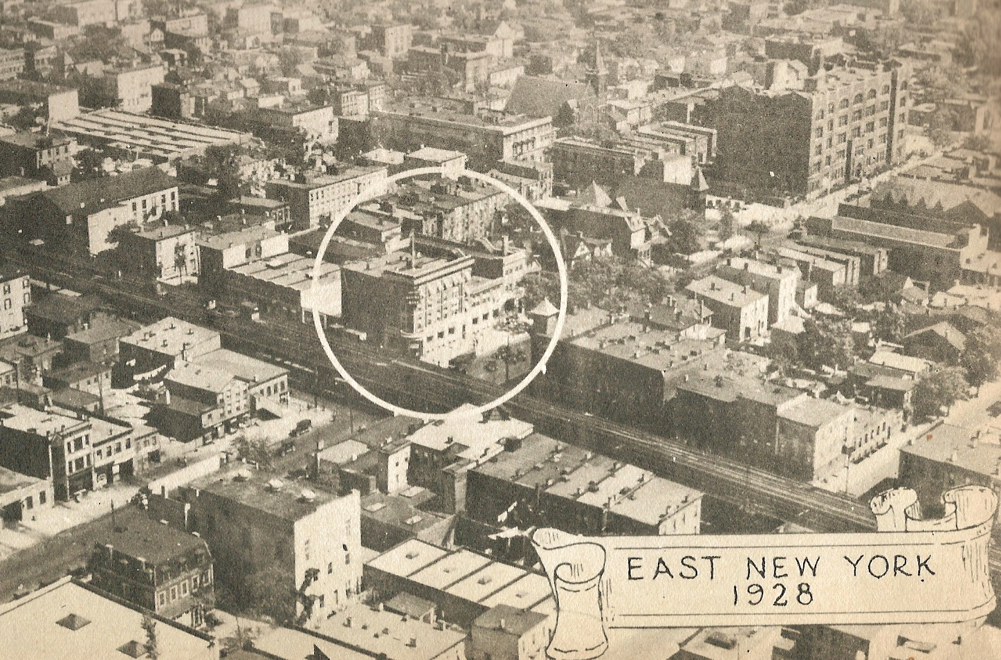 |
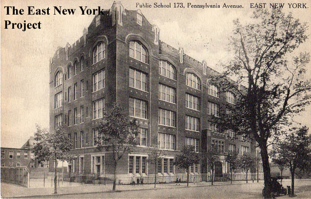
Aerial view, 1928 From the back of the "Good Old East New York" publication, the bank itself is circled to orient the viewer to the Penn/Atlantic intersection. The view is south-southeast. One block behind the bank, to the right, you can see the dormers of the YMCA building. You can also see catty corner from the Y the tower of St. Clements, still standing 1928. The large school in the background is P.S. 173, seen below. |
|
 |
Pennsylvania and Liberty, 1938 This series of images was taken to document work on the new IND line running below this section of Pennsylvania Avenue. The first image was taken before construction began. The view is south along Pennsylvania Avenue across Liberty Avenue. |
|
 |
Looking Northwest, Pennsylvania and Glenmore Avenues, 1940 The city used 'cut and cover' techniques as they moved down Pennsylvania Avenue. The building peeking out in the background on the left is the Piels Brewery. To the far right would be Liberty Avenue, and we can see the original YMCA building and First National City Bank. Al Knecht grew up in the building right next to the one with the "Howard Clothes" sign on it and described the apartment; "My parent's apartment was called a "train apartment". You had to walk through one bedroom to get to the second bedroom! It was a straight line from the kitchen, through the living room, through my room, to get to my parents' bedroom, which faced Pennsylvania Ave." |
|
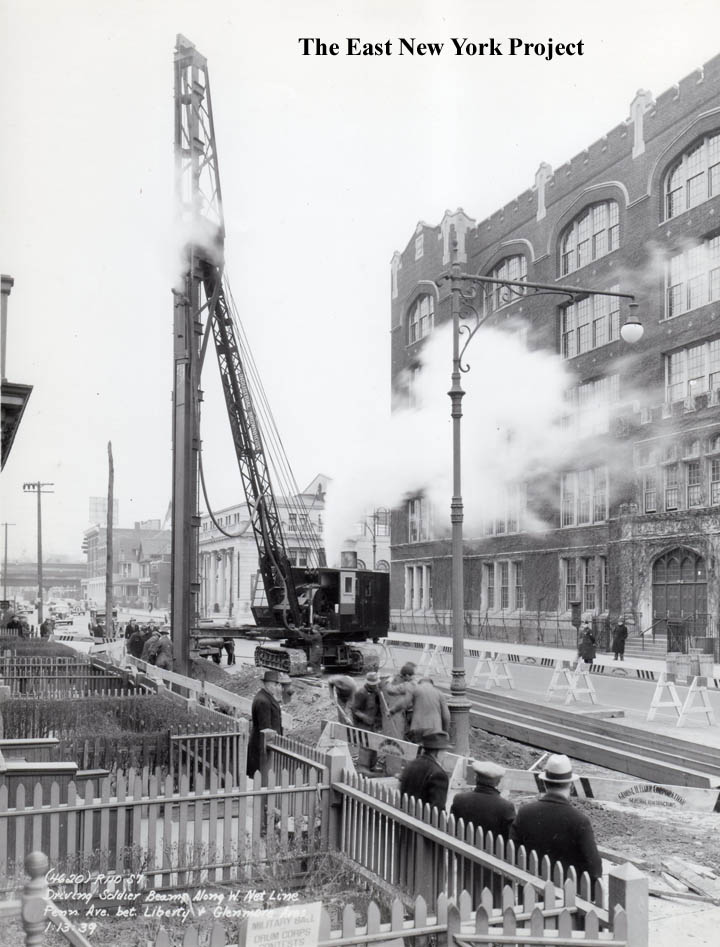 |
Pennsylvania and Glenmore Avenues, 1939 This 1939 image is looking northeast. They are driving the soldier beams. P.S. 173 (later Maxwell Vocational) is on the right. |
|
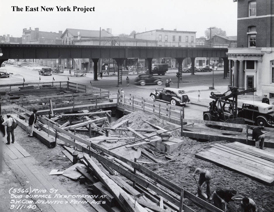 |
Pennsylvania and Atlantic, 1940 The view is northeast, and they are restoring the surface in the images from 1940. The LIRR elevated is still standing along Atlantic Avenue at this time, and we see the East New York Savings Bank on the right. |
|
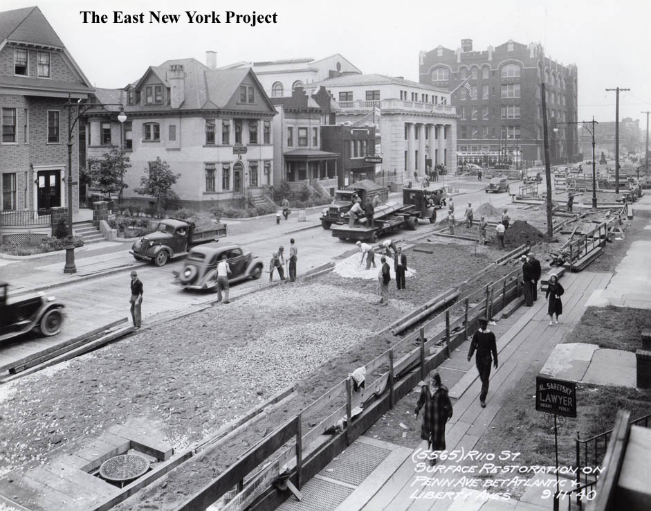 |
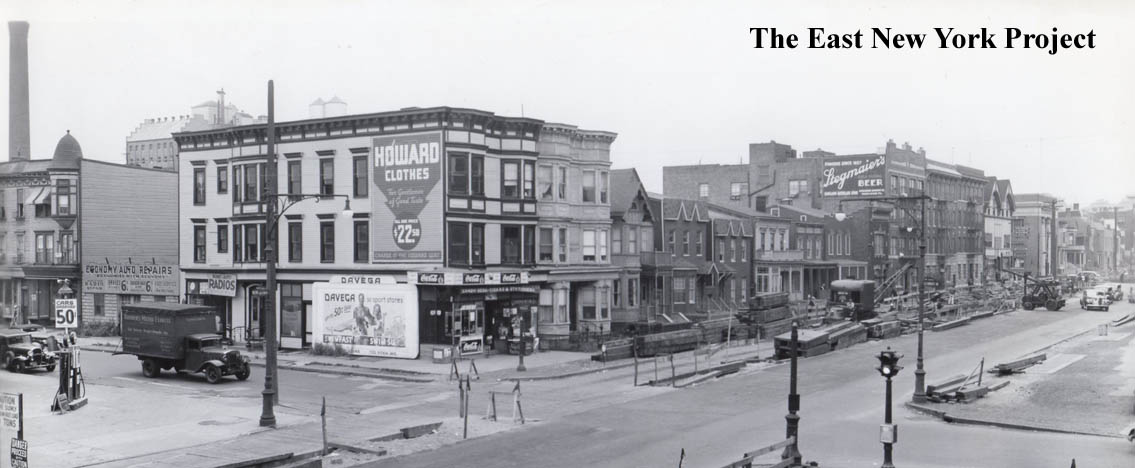
Pennsylvania Avenue, Atlantic to Liberty 1940 This great shot is looking south, a nice panoramic view along Pennsylvania Avenue from Atlantic to Liberty. |
|
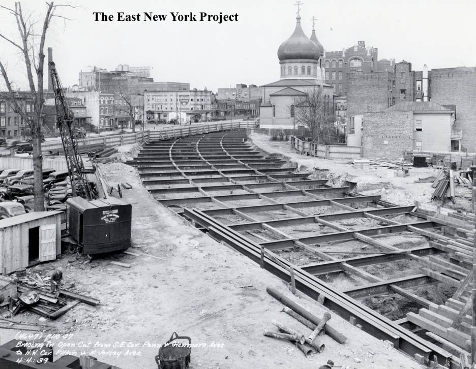 |
Pennsylvania and Glenmore, 1939 My favorite view in this series, because it captures the Russian Orthodox Church in the background and shows the bracing placed over the cuts made for the subway. |
|
 |
Pennsylvania north from Pitkin, 1940 This P.L. Sperr photograph is a rare view in this direction. |
|
 |
 |
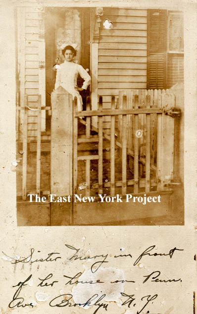
250 Pennsylvania Avenue, 1917. There were enough clues on this card (including the house number) for me to identify the family. The sender was John Maier jr., written in 1917 to his soon-to-be bride Freida Zipke. John Maier Sr. immigrated from Baden in 1889 and was a brewer; given the family’s location he likely worked for the Piels Brewery on Liberty Avenue. They were on Sheffield Avenue by 1907 before buying the house on Pennsylvania Avenue, where they appear in the 1910, 1915, and 1920 census. John’s sister Mary is standing the doorway and she would be married by year’s end. It’s the timing of the card that interested me- shortly before Prohibition and World War I. John Sr. is still listed as a brewer in 1920, but on his 1924 death certificate he is identified as a “Handyman”, suggesting Prohibition ended his career. I wondered if his son John had to fight against his father’s former homeland? Although John jr. lists himself as a WWI veteran in the 1930 census, I could not uncover a military record. The modest woodframe house probably dates to the 1880s. It was still standing at the time of the 1940 tax photos, seen on the right. Most of that block was cleared in the late 1960s and about 1972 the Grace Towers Housing development was constructed. |
 |
 |
Pennsylvania Avenue Congregational Church This was the Congregational Church that sat on the location where 173/Maxwell sits today. The congregation was formed in 1892, and I believe built this structure in 1896. It was a very small congregation, and financial issues forced the sale of the building and the group was dissolved circa 1901. The building was sold to the Lutheran Church of the Reformation who occupied it until they built their permanent home on Barbey Street in 1909. |
 |
A view of the southwest corner of Pitkin and Pennsylvania Avenues, 1950 | |
 |
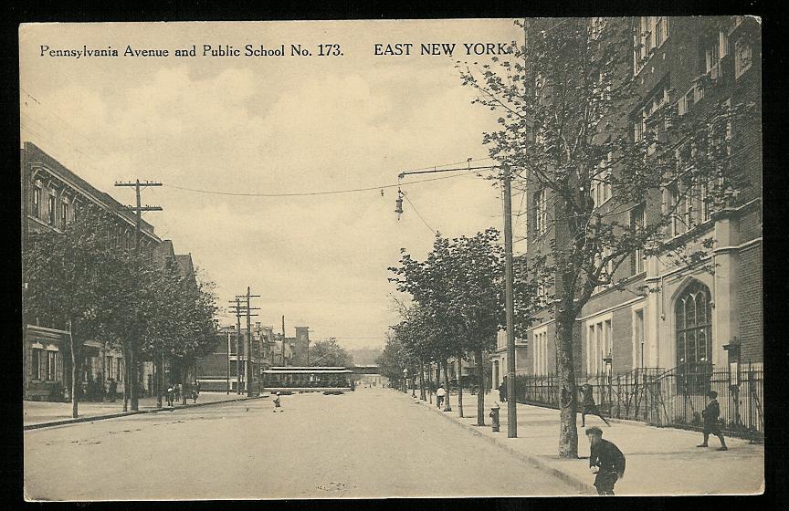 |
Public School 173, Pennsylvania Ave. Dated:1923 Maker: P. Miller Status: Own (RG) Pennsylvania Ave. and Public School No. 173 Dated: 1915 Maker: P. Miller Status: Need P.S. 173 was built in 1913 and eventually became the William Maxwell Vocational School in 1950. We now have a Maxwell Vocational page devoted to both the history of P.S. 173 and the vocational school. |
 |
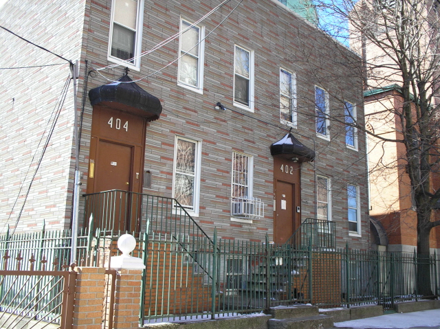 |
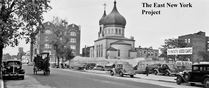
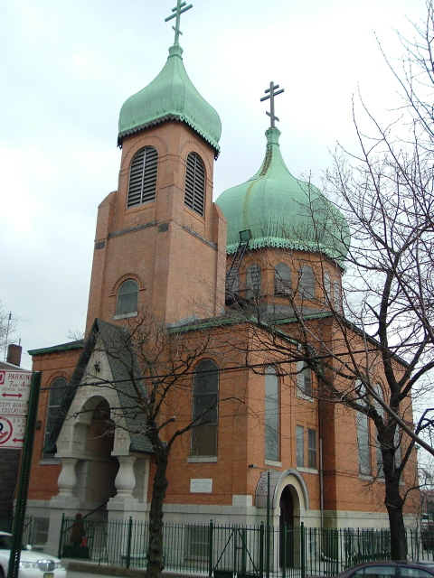
Holy Trinity Russian Orthodox Church, Pennsylvania and Glenmore Neil Sullivan supplied these photos. The building sits on the southeast corner and dates to 1935, though the congregation dates to 1909. Joanne Ahern Kirk was the first to send a picture and some information about the church and 402 and 404 Glenmore, the houses with the onion-dome pediments. "They were acquired in 1949 and after extensive alterations, three dwellings were established. For the Priest, the Choirmaster and the Church Custodian. Provisions were also made for an office, a Church School and a club room for the youth. I can attest to the fact that we had many good times in the youth group that I belonged to back in the late 60's early 70's. " |
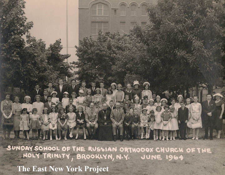 |
Sunday School class, 1964 Joanne also supplied this great shot of the Sunday School class from 1964. The view is north from the courtyard towards Glenmore Avenue, with Maxwell Vocational in the background. Joanne IDs;" I am 7th from the right in the second row with the hat on and my Sister, Marsha Elsner is 2nd row from the top - second in from the left with the hat on" I asked Joanne to fill me on some details of the church at that time; "The Priest's name was Very Rev. George Lukashuk. There were about 250-300 parishioners at the time the photo was taken. There were approximately 60 children registered in the Church School." Joanne lived way over on Jamaica and Logan, and recounts a distinct memory about attending the church; "We would attend Church every Sunday morning along with my Grandmother who never had the patience to wait for the B56 bus. She would have us walk the 25 blocks to save the 15 cents carfare! " Thanks to Joanne and her sister Marsha for the info. |
|
 |
 |
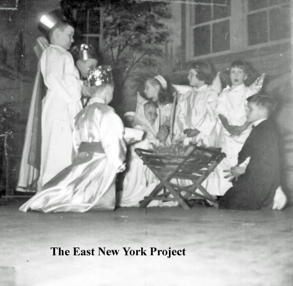
Holy Trinity Russian Orthodox Church, Christmas play Richard Woitowitz followed up on Joanne's Sunday School picture (he was in the Sunday School) with shots from a Christmas play put on by the school in the 1960's. Richard explained to me that the church has a huge basement with a stage where the plays would take place. |
 |
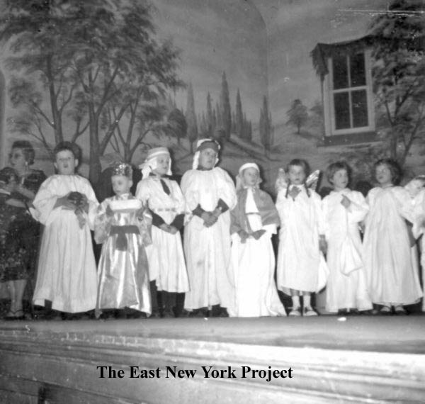 |
Holy Trinity Russian Orthodox Church, Christmas play Second group of shots from the plays. Richard explained; " The Russian Orthodox denomination is part of the Eastern Orthodox Church, which follows the old Gregorian calender. As such our Christmas plays were in January on or around the 7th of that month." |
 |
This magnificent home once sat at 306 Pennsylvania Avenue. By 1940 it was a multifamily house. It is no longer standing. The small octagonal structure to the left remains.(Note: the octagonal structure belongs to the address next door and is still standing. Joan Jano Mattiez knew the family; "Asher Goldfarb, Esq., a lawyer, and his family lived there. The octagon shaped building next to it (which is still there you said) was his law office. I went to school with his youngest daughter, Joan Goldfarb. We went to PS 182, JHS 149 and Thomas Jefferson HS. She had a brother Charles Goldfarb, who also became a lawyer and who took over the practice when Asher passed away and an older sister whose name I forget.") | |
 |
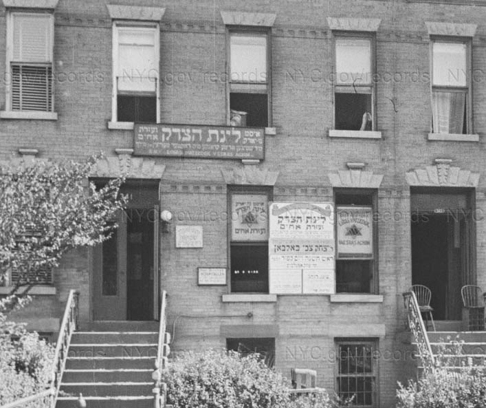 |
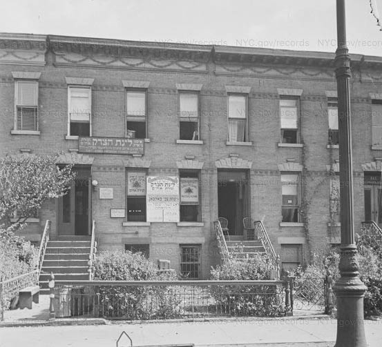
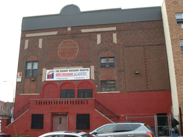
Temple linas hatzedek v'esras achim Demetrius Pestun first identified this synagogue for us. I would later hear from Jonathan Wolf,whose great-uncle Joseph Bauman was Rabbi for the congregation from about 1930 to 1940. The congregation originally met at 351 Bradford Street, where Rabbi Bauman also resided. By 1940 the congregation was worshiping at 339 Pennsylvania Avenue, between Blake and Sutter. . |
 |
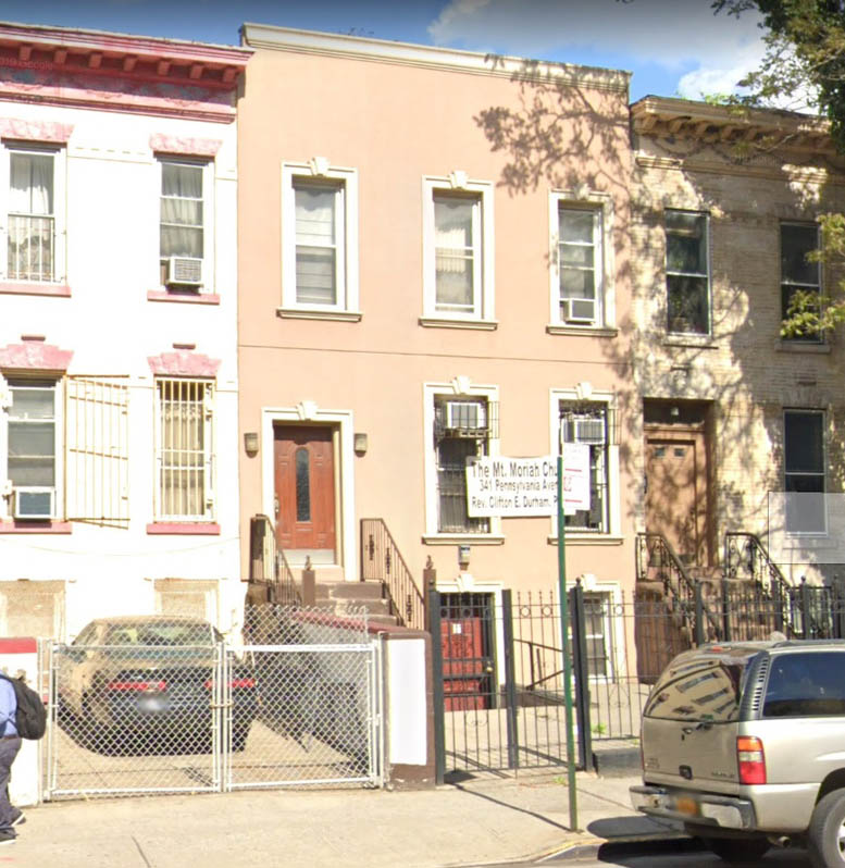 |
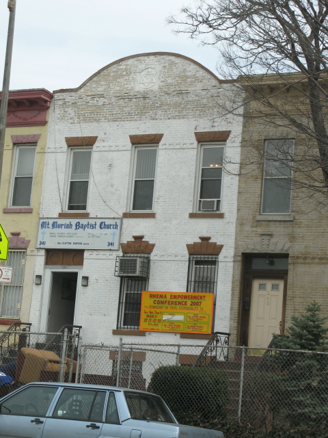
Mt. Moriah Baptist Church Sometime after 1940, the Linas Hatzedek congregation moves next door to 341 Pennsylvania Avenue. They modify the front roofline to include a Star of David, seen in Demetrius' 2007 image. Mt. Moriah Baptist Church took over the location about 1969. A 2019 Google streetview image shows the roofline has been modified to cover the symbol. |
 |
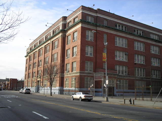 |
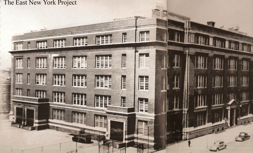
Thomas Jefferson High School Located at 400 Pennsylvania Avenue near Dumont Ave. We now have a Thomas Jefferson High School page . They have accumulated a decent following at "Classreport.com" which can be found here. Unfortunately the city has chosen to close it and the last graduating class was in the spring of 2007. Neil Sullivan provided the 2006 shot. |
 |
New Lots Talmud Torah Demetrius Pestun sent over this 2007 shot of the former New Lots Talmud Torah, located on the southwest corner of New Lots Avenue and Pennsylvania Avenue. Mitch Kahn brought to my attention that this location was formerly the New Lots Theatre, which operated from 1914 to 1918. Although there are references to the theatre being modified into the synagogue, the reality is the theatre was a 1-story building with a different footprint. Though it is possible part of the foundation and/or a wall was retained, it is misleading to suggest the current building served as a theatre. |
|
 |
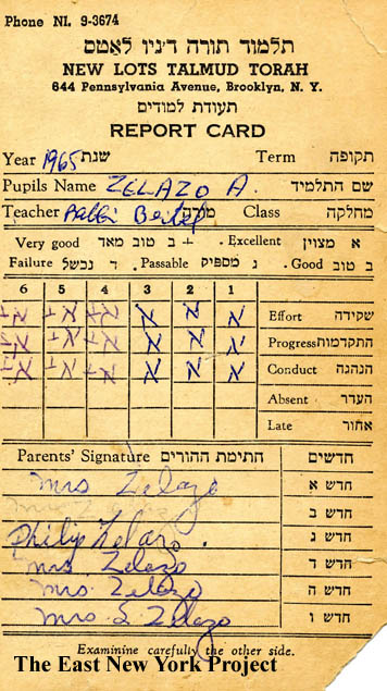 |
New Lots Talmud Torah Hadassah card From Al Zelazo; a Hadassah card from 1976 and on the right, a 1965 report card from the school. |
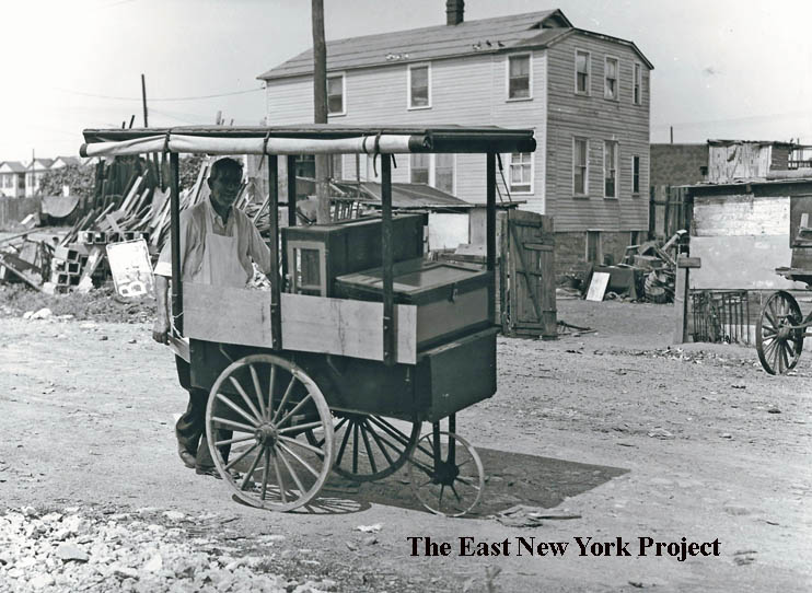 |
Pushcart vendor, 1934 This P.L. Sperr photo was taken looking north towards Stanley Avenue. I believe those buildings in the background were replaced by the Linden Houses. |
|