        |
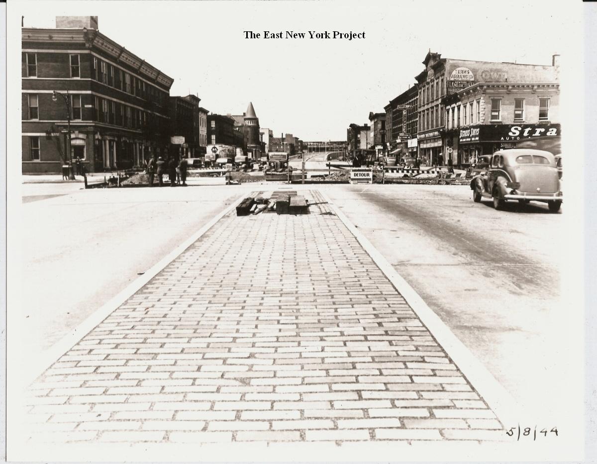
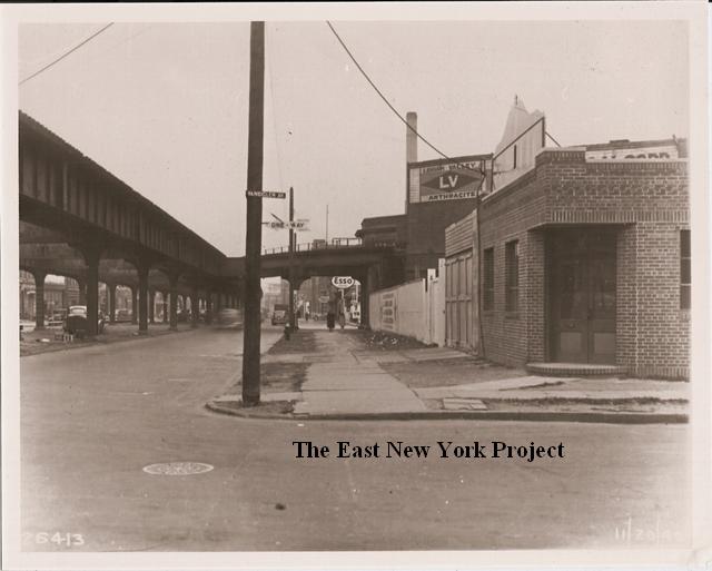
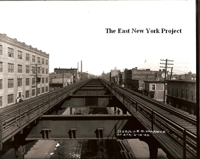
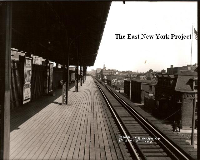
Atlantic AvenueFor Atlantic Avenue east of Cleveland, visit Zone 6. There are additional images west of Georgia Avenue located in Zone 1. Prior to 1943 Atlantic Avenue was dominated by the elevated Long Island Railroad, which was subsequently placed underground. The LIRR closed the local run between East New York and Jamaica on November 1, 1939 to commence the removal of the tracks. Service reopened on July 1, 1944. A number of images here document that change. |
|||
|

|
Atlantic Avenue, east from Alabama Avenue, 1942, 2015 This is the north side of Atlantic Avenue, and we can see in the 2015 image those buildings remain standing. | |
|
|
Atlantic Avenue, looking east, 1930, 1939 These two views are from track level of the old LIRR elevated. The first from 1930 is from Alabama Avenue. The 1939 image on the right is toward Williams. | |
|

|
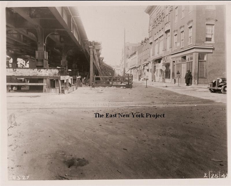
Atlantic and Georgia, 1942-1943 I'm going to run this series west to east. The first shot is a view of the northwest corner,looking west ,and shows the work underway to remove the el. On the right, the view in 1943 with the work completed. We have additional view os this intersection on the Georgia Avenue page. | |
|

|
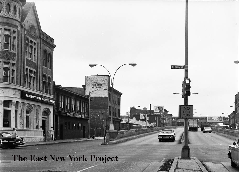
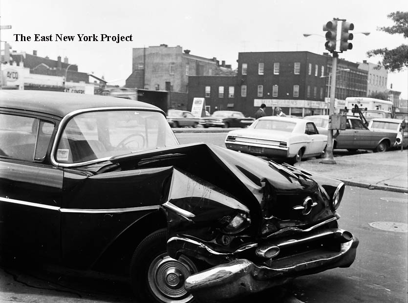
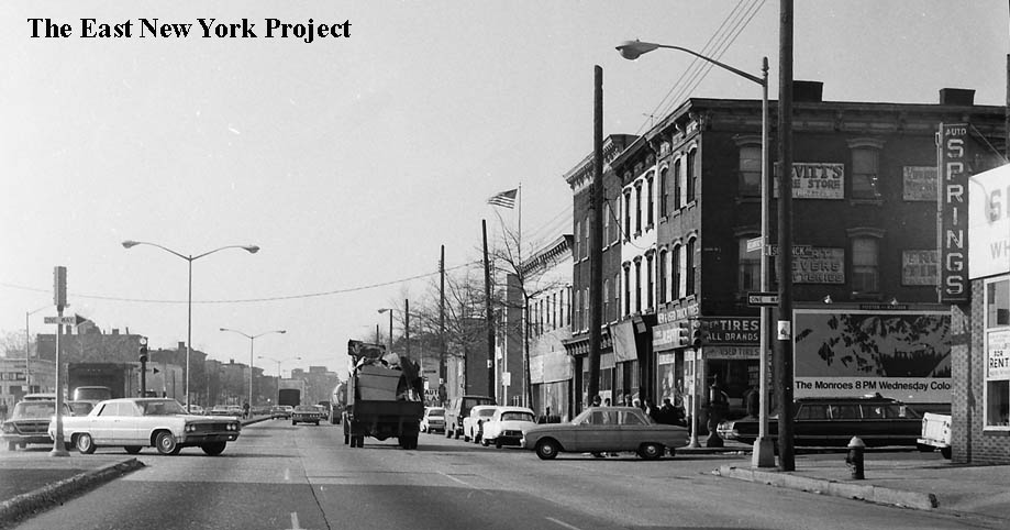
Georgia and Atlantic Avenues, ca. 1966 In the first view we are looking west, and my uncle always told me that spot was almost a daily accident scene. On the left is the old 26th Ward Bank, then a Manufacturers Hanover branch. My aunt used to live in that building (her father was the caretaker) and in fact the room at the top with the oval windows was her bedroom. On the right the view is east and we can see why it was an accident magnet. There is no stop sign, drivers on Atlantic had the right-of-way but they could not see to their left nor could they be seen by anyone turning off or crossing Atlantic Avenue. | |
|
|
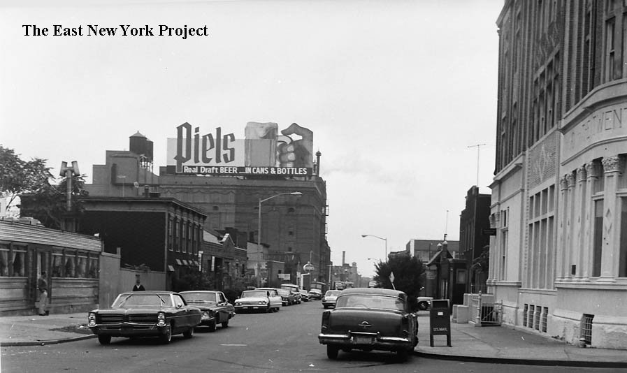
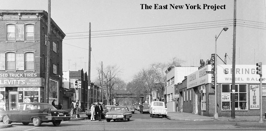
Georgia and Atlantic Avenues, ca. 1966 I promised a better view of the Piel�s sign, as we can see looking south down Georgia Avenue. Sadly, the famous neon-lit sign of the gnomes bowling was long gone. I have a poor version on the Piel�s page but my search continues for a good one. The view on the right in looking northeast back toward Atlantic Avenue. | |
|
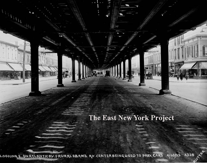
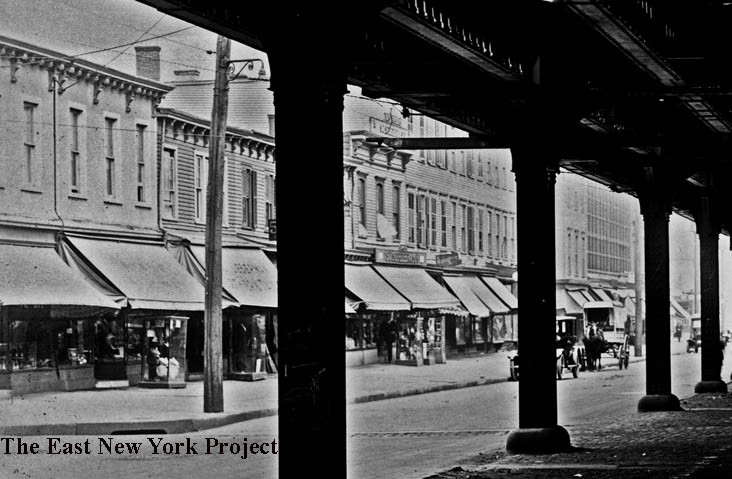
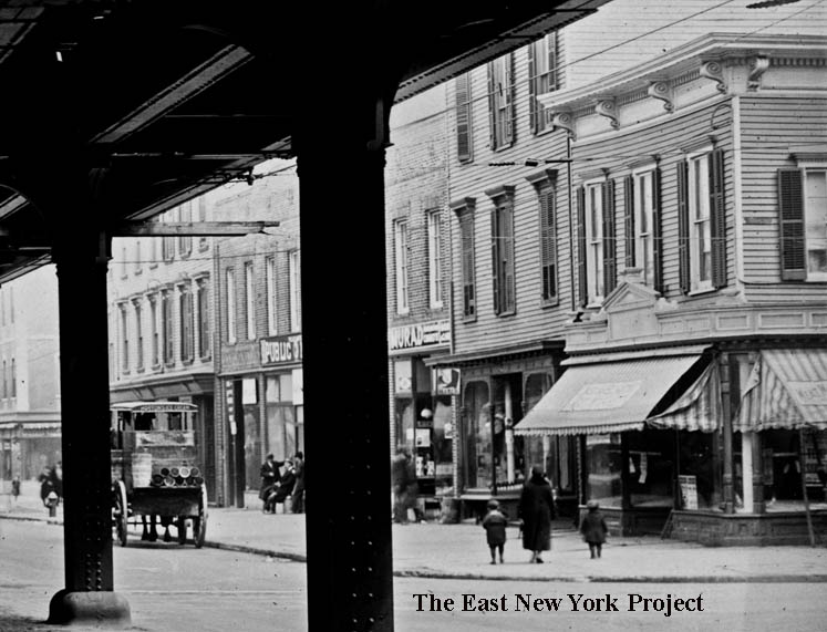
Atlantic Avenue between Georgia and Sheffield Avenues, 1923 Although the Rutter image is labeled as "East of Alabama Avenue", the view is really between Georgia and Sheffield. Note the area beneath the LIRR tracks is being used for parking. I split this photo in half and zoomed in on each side, which you can see below. | ||
|
|
Atlantic Avenue between Georgia and Sheffield Avenues, 1923 On the left is the north side, in this 1923 closeup. The vendors used to roll out glass display cases in front of their stores each day. All these buildings are gone; a full-block car wash occupies the location today. On the right is the south side of Atlantic Avenue between Georgia and Sheffield. Surprisingly most of those buildings are still standing. Note the ice cream cart, advertising "Horton's." | |
|
Atlantic Avenue, east of New Jersey Avenue, 1934 Photographed by P.L. Sperr, the Ardley Palace (see below) with the large vertical sign is visible down the block. | ||
|
|
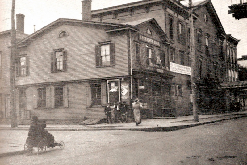
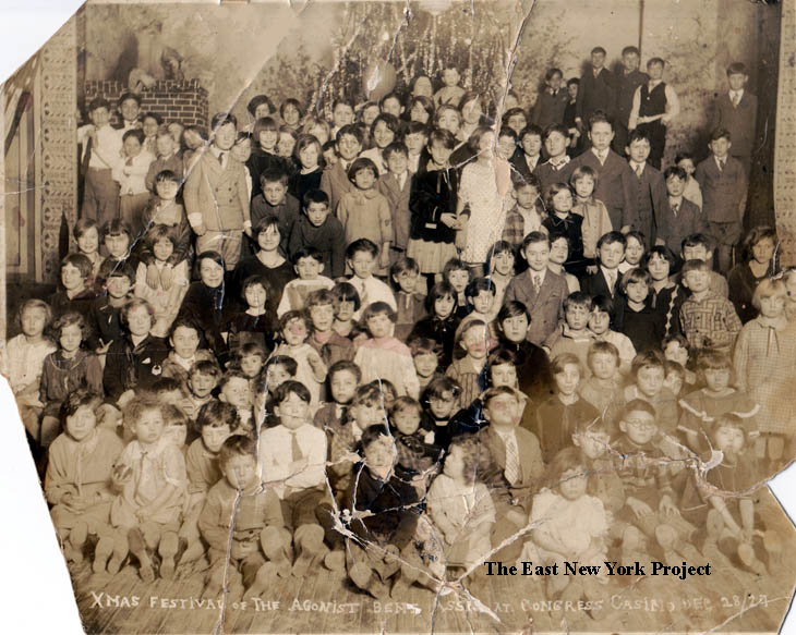
Atlantic and Vermont On the south side of Atlantic sat Congress Hall, on the corner of Vermont Street. Originally a hotel owned by George Schiellein, it was an important meeting place for many years. In the 1929 Armbruster photo the building was then known as the Ardley Palace. On the right is a rare interior view sent in by JoAnn Montgomery. The "Agonist Bent Association" was philosophical society from the turn of the century. This picture was from a Christmas party in 1927. | |
|
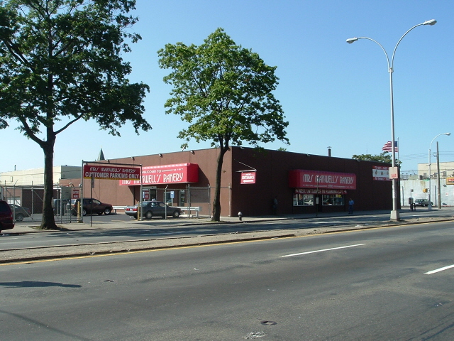
On the southeast corner of Vermont and Atlantic is Maxwell's Bakery, a long time favorite of the area, seen in this 2005 photo from Neil Sullivan. | ||
|
|
Atlantic and Pennsylvania, 1944 The view is west across Pennsylvania Ave. We have a number of shots of this intersection on the Pennsylvania Avenue page. Neil SUllivan provided the 2006 view. | |
|
|
Miller and Atlantic Avenues, ca.1965 The first view is looking north, we see the northwest corner of Atlantic Avenue and the el on Fulton in the distance. The second view is south across Atlantic along Miller Avenue. | |
|

|
Atlantic and Van Siclen, 1940,1938 The photo on the right is from arrts-arrchives, and though essentially the same shots 2 years apart, arrts' photos shows the name of the coal company, Luzerne. That photo, from 1938, is incorrectly identified as east of Hendrix. The Brian Merlis image on the left clearly shows the Van Siclen sign. Luzerne had their own rail connection to the elevated tracks, and though I have not confirmed it I assume they delivered coal to the Ridgewood pumping station. Also note the pre-Exxon "Esso" station. . | |
|
|
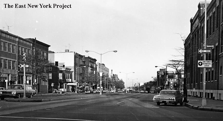
Atlantic and Schenck Avenues, ca. 1966 The first view is east, and we can the Borden Plant on the right. The other view is west on Atlantic across Schenck. | |
|
Atlantic and Schenck Avenues, ca. 1966 This view is north along Schenck across Atlantic. The el on Fulton is visible in the distance. | ||
|
|
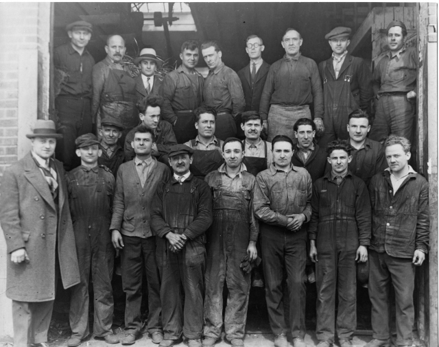
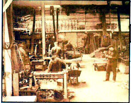
These 2 great early photos are from Janice Abrams. Janice sent us a great early shot of 87 Barbey (posted on the Barbey St. page in Zone 2). Her grandfather owned an Iron shop on Atlantic Avenue near Barbey known as the Philips Iron Shop and these photos were taken outside and inside. We are trying to pinpoint the exact location, sometime between 1910-1930. | |

|
This view dates to 1932, shot in a backyard of 234 Jerome Street. The view is north toward Atlantic Avenue, and its the background that is of historic interest. It is a rare view of the Vienna Flats apartment building on the northwest corner of Atlantic Avenue and Jerome Street. Apparently it had a significant turret when it was first constructed, which was gone by the time of the 1940 tax photos. | ||
|
|
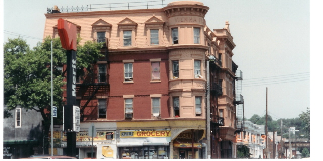
Atlantic west from Jerome, Vienna Flats The 1943 view on the left comes from the Brian Merlis archives and and shows the entrance to the Vienna Flats apartments on the corner as well as the Borden Milk plant in the distance. Vincent Luongo sent the 2005 view of the Flats, the name is still visible at the top. The turret is long gone. | |

|
|
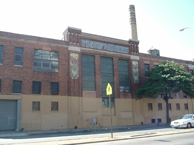
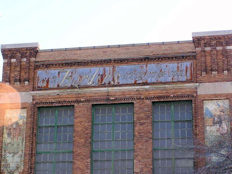
Borden Milk Plant We're still researching this plant. At the turn of the century the location belonged to the Empire State Dairy. That rare postcard view comes from the Brian Merlis archives. It is the southwest corner of Atlantic and Schenck, with Schenck on the right hand side of this view. At the time the Borden Dairy was located over on Liberty Avenue between New Jersey and Vermont, on the site of the old St. John's. Borden buys the Empire State Dairy, and builds a new plant in this location. Neil Sullivan supplied the 2006 view of the plant, long closed. We are still researching the dates of the plant and its closure. Rod Maggio adds that Borden was still using horse wagons into the 1940s, still doing milk and ice cream out of the plant in the 1950s (step wagons then). Tony Cottone notes Schenck was 2 way from Liberty to Atlantic then. | |

|

|
Borden Milk Plant The Borden's plant had some great tilework, and Glen Gochal managed to get these closeups for us before the plant disappears. Michael Padwee, a tile collector and historian, informed me the tiles were made by the American Encaustic Tiling Co. of Zanesville, OH. | |

|
|
Borden Milk Plant Michael Padwee also tracked down the blueprints. Although the image is not strong, it contains some important facts. You can see the building designed by Otto Strack was intended for the Empire State Dairy, not Bordens. The plans were dated 1913 which gives us a good idea of the building date. We are not sure when Bordens bought the Empire State Dairy and if the sign needed to be changed. On the right, a closeup from Glen. | |
|
|
Atlantic Ave., 1982 Rod Maggio took these shots in 1982. On the left, the southwest corner of Warwick and Atlantic was Joe Arcaro's music store and a diner where the Aamco is sitting. Note St. Michael's tower in the background. On the right, the northeast corner of Barbey and Atlantic, site of Kitty Rascher's bar in the 50's and later "Stan's". Tony Davenport recalls the owner was Stan Anania and he played football with his son Ivan on the Lynvets. | |

|
This is the north side of Atlantic Avenue, looking west to Barbey Street in February 1967. Stan's is visible on the corner. | ||
|
|
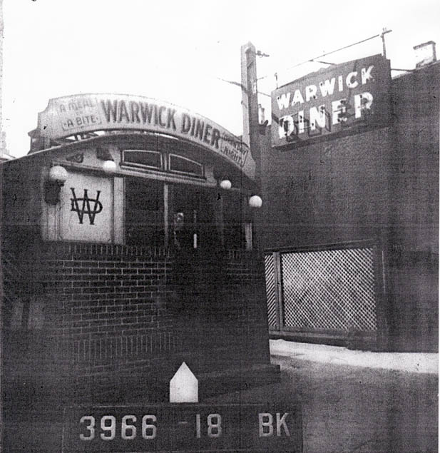
Atlantic and Warwick, 1940 A view of the southwest corner, looking west. Some neat details; a cigar/candy store, a barber pole, and the Warwick Diner as you move down the block. On the very far left you can see the street is closed off with a "play street" sign. Therese Panariello confirmed that was for St. Michael's. On the right, Joanne Montgomery supplies a tax photo shot of that neat-looking Warwick Diner. | |
|
Novocol Chemical, 1940 The building on the north side of Atlantic by Warwick was a fairly nondescript factory for Novocol Chemical- a manufacturer of Procain, the novocain used by dentists. Developed by a German scientist, the U.S. used to import it until World War I. At this point a license was issued in the U.S. to synthesize and produce the drug, and Novocol switched from importing to manufacturing. There is a partial view of the plant on the left of the 1940 image. Rod Maggio recalls they had more than one plant in the area. Al Pugliese recalls the loading dock was their "dugout" for stickball games! The building now has a new future as the permanent home for the Cypress Hills Community School. On September 17, 2007 the Cypress Hills Development Corp announced they had received funding to renovate the building for the school, which has been in temporary quarters for ten years. | ||
|
|
Atlantic east of Warwick, 1920 Two views east down the elevated LIRR tracks, the stacks of the pumping station are visible in the distance. Advertising on the right hand side; Cowperthwait was a furniture and bedding store, Knorpp Candy visible in the distance, and even further down "Weisglass" is visible past Logan. Knorpp was a longtime candy maker in the area, dating to 1910, and when it closed in the 1960s the building was sold to a toy company that used the building for storage; it was destroyed in a fire in 1966. | |
|
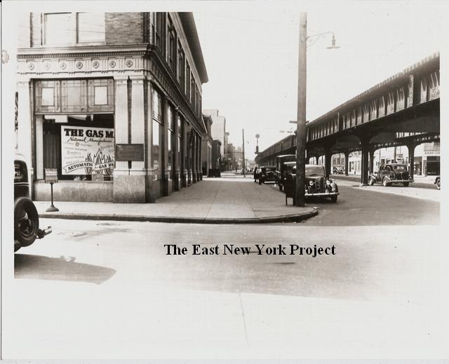
Atlantic and Ashford, 1940 A view looking north, towards Atlantic. From Arrts Arrchives. | ||
|

|
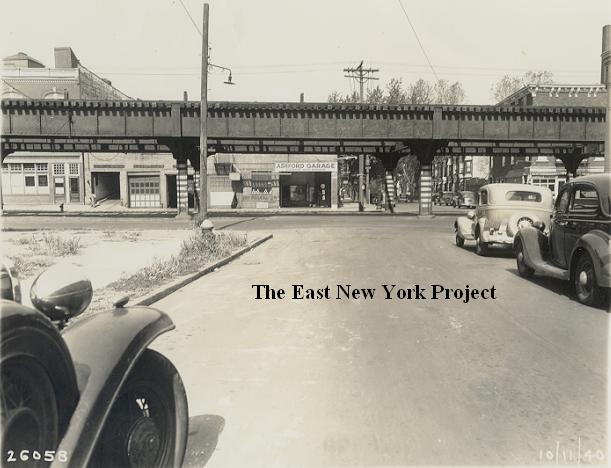
Atlantic and Cleveland, 1940 The first view is of the southwest corner, looking west. You can see the Ashford Garage from the above picture, and in the distance the sign for the Warwick Diner. That's the Brooklyn Union Gas Co. on the corner. The second shot is looking north towards Atlantic. I was able to make out "Oakland Fur Dyeing" on one of the trucks. | |