        |
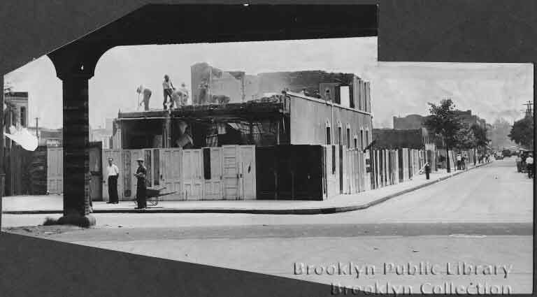
Atlantic Ave. , East of WarwickIn order to lighten the picture load in Zone 6, I have decided to create an Atlantic Avenue page to stand on its own, though some pictures may duplicate themselves elsewhere. Atlantic Ave. is closely tied to the history of the Long Island railroad. There are some terrific websites dedicated to the LIRR and it is not my wish to duplicate that work. I recommend aRRts aRRchives to those who wish to see more. The LIRR was first constructed at ground level, then a portion went elevated in 1903. In 1943 the el portion was moved underground. Many photographs were taken to document these changes and quite a few appear here courtesy of the Brian Merlis Collection. |
||
|
|
Elton and Atlantic This series will run west to east,starting with these photos to take advantage of work done by Neil Sullivan. We both believe the 1938 shot is a view south, and thus where the work is being done is the eventual site of Liberty Park. Neil provides a current view; the street no longer goes through and I.S. 302 sits on the site of the playground.  |
|
|
Liberty Playground The playground, known as the Elton St. Park to some and Liberty Park or playground to others, opened around 1939. The shot on the left comes from Arrts Arrchive's and is a view west down Atlantic from Linwood. You can see St. Michael's in the distance. We have received photos from Elsie Anzalone and Cynthia Rongione and there is now a page devoted to the park which can be found here. |
|
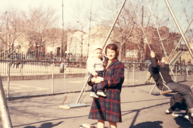
Brooklyn Day, 1938 Elsie also recalls this day being refered to as "Decoration Day". We're not sure which side of Atlantic Ave. this shot was taken, but Elsie doesn't look too thrilled about participating. | |
|
|
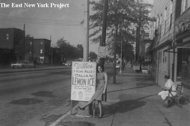
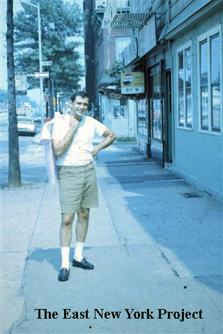
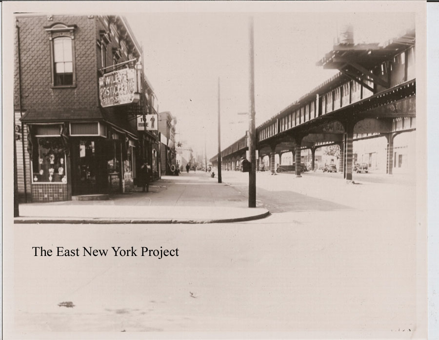
Willies Lemon Ices When we started this website, my brothers and I wondered "Would we ever find a picture of Willies?" Eleanor Deliberti, his daughter, comes through with these shots from 1964. That is in fact Willie in sitting in front of the store on the south side of Atlantic between Essex and Linwood. |
|
|
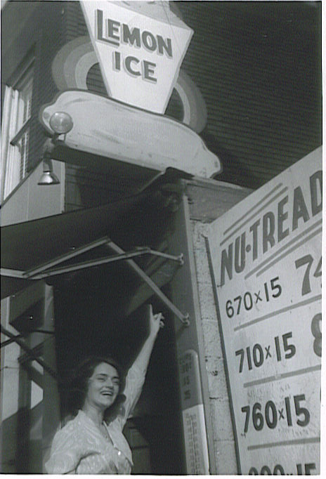
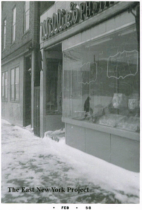
Willies Willies actually started on the southwest corner of Essex and Atlantic in the 1940s, seen below. The pasticceria moved a few doors down and can be seen in these shots from 1958 and 1967. The corner became Barneys Candy Store. |
|

|
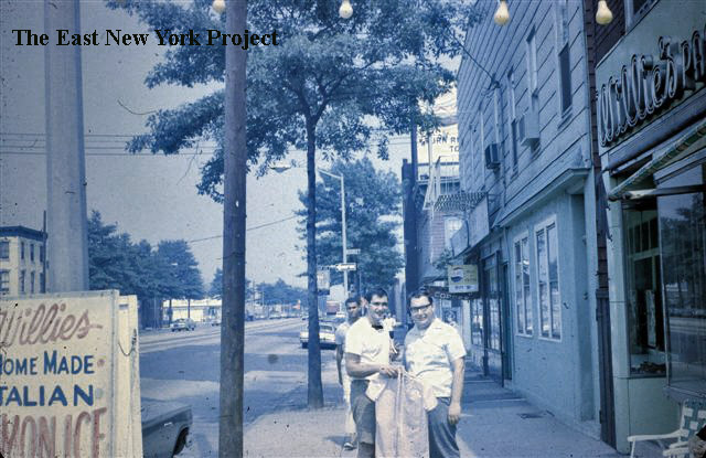
Willies Tony Della Croce sent over these views from 1969. Looking east towards Essex, you can see the awning for Barneys just poking out. That's Bill Deliberti, Willie's son, in the picture. On the right, its Bill again with Mike Della Croce and Peter Noto in front of Willie's. |
|
Willies Finally, we have Bill with Tony Della Croce, and the Willie's Ices sign visible on the left. Thanks to Tony for sending those over. | |
|
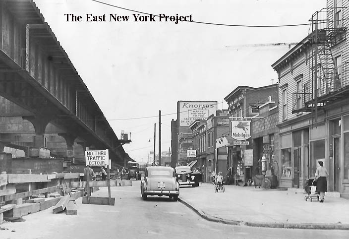
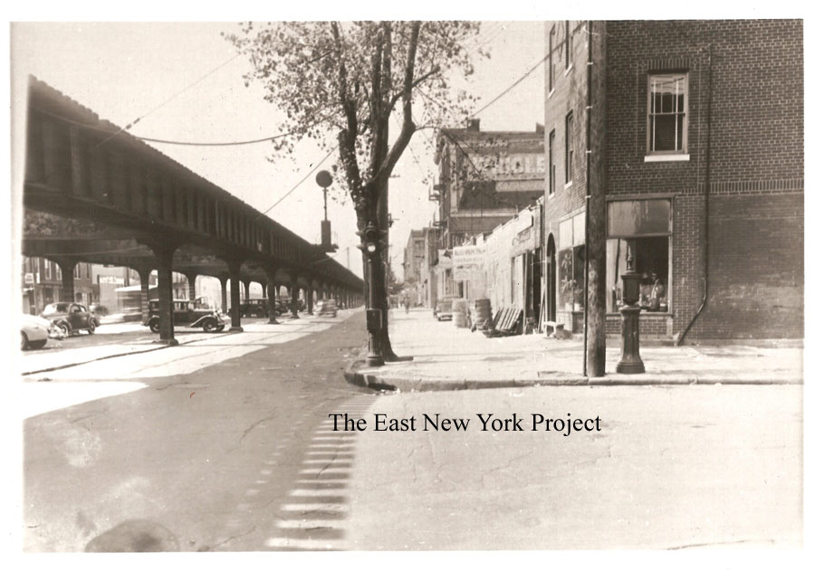
Atlantic, east of Linwood 1941 In the background of the above shot you can see part of a billboard; in this 1941 image looking east along Atlantic from Linwood, you can see a full sign for Knorp's. This news picture was documenting removal of the Atlantic Avenue LIRR elevated line and associated traffic headaches. | |
|
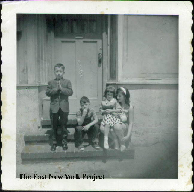
3001 Atlantic Avenue From David Picascia, a shot in front of the Corso residence circa 1965; "I am the one praying and my sister, Madeline, is the girl sitting on the older Corso girl's lap. Her brother (Louie) is sitting between us.." | |
|
|
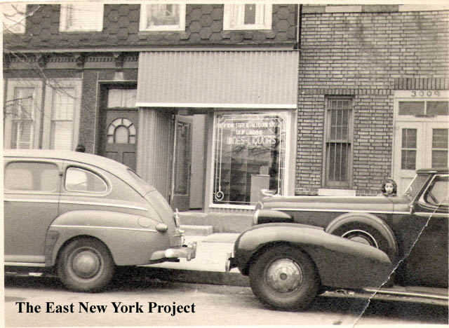
3003 Atlantic, circa 1951 Danny Blanda sends over a shot of his Dad's liquor store, which was on the north side of Atlantic off the corner of Linwood. The girl peering over his Dad's Cadillac is unidentified. The shot on the right is from 1953 looking south across Atlantic from the store, and yes that is Willie's in the background. The building with the Knorrp's ad was the toy factory that burned down in 1966. That's Danny's dad in the picture. |
|
|
Atlantic and Essex, 1940 We all remember Willies Lemon Ices a few doors down, but his first location was on the southwest corner of Essex and Atlantic. After Willy moved, this location became Barney's Candy Store. The second shot is the northwest corner. Eleanor Deliberti's brother alerted us that this was a section office for the Sanitation Dept and Charlie Witte confirmed that- back when the area was District#41 for the Sanitation Department. Charlie worked with Tony Danza's father Matty in sanitation and reminds as that their name was actually Iadanza. |
 |
|
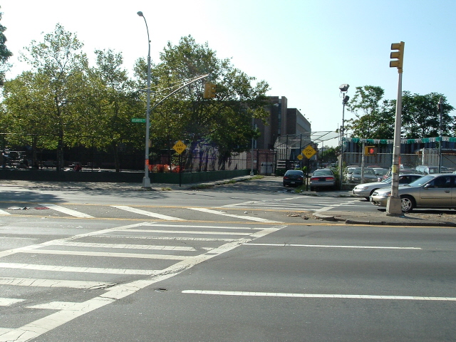
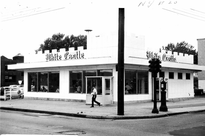
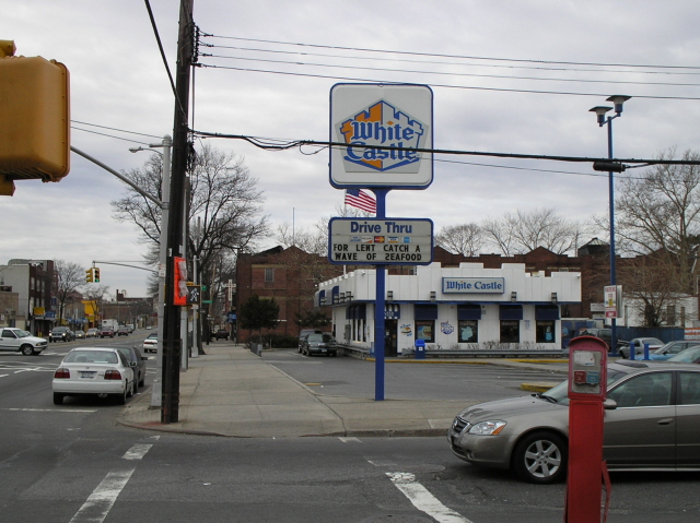
White Castle Dominick Mondelli gets huge credit for perseverance, contacting the White Castle Corporation to track down a photo of the original White Castle which sat on Highland Place and Atlantic. The shot is from 1958, the year it opened. Neil Sullivan supplied the 2006 view of the newer building which was built on the original parking lot so technically is on Shepherd Ave. Now we need to track down the original Carvel across the street! |
|
|
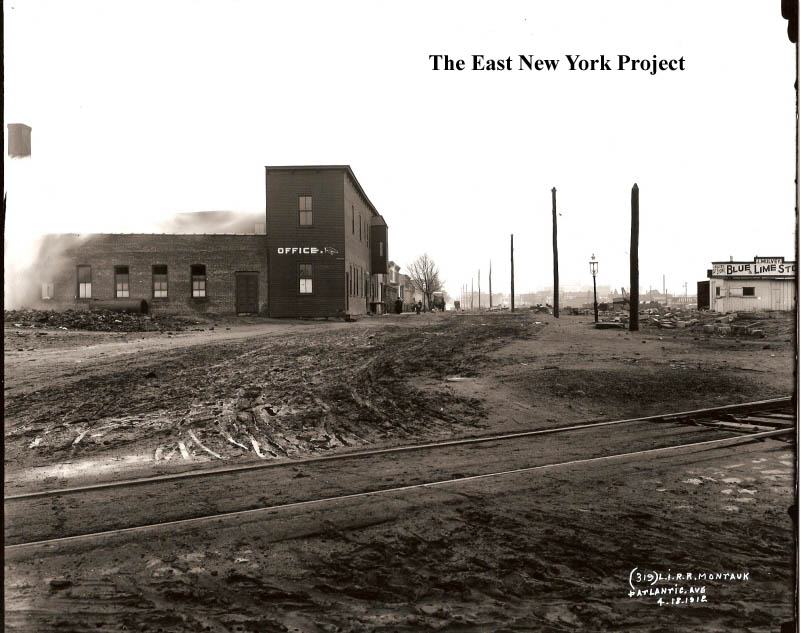
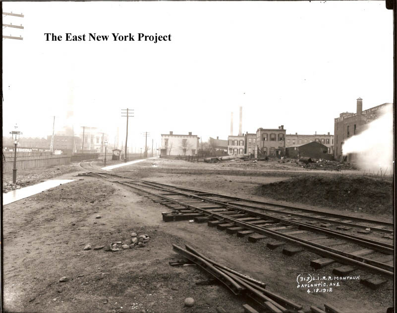
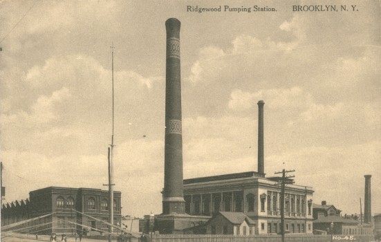
Atlantic and Montauk Ave., 1912 Two views from the Brian Merlis Collection. The first is a view south and the second is a view northeast, towards the Ridgewood Pumping Station. |
|
|
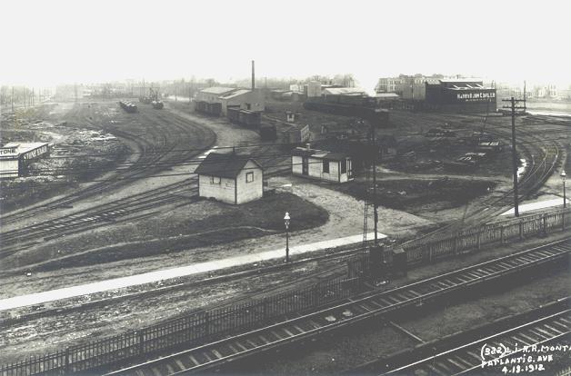
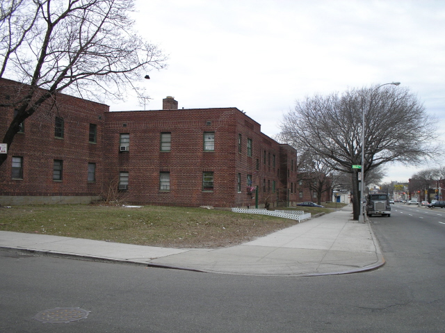
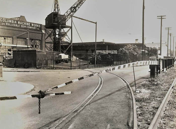
Montauk Yards The tracks curving off in the photos above led to the Montauk Railyards. The 1912 photo on the left from Arrt's Arrchives picks up just west of the photo above it (You can see the word "stone" on the left from the J. Mulvey sign). Neil Sullivan snapped the 2006 photo on the left; the Arlington Village apartments were built here after World War II. For more pictures and background, visit Zone 6. |
|
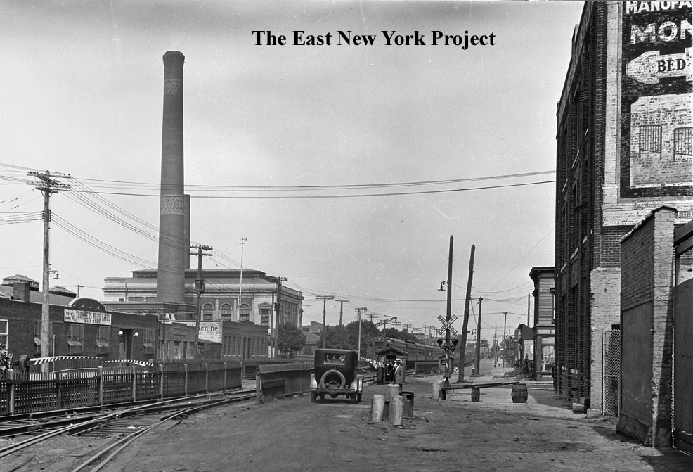
This eyeful is looking east along Atlantic Avenue from Montauk Avenue in 1930. We can see a Trommer's Distribution warehouse on the left, Columbia Machine Works behind it, the pumping station, and even an LIRR train chugging towards us on the tracks. Mountauk Bedding was the building on the right. | |
|

|
Ridgewood Pumping Station, Brooklyn Dated: 1915 Maker: Unk Status: Need Ridgewood Pumping Station Water Works Dated: 1907 Maker: Unk Status: Need Located at Atlantic and Logan, torn down in the 1960's for a public park. The chimneys were a landmark for a number of years. There is now a page devoted to the Water Works located here. |
|

|
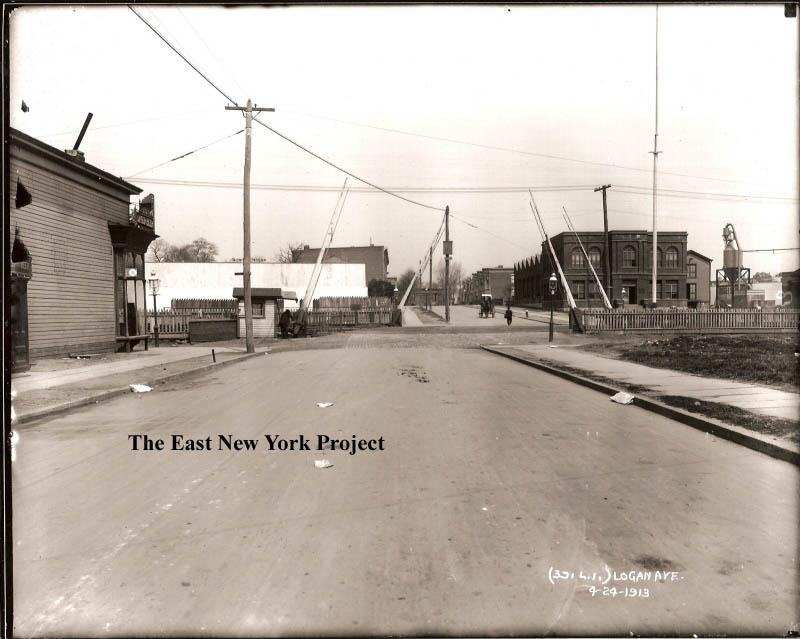
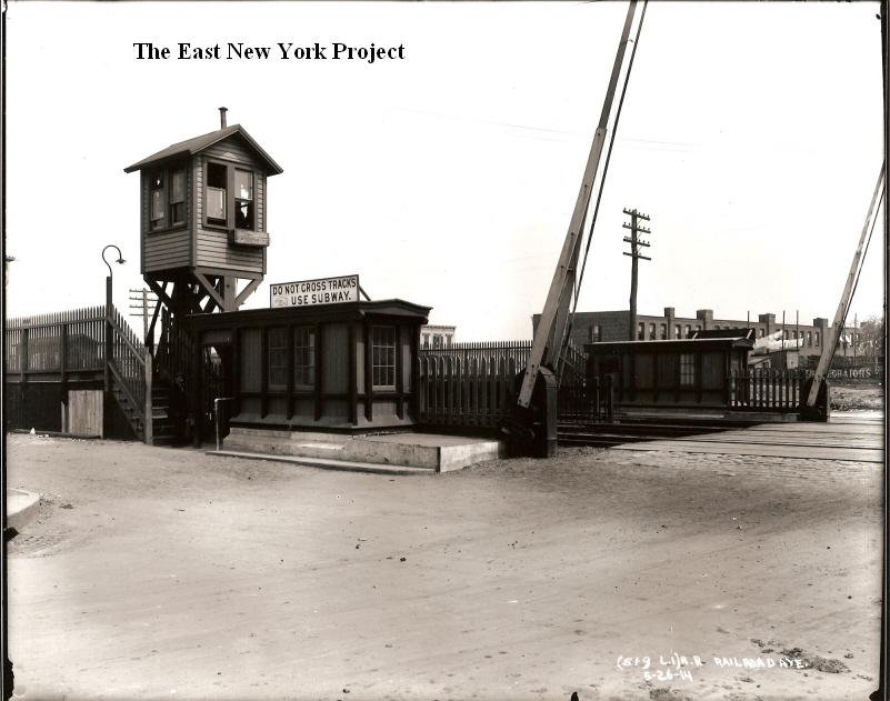
Atlantic and Logan, 1913 This view from the Brian Merlis Collection is looking north across Atlantic on Logan. The building on the northeast corner is part of the Pumping Station (Visible in the postcards), though I am not sure what that tank is on the right. On the southeast corner the signs are advertising "Lager Beer", I can't tell if it is a bar or a distributor. The Jamaica El is visible in the distance. On the right is the 1940 tax photo courtesy of Neil. |
|
|
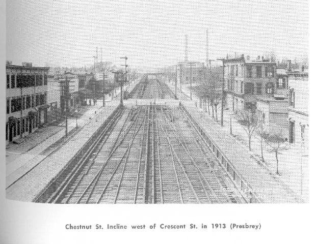
The first photo can also be found on the LIRR page here.It is a view east on Atlantic from Logan in 1906.The significance is that it shows the connection coming in from the BMT line that existed only for a short time. The second view is from Chestnut St. in 1913. |
|
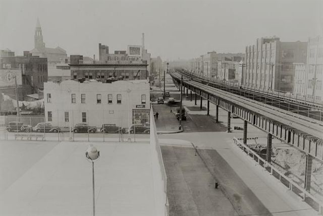
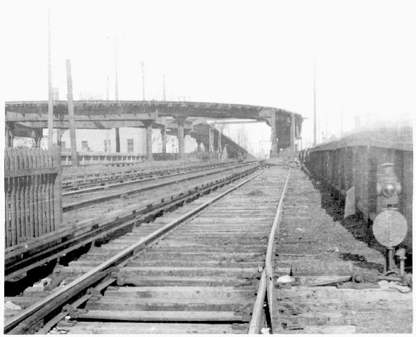
The view is east from Chestnut Street in the early 1940s. The incline over Atlantic Avenue has been removed, but the el structure still stands at the end of Chestnut Street. It would be removed during the war effort, we have a picture of that on the Euclid Avenue page. | |
|
|
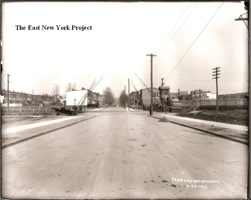
Atlantic and Autumn, 1913 Two more from the Brian Merlis Collection, you will notice Autumn Ave. was known as Railroad Avenue at the time. On the view north, you can see a sign advertising "5 1/2 Miles to Abraham and Strauss". I also believe that is 171 in the distance on the right. |
|
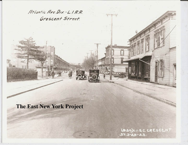
Atlantic and Crescent, 1923 If I have it right, the El would come to ground level around Chestnut St. This view is north; you can see the Jamaica El in the distance. It appears the switching station was still there in 1923, something to investigate. Its hard to see, but the building on the northeast corner has a sign on the wall advertising the "Brooklyn Baseball Club". | |
|
 |
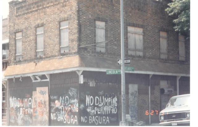
Atlantic and Lincoln We're still missing an old shot of this corner, where Vincent Luongo recalls a Country and Western Bar. Neil sent in an update foto, and noted that the 1939 tax image was poor but he could make out the sign which read "Autumn Cafe". Thanks to Vince for the shot on the left. |

|
Atlantic and Enfield St. (Eldert's Lane), 1913 Another view north across Atlantic, You can see 171 in the distance at the far left. Those are gas streetlights on the corner. | |