        |
Upper Highland ParkNote: The Reservoir has its own page, use the dropdown menus under Highland Park.The HP Postcards page contains all the Highland Park postcards.  |
||||
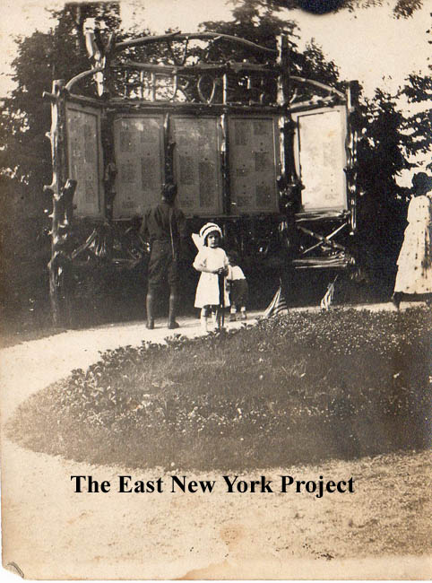 |
"Heroes" arbor, Highland Park, Brooklyn N.Y. I'm starting with this rare image from Gary Davidson, who still resides on Logan Street. This arbor-style "Heroes" monument was dedicated in Highland Park on Dec 1, 1918 by Mayor Hylan. It contained the names of 600 Queens residents who lost their lives in World War I. We believe this was in the Upper Park. My research also turned up something called "Heroe's Day" which was celebrated in Brooklyn on Sep. 1st of each year, though I'm not sure how long the tradition continued. I'm not sure when this memorial was removed, but I suspect when they dedicated the "Dawn of Glory" statue in the lower park in 1924, this may have been considered redundant. . |
|||
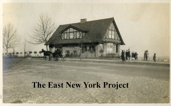
Highland BoulevardEarly turn of the century postcards featured the Upper Park, as most of the lower park was not purchased until 1905 and not developed until a few years later. In the early days the Boulevard had a gazebo on the south side of the roadway with a terrific view looking out over East New York. That gazebo acts as a marker to help ID a number of the old postcards including the orientation of the view. The story here is from Alfred Kazin's book, "A Walker in the City"  |
||||
 |
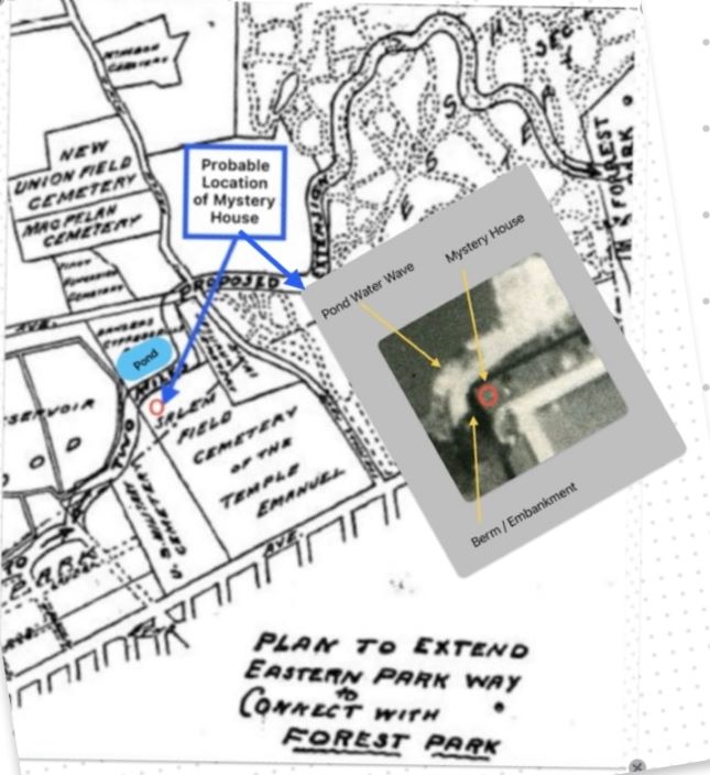 |
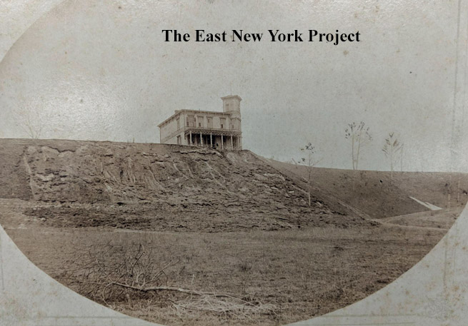
Highland Boulevard, Mystery house We open with this turn of the century image from Brian's collection that is simply marked "Development of Highland Boulevard." Our first reaction was this was the Ridgewood Reservoir's caretaker's house, but it doesn't match known images. Anthony Messina has developed a plausible theory, but you have to be an Uber-ENY nerd to process it. He also supplied the supporting graphic on the right. Early proposed extensions of Highland Boulevard ran past the reservoirs and south of Banzer's Park. There were embankments constructed on this path to prevent encroachment of Banzer's Pond, and the visible erosion was likely caused by the pond's wave movements. In addition, the 1873 maps show some buildings along that route in this location. |
||
 |
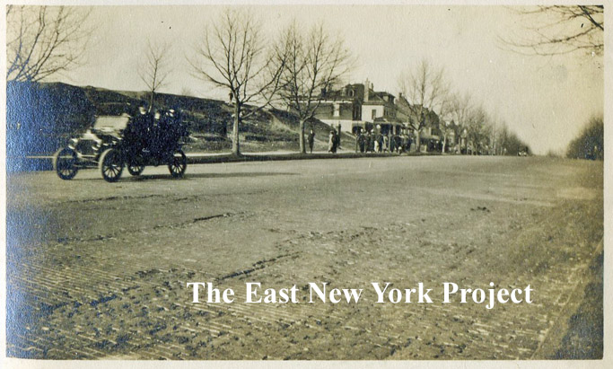 |
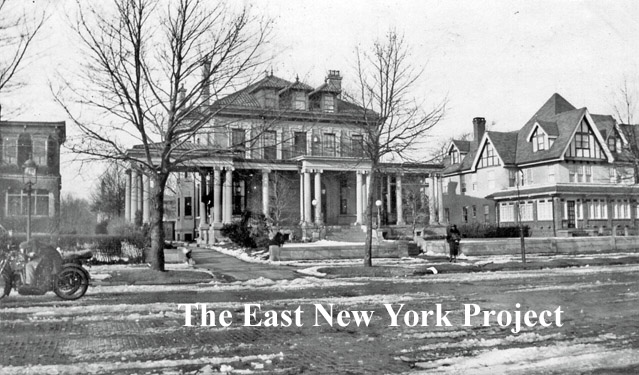
There existed another reservoir atop Highland Park along the boulevard as seen in the 1909 map on the left. It was privately owned by the Long Island Water Supply Company, serving the Town of New Lots when it was not part of Brooklyn. On the right is a very rare view of the Boulevard taken in front of that reservoir, looking east about 1910. | ||
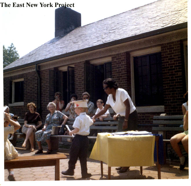 |
In 1893 Long Island Water wanted to sell the system including the reservoir to the City of Brooklyn, but apparently it was not an impressive affair. The city does eventually buy it and it becomes part of Highland Park, the area where the upper park house, playground, and ballfields sit today.On the right, Tony Davenport contributes a 1963 photo of his pre-school graduation in Upper Highland. The teacher was Ms. Flemming (Thanks Lou Alba.) | |||
 |
 |
279 and 278 Highland Boulevard This 1921 image of 279 Highland Boulevard on the left made our book, and some time ago historical blogger Suzanne Spellen did a piece on the original owners of the home for The Brownstoner. It was the residence of Adolf Gobel, once known as "The Sausage King of Brooklyn". You can find the original article here. (Thanks to Marco Panchame for that tip.) The builder of that home was Adam Wischert, who had conveniently constructed his own across the street at 278 Highland Boulevard. That rare image on the right probably dates to 1909 when the house was likely completed. Suzanne speculated the architect for the Gobel home was probably Louis Allmendinger, and he may have designed Wischert's as well. Both homes remain standing today. |
||
 |
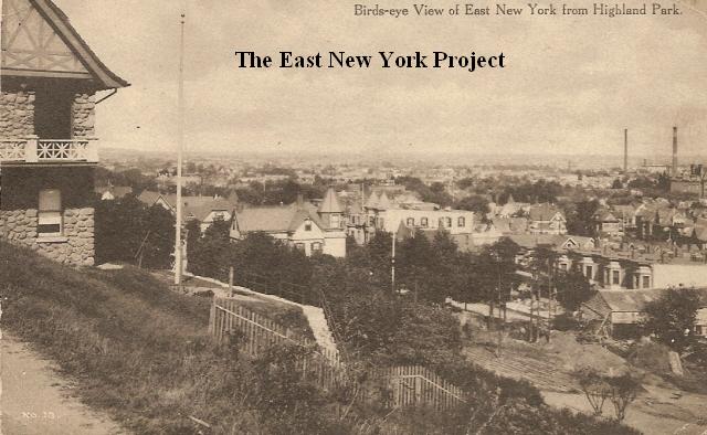 |
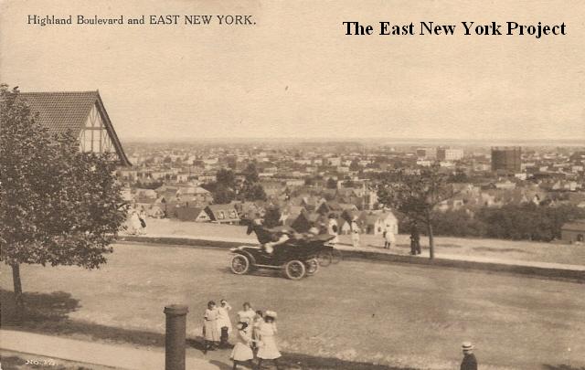
Highland Boulevard and East New York Dated:Unk Maker:P. Miller Status: Own(BG) Birds eye View of East New York from Highland Park Maker: Wm. Fick Dated : 1911 Status: Own (RG) Wischert's tudor-style home can be on the left of both post cards. The tank in the distance was located south of Atlantic between Cleveland and Ashford and belonged to Brooklyn Union Gas. Given the sightline, that must be P.S. 64 in the distance. Thanks to Anthony Messina for spotting that. The house with the turret still stands on Barbey and Sunnyside and is circled and labeled "A" in the Local live shot below. |
||
 |
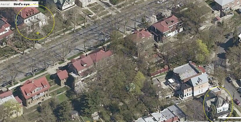 |
Highland Boulevard, East New York Dated:Unk Maker:P. Miller Status: Own(RG) This view, looking east, shows the houses on the northern side. 279 Highland on the left is still standing and is labelled as "B" in the Local Live shot. I actually think most of those houses on the north side are still standing; the few towers and turrets that are visible seem to match those of the 2006 shot. |
||
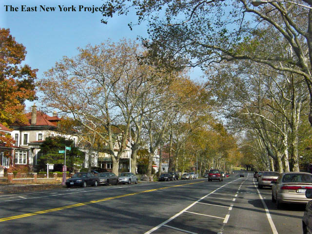 |
A shot I took in 2006 gives a view of the majestic houses on the north side. Many folks have told me Lena Horne lived in this section, but I haven't identified the house. Rick Constant wrote; "She lived up at the top of Highland Blvd. I'm not sure which house, think it could have been a real large house on the north side of Highland Blvd. east of Miller Avenue across the Blvd, but I'm really not sure. Her son, older then me, had a white Daimler SP250 sports car and once I met him at a local Gulf gas station across from the National Cemetery on Jamaica Avenue; when I admired his car we had a conversation. He some times walked down Linwood Street, I guess going to take the el at Cleveland Street." | |||
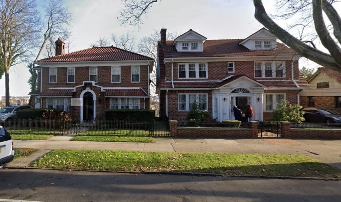 |
286 and 290 Highland Boulevard Highland Boulevard has carried the subtitle "Vito P. Battista Boulevard" since 1992. Born in Bari, Italy in 1909, the architect and state Assemblyman (1909-1990) served the 38th Assembly District from 1969 to 1975 and ran unsuccessfully for Mayor of New York on 6 occasions. He was a Republican State Committeeman for 20 years and was a delegate to five national Republican conventions. He resided at 290 Highland Boulevard (house on the left). He passed in 1990. |
|||
 |
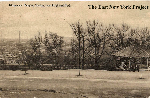 |
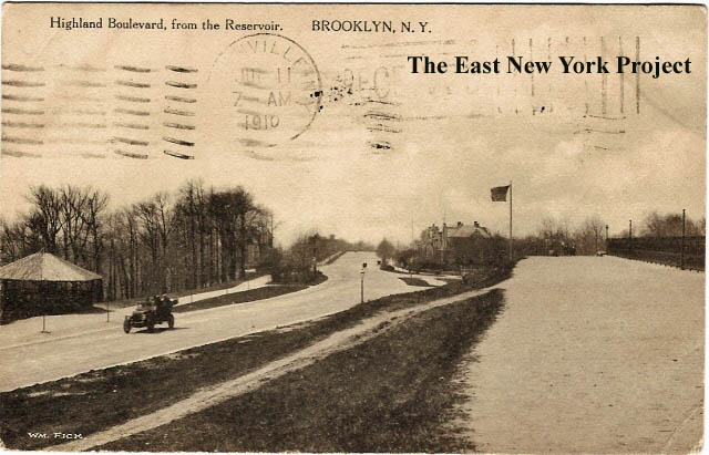
Highland Boulevard, from the Reservoir Maker: Wm. Fick Dated: 1910 Status: Own(BG) Starting from the eastern end of Highland Boulevard, this view is west with the reservoir on the right and the gazebo on the left. Ridgewood Pumping Station from Highland Park Maker: Wm. Fick Date: 1910 Status: Own(BG) This view looking south shows the great view from the gazebo. |
||
 |
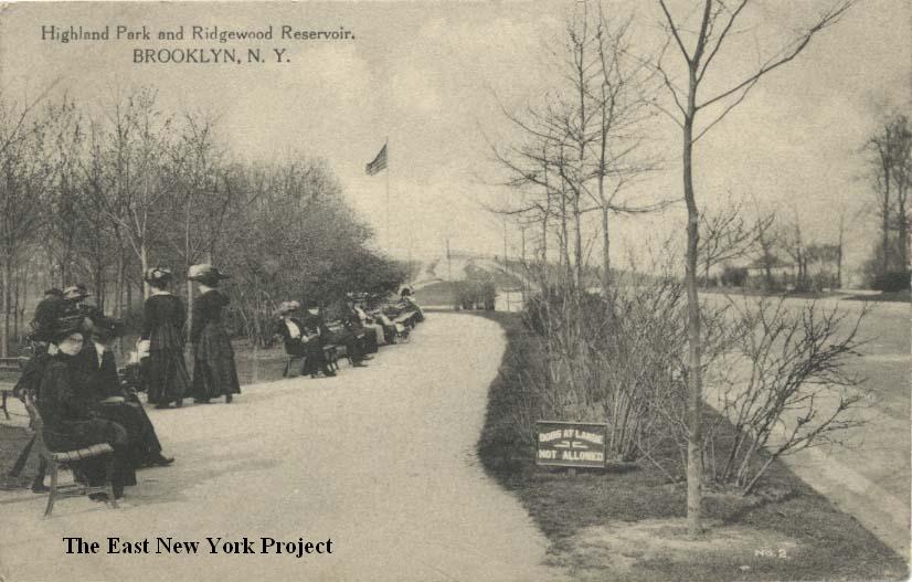 |
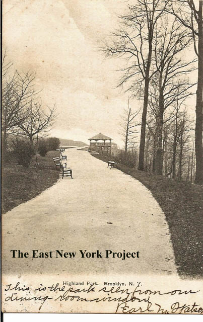
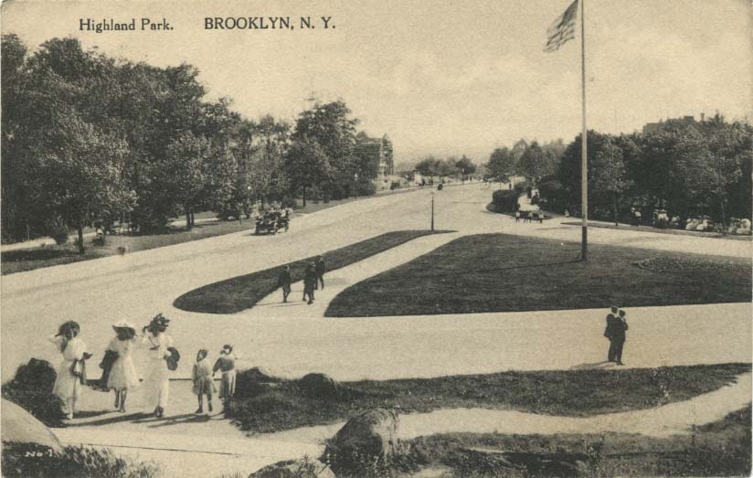
Highland Park, Brooklyn N.Y. Dated: 1906 Maker:American News Co. Status:Own(BG) Highland Park and Ridgewood Reservoir Maker: Wm. Fick Date: 1910 Status: Own(BG) The view on these two shots is east. I do not know when the gazebo was removed. |
||
 |
 |
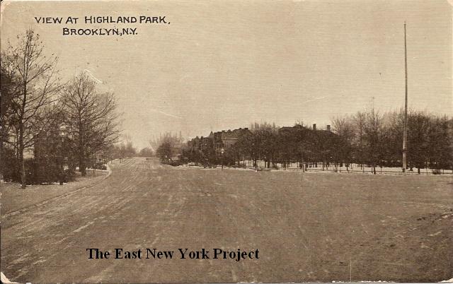
Highland Park, Brooklyn N.Y Dated:1907 Maker:Wm. Fick Status: Own(RG) A view west down Highland Boulevard, taken from the reservoir elevation. On the right, the view in 2007. |
||
 |
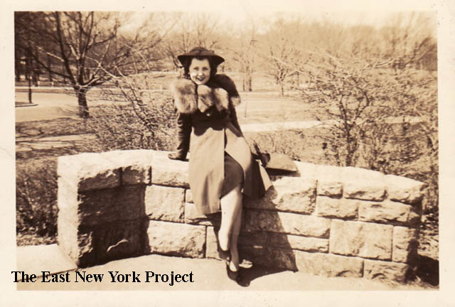 |
A View of Highland Park, Brooklyn N.Y Dated:1916 Maker:Kraus Status: Own(BG) The view is west down Highland Boulevard. On the right, Joann Montgomery supplied a picture of her aunt Louise Sholz in April of 1943. I believe she is at the southwest corner of the reservoir. |
||
 |
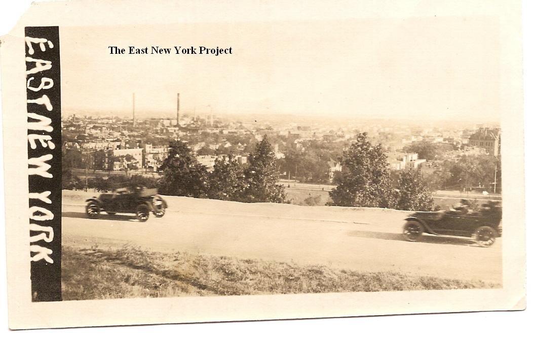 |
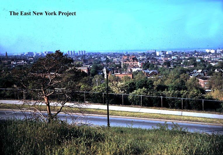
On the right, a photo circa 1920 with a view south, probably taken from the reservoir. P.S. 108 can be seen in the distance on the right. Note the lack of any fence or guardrail. Gloria Gallaway supplied a color view from a similar angle in the 1950s, with P.S. 108 visible in the distance. | ||
 |
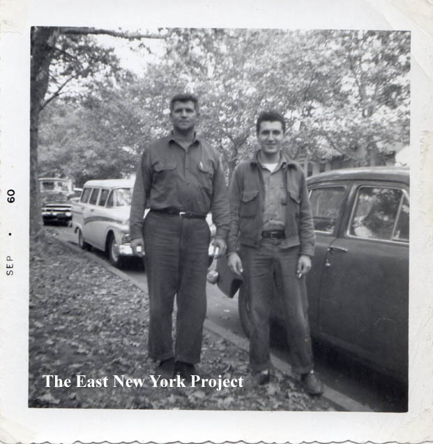 |
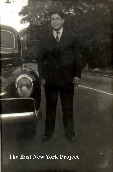
On the left, Leonora Licata sent this image of her father Mario on Highland Boulevard sometime circa 1939. On the right, Ronnie Amerise and park co-worker Dom by Ronnie's car on Highland Boulevard circa 1960. . | ||
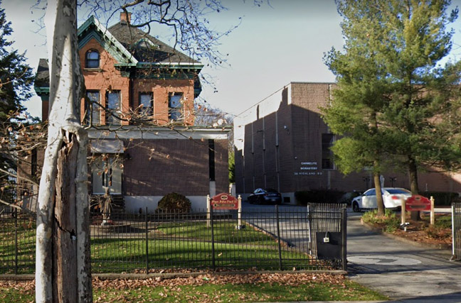 |
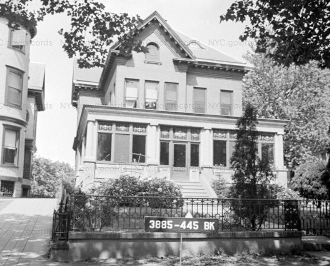
Carmelite Monastery, 2023 I was tipped off in the spring of 2023 that the Carmelite nuns who inhabited this monastery were leaving after 20 years. The loud noises of weekend Highland Park crowds were no longer conducive to their devotion to peaceful meditation and prayer. The Diocese had purchased the property from the Society of Franciscan Father of Greene, Ma. back in 2004. That organization had acquired the properties at 341 and 361 Highland Boulevard in the late 1960s. Apparently the lots along Highland Boulevard had covenants dating to 1887 mandating only single-family residential properties could be built, and local residents including Assemblyman Vito P. Battista opposed the Franciscans plans. A court ruling in 1968 allowed the Franciscans to proceed, and in 1974 they constructed new buildings at 361 and altered 341 Highland Boulevard. |
|||
 |
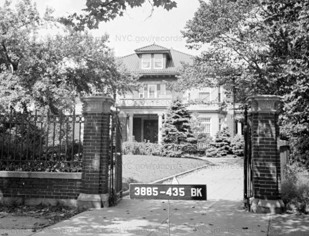 |
341 and 361 Highland Boulevard, 1940 I tracked down the 1940 tax photos for these properties. The alteration to 341 wasn't very kind to the original architecture. The mansion that was demolished at 361 Highland Boulevard appears to have been built around 1912 for Morris Salzman (1869-1930), a successful liquor merchant who would eventually go into banking and was very prominent in Jewish philanthropies. His son Samuel would not only follow in his footsteps as a liquor merchant and philanthropist, he remained at the mansion into the 1940s. Samuel was President of the Jewish Federation of Brooklyn Charities. Reviewing the census records of 1915-1950 reveals life in a different time, when the help often outnumbered the family. Chauffeur, gardener, cook, maid, and families were all listed in the household, including a "rear building" not seen in the tax photo. |
||
 |
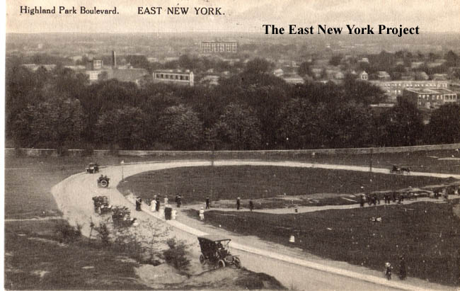 |
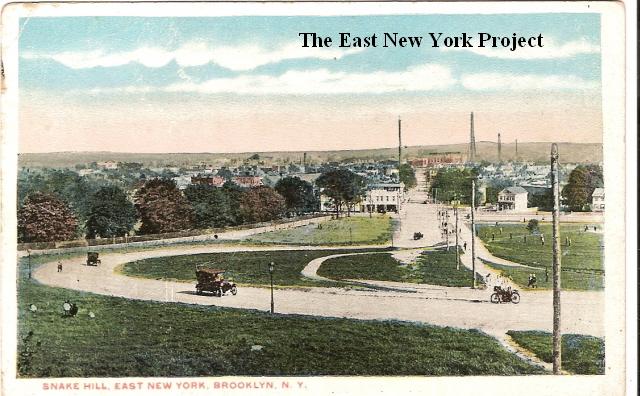
Snake Hill, East New York Dated:Unk Maker:Commecial Art Post Card Co. Status: Own(BG) Highland Park Boulevard, East New York Maker: P. Miller Dated: 1915 Status: Own (RG) "Snake Hill" continued to be used as a reference to the section of Highland Boulevard curving down toward Jamaica Avenue in the 60s and 70s, but in fact these two post cards show the real "Snake Hill." The road was designed with the S-shaped switchbacks to ease the incline on horses pulling carriages up the slope. When automobiles came along, these curves proved to be challenging and accidents were common events. After much public outcry, the sharp curves were removed and the road was dedicated on October 31, 1925. |
||
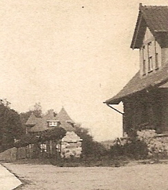
The Haunted HouseThis is a childhood memory of mine, I am still chasing it. On the south side of Highland Boulevard stood a Victorian-inspired house, the rear of which overlooked the park. It was damaged by fire in the late 1950s or early 60s and was boarded up. The combination of weeds, Victorian touches, and damage gave it the perfect haunted house look. My mother used to take us on walks up to the reservoir and we always stopped to look at the house. Sometime in the mid 1970s it was purchased by my aunt's former landlord on Georgia Ave. and a new house was built which still stands. I'm still searching for pictures of the original, in its damaged state, the replacement, as well as its history. |
||||
 |
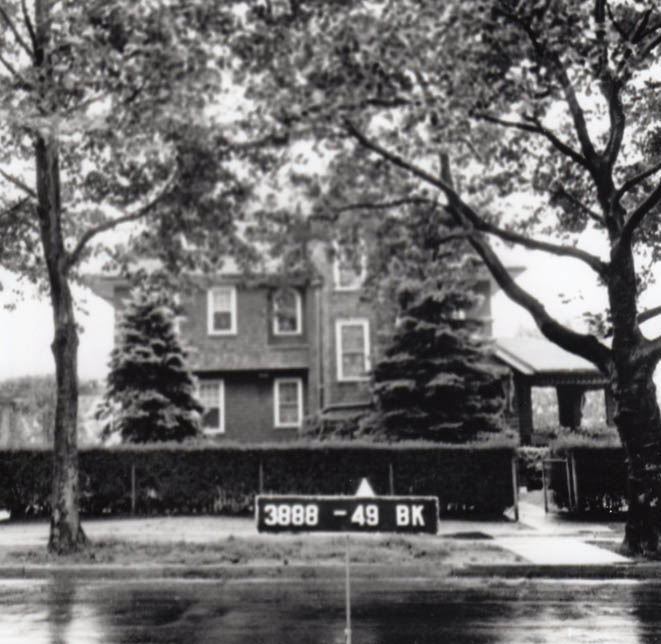 |
"Haunted house" picture and location On the left I enlarged the last Highland Boulevard postcard to point out the house. After further investigation I have determined Neil Sullivan did find the correct tax photo of the house, shown on the right. The house was built in 1909 for Harold C. Smith, a lawyer. The 1930 census records show Harold was still living there at the age of 75 with several maids and a nurse- his wife must have passed away between the 1920 census and then. In the 1930 census, the value of houses were recorded and this was was estimated to be worth $100,000 at a time when a typical house in the area ranged around $10,000. |
||
 |
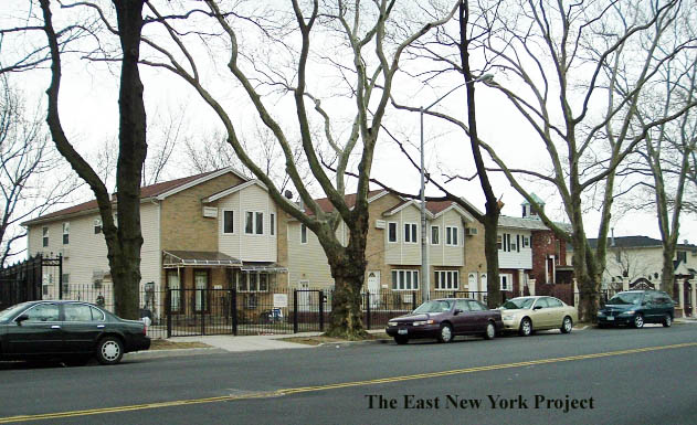 |
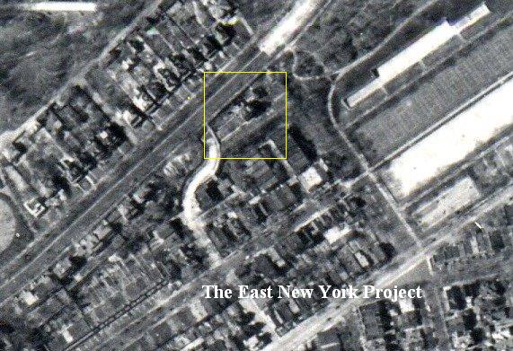
On the left, a 1951 satellite image shows the location. We do not have the date of the fire which destroyed the house. We know Stanley Sasowski purchased the property in 1967 and built a new house. We heard from his daughter Anastasia who informed me the house is the one on the far right in that update photo sent by Neil Sullivan (with the cupola). She lived there to 1983 and those newer houses to the left were built after that. | ||
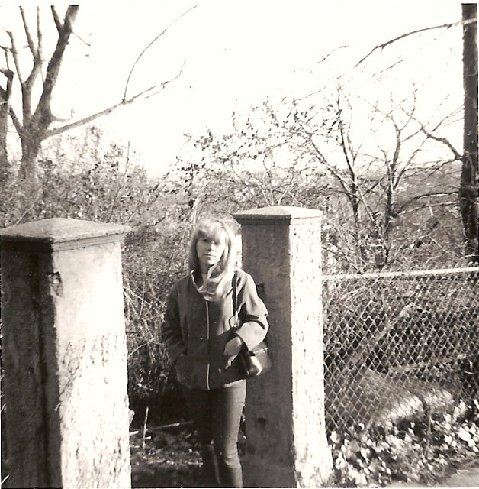 |
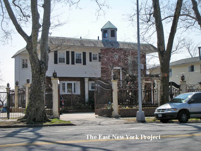 |
A step closer? Lucy (Patini)Ellis sent in this 1965 photo and she believes she is standing at the gate to the house. On the right, a full 2009 shot of the house Stanley Sasowski built. | ||
Banzer Park"Youngsters residing in East New York of old are not required to go without the thrills to be found riding astride the brilliantly painted animals riding atop a merry-go-round, for one was operated in Banzer's Cypress Hills Park. This amusement spot, opened in 1860, was located at Rocky Hill Road and Cypress Avenue, opposite the reservoir. It had all of the recreational facilities looked for years ago. Parties of picnickers out for a day of wholesome amusement found it in the bowling alleys, shooting galleries, swings, dancing pavilion (which was of considerable size, being 240 feet square), and a dining room large enough to accomodate 450 people. Those who visited Banzer's also were able to enjoy boating for of the 11 3/4 acres contained in the park, 5 1/4 acres were taken up by a lake. And when cold weather set in, the frozen surface of Banzer's lake hummed day and night to the tune of steel blades gliding across the surface." -Frederick Heidenreich, 'Old Days and Old Ways in East New York' |
||||
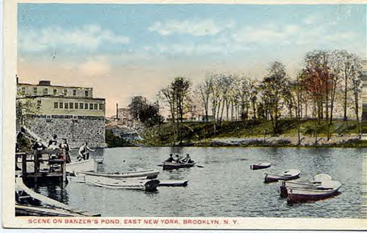 |
Banzer Park Pronounced 'Bahn-zer', I was informed by June Marmo, whose mother used to visit the park. In those days people used to 'dress to the nines' on a Sunday and head to the park to hear live concert music,go boating in the lake, and enjoy the outdoors. Peter Stango's Uncle Ray is old enough to recall taking a girl on a date at the lake; "..she had on this big fancy hat (I'm thinking dressed to the 'nines') and it blew off her head. He said he was rowing like crazy all over the place. anyway the hat went under and 'That was the end of that date' never saw her again. " |
|||
 |
 |
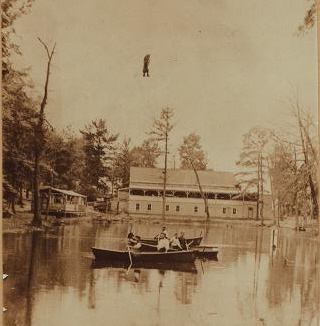
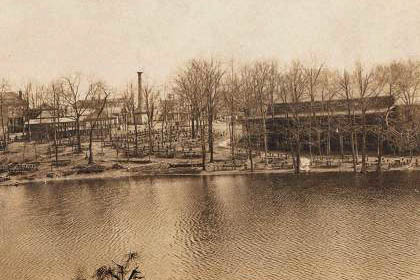
Banzer Park These images are undated, described as a view of the "Banzer Estate". Check out the first photo; a tightrope walker is practicing above the pond!The second photo is described as a view south from Cypress Hills Avenue. Dec 9, 1901 Brooklyn Eagle article on ice skating at Banzer's Pond |
||
 |
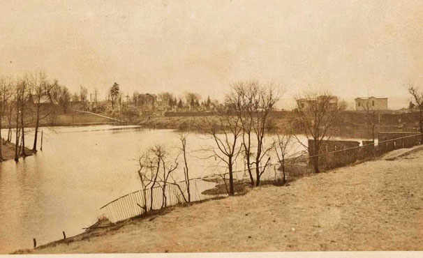 |
Banzer Park Anthony Messina and I have been going over these images which we believe are misidentified. The one on the left is circa 1916 and was identified as Highland Park, and the one on the right as the reservoir. We believe these are both images of Banzer's. |
||
 |
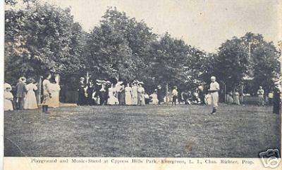 |
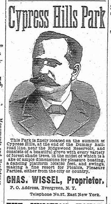
Cypress Hills Park At some point, Charles Wissell becomes involved in the park, and it is also referred to as "Cypress hills Park. This advertisement ran in the Newton NY Register from 1889 to 1895. |
||
 |
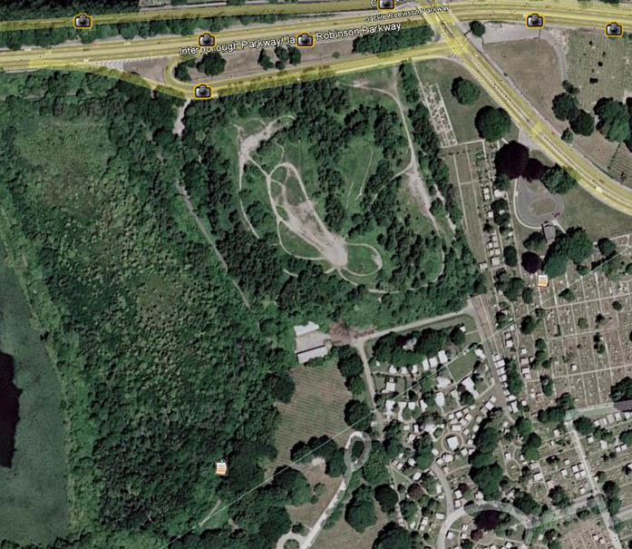 |
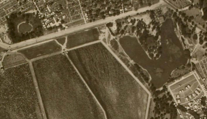
Banzer Park location aerials On the left is a 1924 aerial view; Banzer's lake can be seen on the right. The north part of the property is sold in the early 1920's for the Interboro project; the southern part sold to Salem Fields in the late 1920s. The lake is now gone. Thanks to Anthony for the tip on the 1924 image and his research on the images. |
||
 |
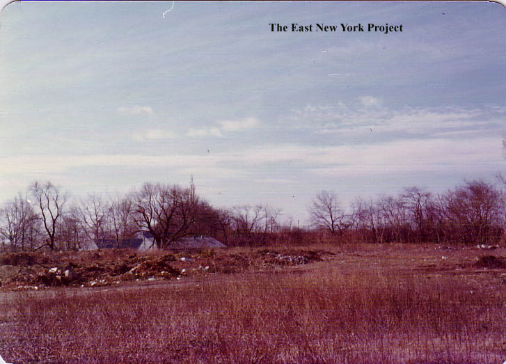 |
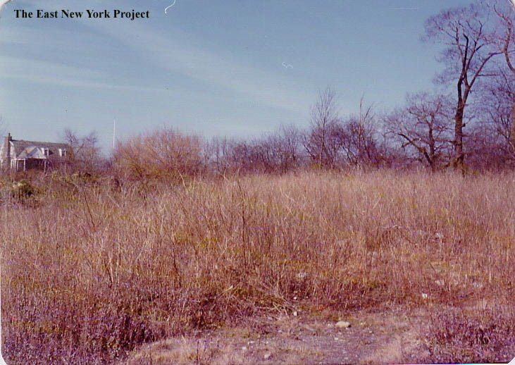
Banzer's Field 1970s Old P.S. 108 pal Dom Most sent these over from Italy- he used to go up to the area where the park was located ("we thought it was Banza's" he said) and took these pictures back in the 1970s. Anthony Messina notes the last caretaker house (see reservoir page) is visible, making the view west toward the reservoir. |
||
 |
 |
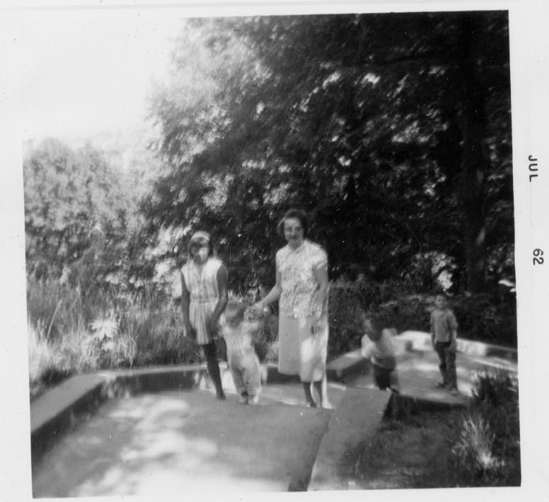
On the left, a 1962 family photo climbing the steps to the Upper Park. On the right, Tony Davenport contributes a 1963 photo of his pre-school graduation in Upper Highland. The teacher was Ms. Flemming (Thanks Lou Alba.) | ||
 |
I've been aware of a mystery reservoir that was located in the Upper Park area since I discovered it on a 1909 Queens map, but it was Anthony Messina who solved the mystery. The Reservoir belonged to the Long Island Water Supply Company, a private concern, and they had constructed a hydrant system along New Lots Road. Note the New Lots Pumping Station served this reservoir. In 1893 they wanted to sell the system including the reservoir to the City of Brooklyn, and apparently it was not an impressive affair. The city does eventually buy it and it becomes part of Highland Park, the area where the upper park house, playground, and ballfields sit today. | |||
 |
Music Pavilion Highland Park, East New York Dated: 1918 Maker:Commercial Art Post Card Co. Status:Own(RG) This is not a structure our generation will remember. Across the road west of the reservoir (near the parking lot) stood a music pavilion, built in 1901. Click here for the pavilion page. I have not identified when it came down, it was quite some time ago, though the markings are still there as can be seen in the 2005 photo. At least ome site fan recalls it was there in 1958. |
|||
 |
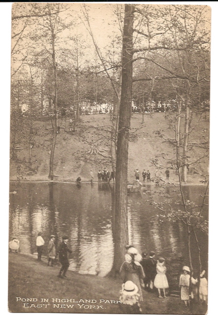 |
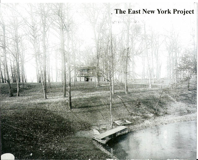
This great image is from the Brian Merlis Archives and shows the orientation of the pavilion. That water is part of a pond that once ran under Indian Bridge. Pond in Highland Park, East New York Dated: unk Maker:Unk Status:Own (BG) The pond is still a bit of a mystery. There were references to a Wright's Pond in Highland Park in some literature, but this was not labeled in the postcard. In addition, in the early photos of the bridge below, there is no water. |
||
 |
Wading Pond in Highland Park, East New York Dated: 1925 Maker:Commercial Art Post Card Co. Status:Own (RG) This card was postmarked 1925, but 1924 aerial images do not show a pond in the park. It's not clear if the pond existed for only a short time, or if the pond only had water intermmitently. |
|||
 |
 |
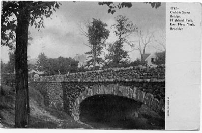
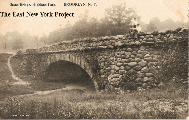
Cobblestone Bridge,Highland Park East New York Maker: Souvenir Post Card Co. Dated: Unk Status: Own (BG) We always knew it as "Indian Bridge" but no, it was built as part of the landscaping of Highland Park in 1902. Even in that early photo there is no water there. Oct 19, 1902 Brooklyn Eagle article on the Bridge |
||
 |
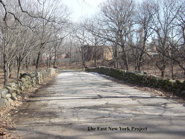 |
Stone Bridge, Highland Park, BROOKLYN, N.Y. Maker: Wm. Fick Dated: 1912 Status: Own (BG) On the back of the postcard I own it reads "I wrote my name and the children's names on this bridge the year it was built- 1903 - Jennie" . The 2005 photo on the right we used to know as "the fort"; does anyone know what this structure was supposed to be? |
||
 |
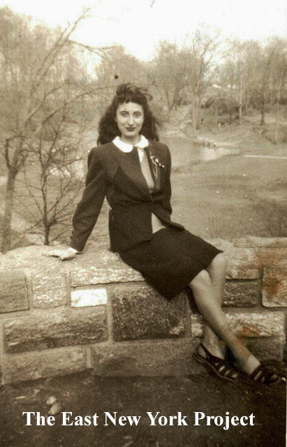 |
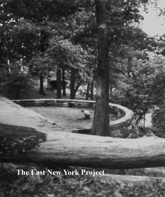
"The fort", Highland Park For some reason we haven't seen many old photos of what we used to call "the fort". Like Indian Bridge, it had its own folklore but the reality is that it was part of the original landscaping design of the park. Gloria Gallaway supplied the image from the 1950s on the left; Ronnie Amerise sent the 1947 image of his sister Rose. |
||
 |
 |
Highland Park, "Boulder Bridge" Dated: Unk Maker: Unknown Status: Own(BG) On the right Mary Ann (LaNeve) sends in this 1954 shot taken by the bridge of her two older sisters, Prudy (taller) and Phyllis, next tallest, with neighbors Maria and Bernadette Smith. |
||
 |
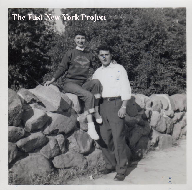 |
Highland Park Bridge Ronnie Amerise supplied this 1940s image of his sister Rosemary on the bridge, and a 1955 image of him and his sister when he was on leave from the service. "Who thought I would be working in Highland Park the following year?". |
||
 |
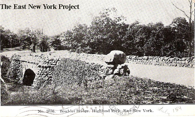 |
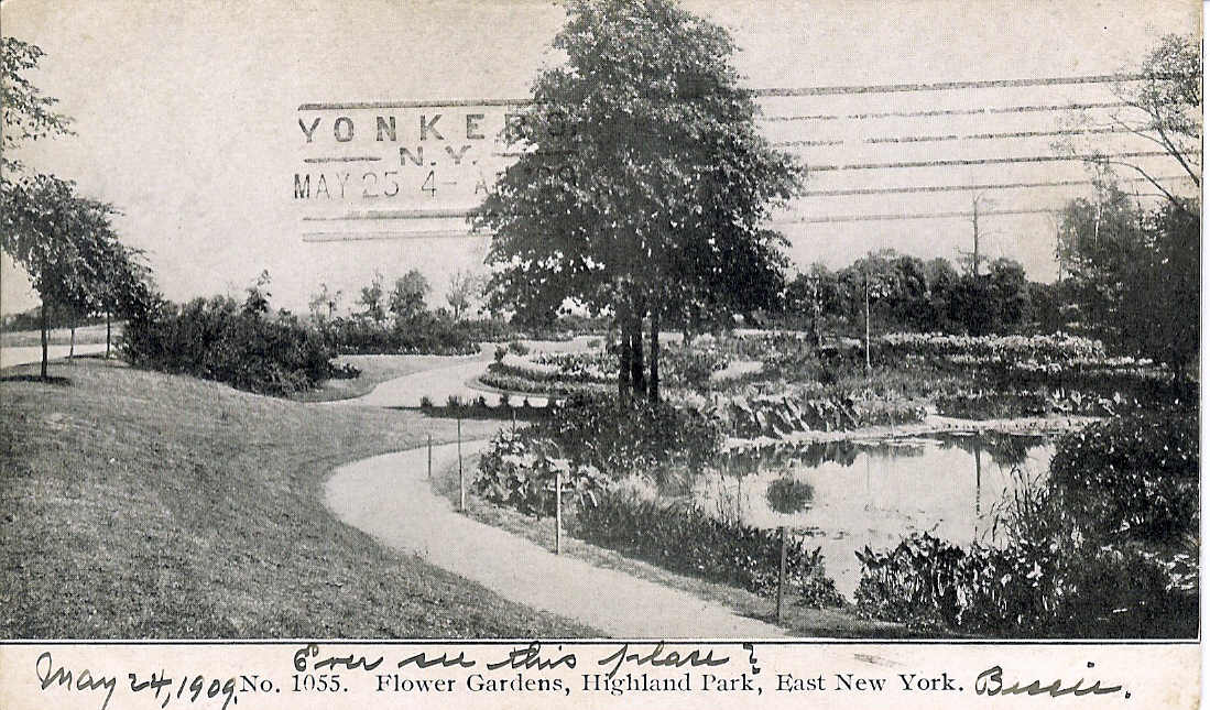
Cora (Gavin) Modica sent in this shot of her mother Marion by he bridge in 1942. Bowlder Bridge, Highland Park Maker: Lowe and Thompson Dated:1907 Status: Neeed We have found three of these Lowe and Thompson cards; #1053 (National Cemetery), #1055 (Flower Gardens) and this one, #1056. I wonder what card#1054 would be? Thanks to Al Durant for the image. |
||
|
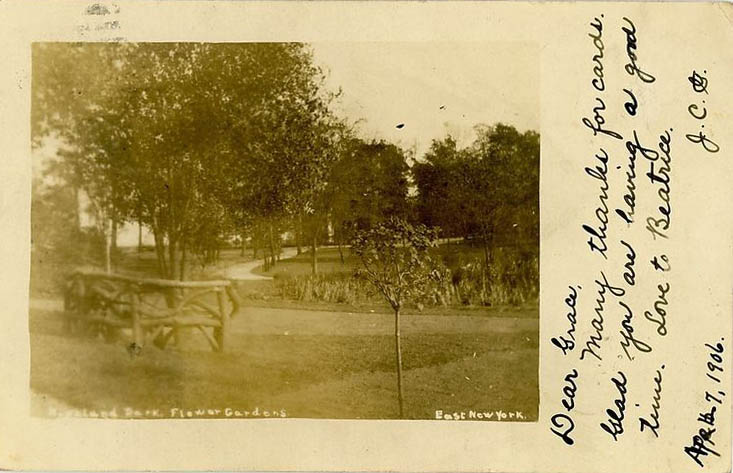
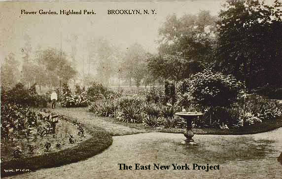
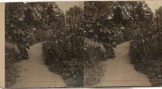
In the early days of the park, there was a area devoted to flowers. I believe the gardens were disbanded in the 1930s remodeling of the park during the WPA work projects. I have added an aerial view to show the location within the park. |
||||
 |
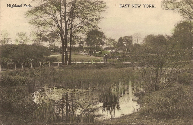 |
Flower Gardens, Highland Park East New York Maker: Unk Dated: 1909 Status: need Highland Park, East New York Maker: Unknown: dated 1914 Status: Own(BG) Well there was water at one point somewhere. This lake or pond existed in the early years of the park, I believe the garden was abandoned when the park was re-designed during the WPA work projects in the 1930s. |
||
 |
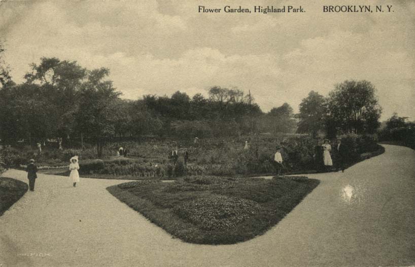 |
Flower Gardens, Highland Park, East New York Maker: RPPC Dated; 1906 Status: Need Flower Garden,Highland Park Maker: Wm. Fick Dated: 1907 Status: Need The rare RPPC on the left shows an arbor bench which does not appear in any of the other card images. |
||
 |
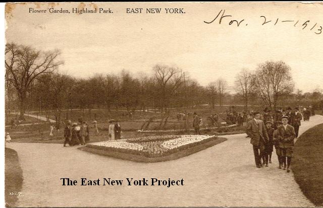 |
Flower Garden, Highland Park Maker: Wm. Fick Dated: 1910 Status: Own(BG) Flower Garden, Highland Park Maker: Wm. Fick Dated: 1913 Status: Own(BG) |
||
 |
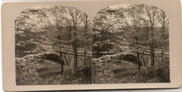 |
Early stereoscopes of the flower garden and the bridge. | ||
 |
 |
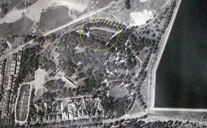
I circled the garden in this 1930s aerial image to show the location. Flower Beds in Highland Park, Brooklyn NY I've never seen this make of postcard before - thanks to Al durant for the image. |
||
 |
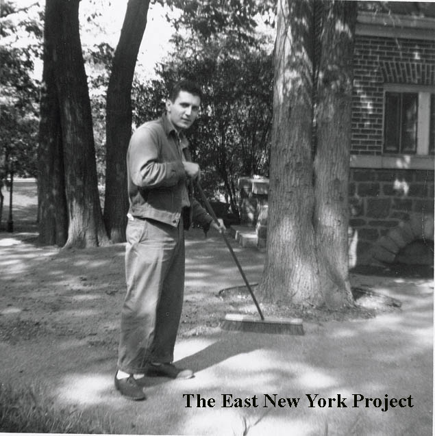 |
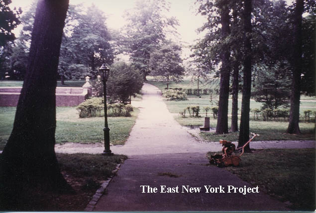
"Ronnie" Amerise worked at Highland Park starting in 1956 and he clarified for me the change in the gardens. The WPA projects in the late 1930s changed the original landscaping. A rectangular low wall was constructed, and I thought the area was meant to be a performance spot but Ronnie recalls it was still a garden area. Ronnie supplied these shots from the early 1960s; the garden area from the comfort station and Ronnie himself by the station, which was removed in the 1980s. | ||
 |
 |
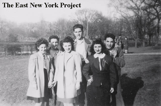
Ronnie also supplied this late 1940s view of his sister and her friends in the upper park. Note the flagpole in the background which was by the gardens. Ronnie notes the practice of putting up the flag daily ended by the time he started there in 1956. On the right is Ronnie himself in 2007, by the roundhouse where they used to keep the tools and cutting machines. | ||
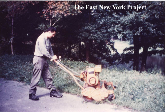 |
Finally here's Ronnie circa 1957 using one of those old cutting machines while doing maintenance in the park. | |||
 |
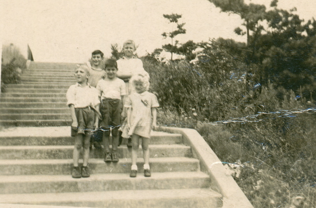 |
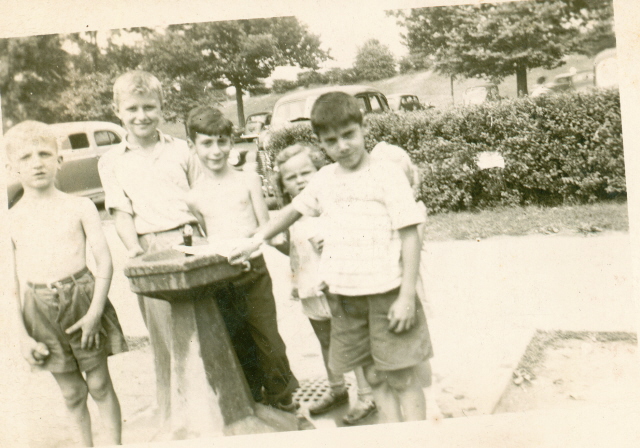
Joe Sadauskas sent in these these shots circa 1947, but he was unsure if it was Highland Park. Ronnie Amerise confirmed they were. The first shot is a view east, with the parking lot next to the reservoir in the background and the slope up to the reservoir behind that. Ronnie notes the concession stand was to the left, out of view. Ronnie also confirms the second shot was taken by the stairs that lead from Snake Hill up to the reservoir on the east side of the park. | ||
 |
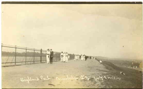 |
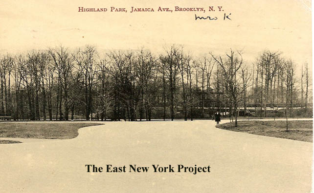
Highland Park, Jamaica Ave. Maker: J. Shinske Dated: 1911 Status:Own(BG) I have had trouble placing this image. The reference to Jamaica Ave. made me think it was the lower park but I believe I see the stone arch bridge and the pavilion in the background of that shot so I believe it is a view in the Upper Park. Highland Park Reservoir, July 26, 1914 Maker: Unk Dated: 1914 Status: Need A relatively new find, I haven't figured out the orientation yet. A reminder the reservoir page can be found here. |
||
 |
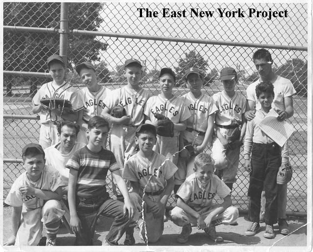 |
Upper Highland ballfields Wes Miller sends over this 1967 shot of him playing in a YMCA league game back in 1967. Gerry Carter supplies the shot on the right and the details; "Here is a picture in upper Highland Park of The Eagles (later known as Montauk Bootery) who played in a league with 5 other teams in 1961-1962. Other teams were Carl's Deli, Cobras, Elks, Seehy Chapel (not sure of the spelling), & the Braves. Standing (L-R) Gerry Carter(1st), Lenny Gates (3rd), Frank Sodano (Pitcher), Frank Bevacqua (Outfield), Jerry Keiger (SS), Doug Licari (2nd), Manager, Bob Crivelli (Catcher) Kneeling (L-R) Unknown (Outfield)Coach (My Father Clyde Carter), Managers son, Thomas Leonard (Outfield), Kevin Hayes (Outfield). The league had some great pitchers. Billy Hoyler (Carl's Deli)- extremely fast & hard to hit; Dennis Gulliano (Braves)- had a crazy wind-up & very fast; Billy Baerlein (Elks)- pitched with a lot of stuff on the ball and was also quite fast too. There could have been other teams and the teams I did list might have had sponsors. The league was run by Chris Hagan's parents from Glen Street. |
||
 |
 |
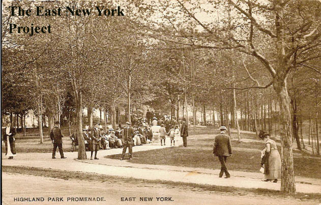
Highland Park Promenade Dated:1914 Maker: P. Miller Status: Own(BG) An Old Landmark in Highland Park Maker: Unk Dated : 1908 Status: Need I don't have the location of either of these shots pinpointed. Its the only reference I've seen to a 'promenade' and I'm guessing the Upper Park with flower garden and pavilion would be the more likely area. Only that obscured house in the background of the other card gives us any clue to location.Update: this tree was on the path near "Boulder Bridge", on the Highland Boulevard side. |
||
 |
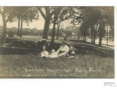 |
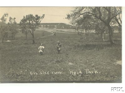
On the Run, Highland Park Dated:1909 Maker: Unk. Status: Need That appears to be the reservoir in the background, so I included this photo in "Upper" HP. Sunday Morning, Highland Park Maker: Unk Dates : 1909 Status: Need |
||