|
        |
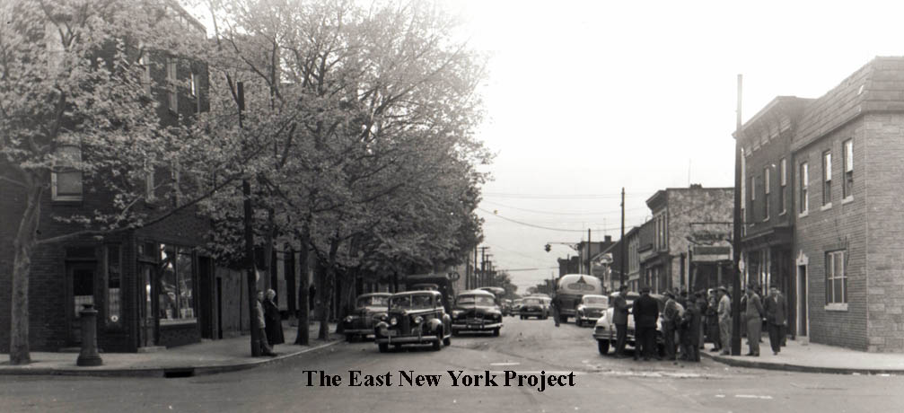
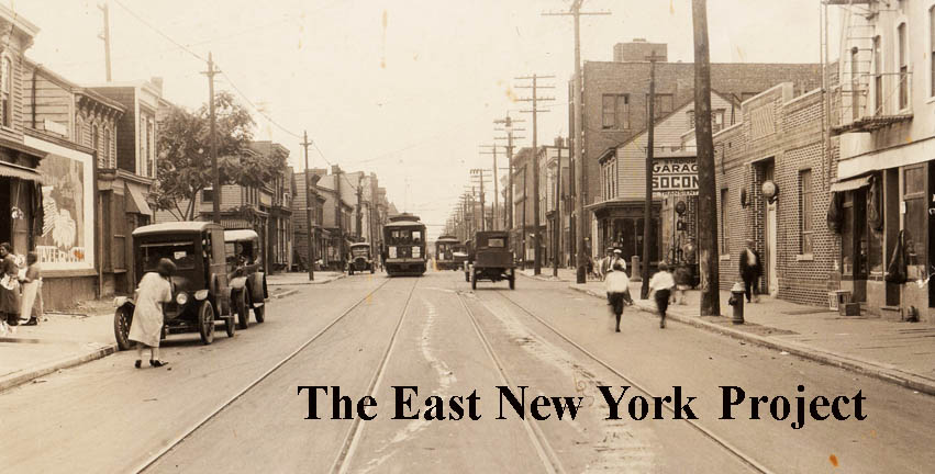
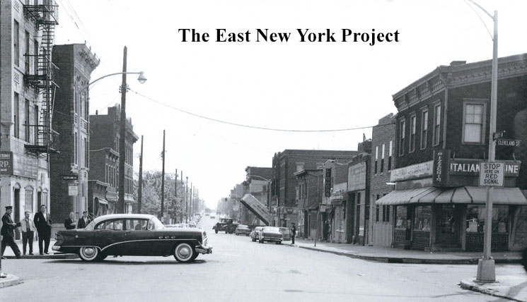
Liberty Avenue
|
|||
 |
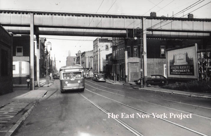 |
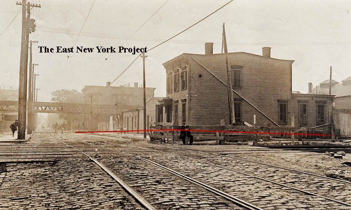
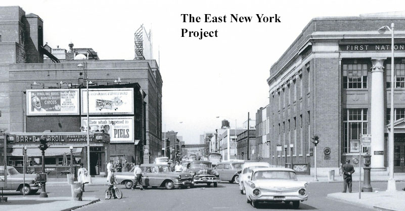
Looking east along Liberty Avenue toward Snediker,1910 and 1948 Starting at the western end, we begin with a really early 1910 view looking east across Van Sinderen Avenue and the old Manhattan Beach line. The tracks were at grade, and we can see a crossing attendant seated by the gates. In the distance , along Snediker, is the Fulton Elevated line. In the 1948 image on the right, we see the defunct Fulton Avenue Elevated structure with updated structure, running above Snediker Avenue. The large brick building in the distance behind the bus is the old Piels plant. There is almost nothing still standing from this image today. |
|
 |
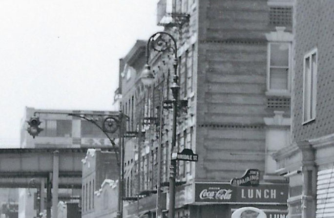 |
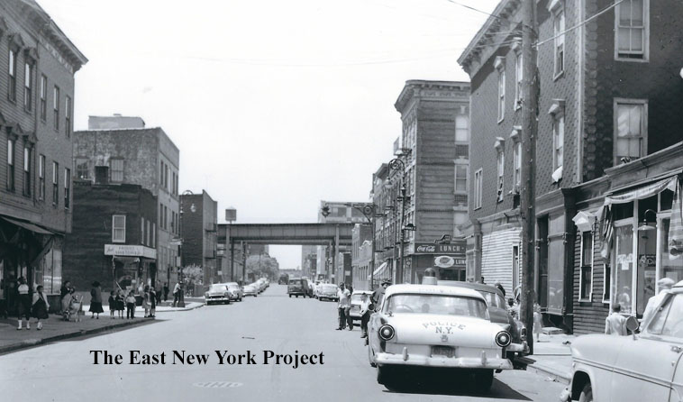
Looking west along Liberty Avenue toward Hinsdale Street, 1958 There wasn't much point in posting an 'update' shot. Nothing in this image is still standing including the Fulton Line El running down Snediker. Instead I focused on the police car of the era, and then I provided a close up portion to show the ironwork on both the traffic light and street lights as well as the shoe-shaped store sign advertising a business. According to Kevin Walsh's Forgotten Brooklyn website, the traffic signal post design was known as "wheelies" for the car tire motif present in the design. Apparently the first ones were installed in 1924. |
|
 |
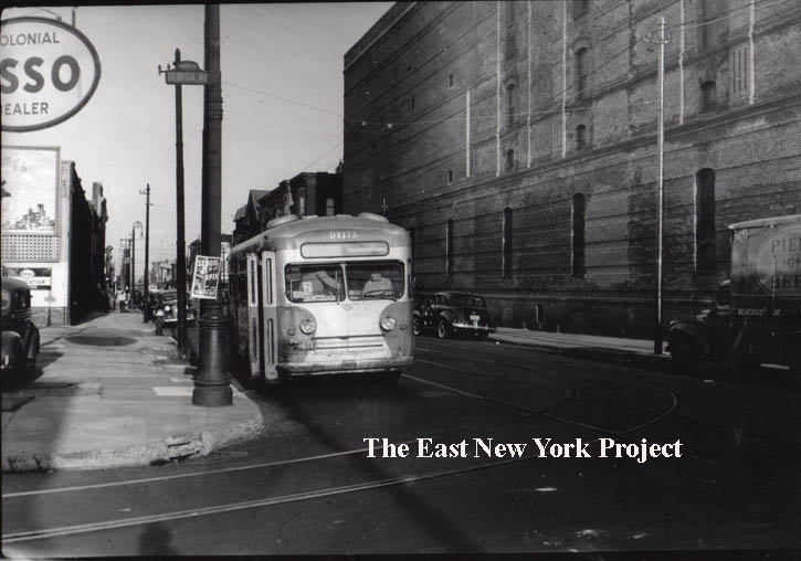
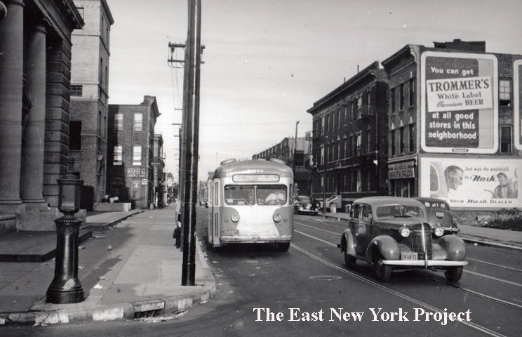
Liberty Avenue looking east toward Williams Street, 1958 Now we are flipping the camera east, with the Piels Brewery in the distance with the large sign atop. Most of this area today is zoned industrial/commercial. |
||
 |
 |
Liberty and Alabama, 1960s The first view is west along Liberty Avenue from Alabama Avenue. Note the updated street lights compared to the 1958 image above. On the right, the view is east along Liberty Avenue and we can see the Piels administration building. |
|
 |
 |
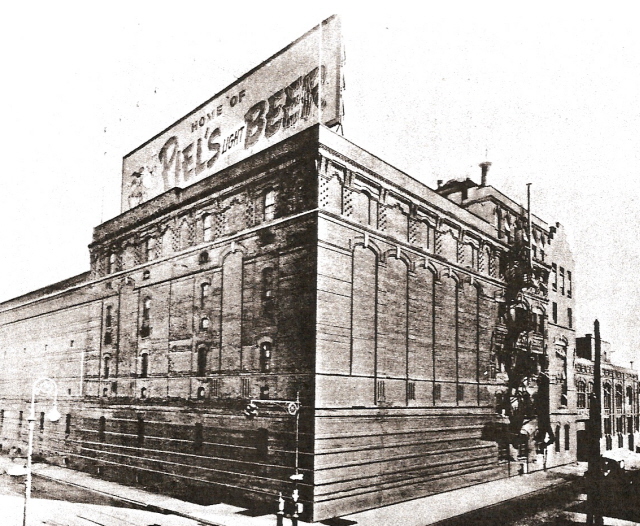
Piel's Brewery, 1947 and Admin building, 1963 Located off Georgia Avenue, the Piels Brewery had a famous neon advertising sign atop the building. Prior to using the "Harry and Burt" advertising scheme, Piels used gnomes in their advertising. These gnomes could be seen in the neon sign "bowling" as the lights changed. On the right, looking west in 1963 along Liberty across Georgia Avenue, we see the Piels Administration Building, built circa 1959. It remains standing today though most of the windows are bricked up. Thanks to the assistance of Breweriana collector TJ Wiegand, we have a page dedicated to the Piels brewery . |
|
 |
Liberty and Georgia Avenue, 1948 The view is east along Liberty from Georgia. The massive structure on the right is the Piel's plant, long gone. The lot currently stands empty. When I showed my mother the image, she remembered the gas station on the left and the attendant who used to tease her about being a Dodgers fan. |
||
 |
 |
Liberty Avenue, east from Sheffield Avenue 1953 and west To Pennsylvania, 1961 In the 1953 image we see the Polish Falcons Nest Bar and Restaurant. It occupied the old 26th Ward YMCA building, and a year later it was lost to fire in an arson incident. More pictures can be seen on the Pennsylvania Avenue page. The remainder of the right side of he block was cleared between 1994-2004, but the buildings on the left remain standing. In the 1961 view looking back west toward the same block, a burger restaurant occupies the lot where the old 26th Ward YMCA stood. |
|
 |
 |
Liberty and Pennsylvania Avenue, 1948 Both views are east along Liberty; the first is towards Pennsylvania Avenue and the courthouse and the second is from Pennsylvania Avenue in front of the courthouse. There's a nice timestamp of two defunct brands, Trommers and Nash, on the billboards. |
|
 |
 |
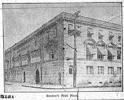
Bordens Dairy, Liberty Avenue 1905 The first Borden plant in East New York was located on Liberty Avenue, between New Jersey Avenue and Vermont Street.They would eventually take over the Empire State Dairy and move to their plant on Atlantic Avenue. For a little bit of mystery, the building in that location today has the exact same footprint, though it is clearly a 2-story building and the Borden building was 3 stories. I know Rubel Bros., the coal and ice company, used the building in the 1930s for garages. This one needs more investigating. |
|
 |
Liberty and Wyona, 1948 We are looking east along the north side of Liberty from Wyona. On the corner is Mannone's Poultry Market. That building and the one next to it are now gone. |
||
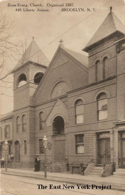 |
Zion Evangelical Church Maker: Wm. Fick Dated: Unk Status: own(BG) Located on the south side of Liberty Avenue between Wyona and Bradford, there is very little history on this church. A building in this location was used by East End Baptist in 1887, but we are unsure if it was this one. We believe this structure was a replacement built in the mid 1890s. The congregation is listed in the 1924 Brooklyn Red Book. In 1923 the Italian Church of Our Saviour was listed at this address, continuing into the early 1930s. Still standing in 1940,but demolished not long after. The address no longer exists, absorbed into another lot. |
||
 |
 |
South side of Liberty Avenue between Bradford and Wyona The one-story brick storage building sits where the church once stood. The uninteresting house to its left has some history. As seen on the right, it was constructed in 1889 to serve the New Lots Exempt Firemen's Association. |
|
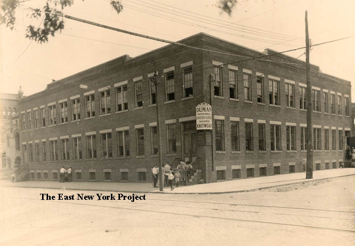 |
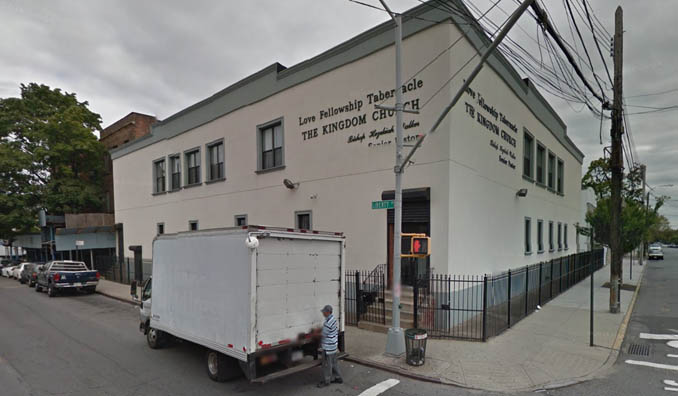 |
Duman Textile, Liberty and Bradford This picture dates to 1915. The view is the southeast corner and on the far left is the police station. The building is still standing and serving as a church, as seen on the right. |
|
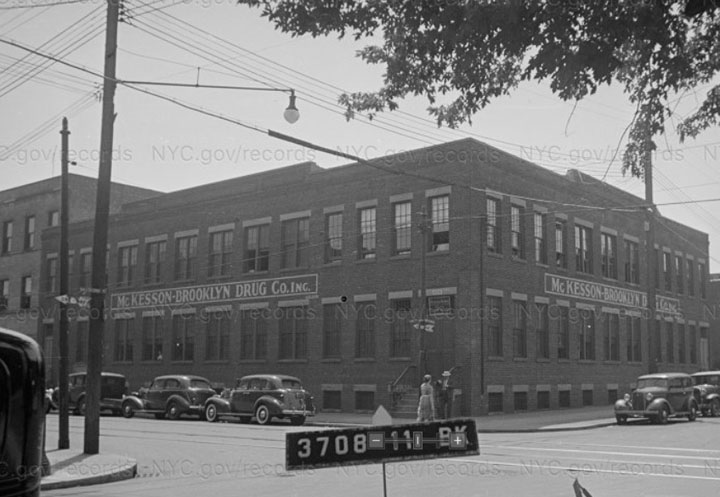 |
McKessen Robbins and the Great Scam By the 1930s, the same building is occupied by McKessen Brooklyn Drug Co., seen here in the 1940 tax photo. McKesson Robbins dates to 1833, but in 1926 they were purchased by F. Donald Costa. Costa was a con man; in fact, his name was fake, because Philip Musica had already served time in a number of scams. With the help of 3 brothers as insiders and outsiders, they created fake companies, fake accounts receivables, and fake inventories, all designed to make the firm look very profitable. Musica would then borrow large sums from his banks, which he spent on himself and co-conspirators. By the time the company treasurer uncovered the scam, there were $19 million in fake assets on the books, roughly $375 million today. Musica would take his life as the authorities were coming to arrest him. The impact of the fraud was a complete re-assessment of U.S. auditing standards. McKesson Robbins recovered, remained at the location until 1952, and is a massive global company today. |
||
 |
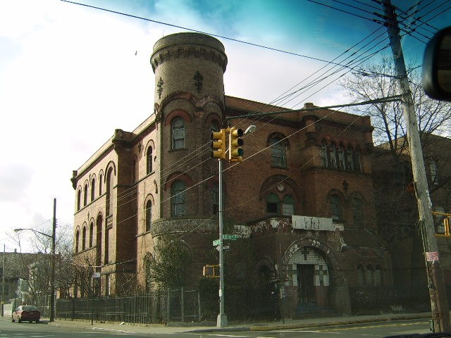 |
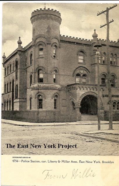
Police Station, Liberty and Miller Dated: 1908 Maker:Souvenir Post Card Co. Status: Own (RG) A current resident and fan of the site sent in a current photo; apparently it was a church for awhile. This station, designed by George Ingram, was constructed in 1892 for what was then known as the 17th Pct. The 75th Precinct is now located on Sutter between Linwood and Essex (thanks Rod). Check out the story on the old police station.  |
|
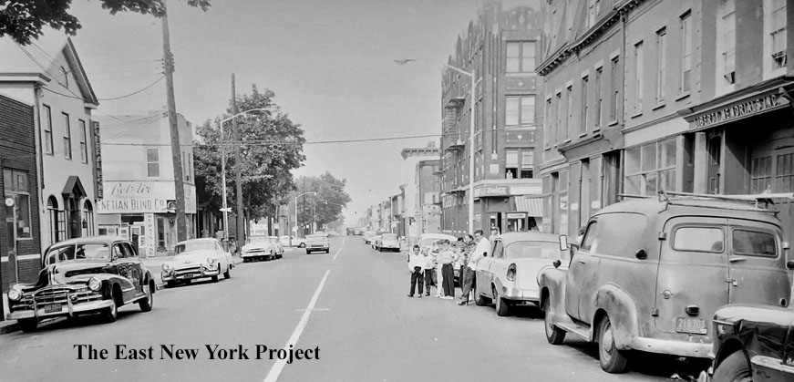 |
Liberty Avenue east toward Van Siclen Avenue, 1961 John Bader's Funeral home, a neighborhood fixture, can be seen on the left. It's pretty much the only building still standing in the image. It continues to serve the neighborhood today as Funeraria Juan. |
||
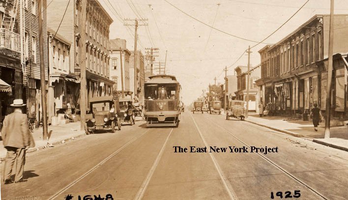 |
Liberty Avenue east from Hendrix, 1925 A great early shot showing a vibrant Liberty Avenue with a trolley rolling towards the camera. What's interesting is that a number of these buildings are still standing. You can spot some in the 1960s shots below. |
||
 |
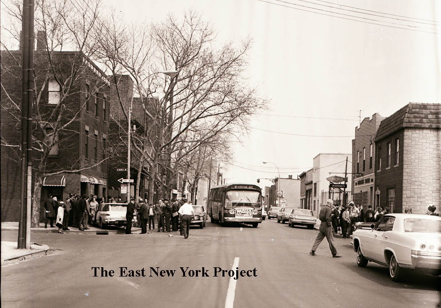 |
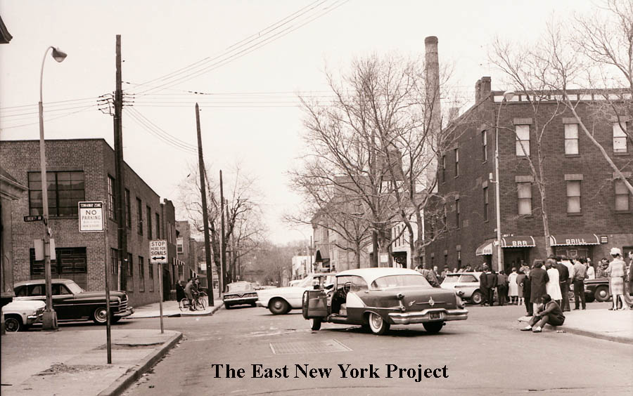
Liberty and Schenck, 1960s From the "accident" series. The first view is looking north, toward Atlantic Avenue. The smokestack is from the old Borden's plant. The view on the right is looking east along Liberty from Schenck. Doering's fishing tackle store is visible on the right. |
|
 |
 |
These are closeups from an alternate take of the second view along Liberty Avenue. | |
 |
 |
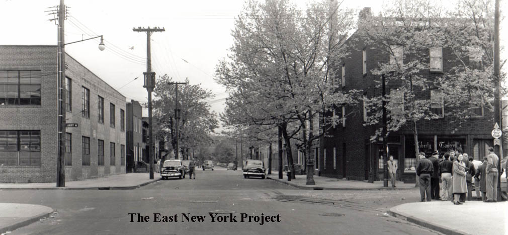
Liberty and Schenck, 1952 Ironically, this collection included an accident on the same corner in 1952; the bar at the time was the Liberty Tavern and we can see the fishing store on the right. |
|
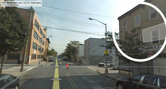 |
Liberty and Jerome On the northeast corner is the old St. Michael's High School, which is now housing the Salve Regina Academy- the combination of St. Malachy's, St. Rita's, St. Sylvesters and St. Michaels. There is a separate St. Michael's page with history and pictures. The location circled in this 2010 image is 606 Liberty. Apparently this is where the actor Steve Buscemi grew up in the 1960s. |
||
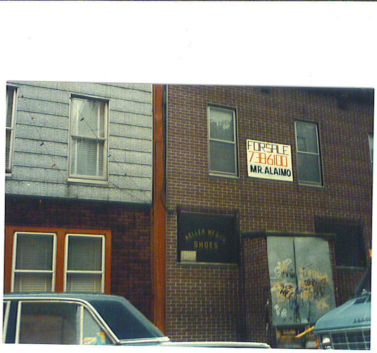 |
OK, we're working the south side of the block now between Warwick and Jerome. That's the remains of Keller Shoe Manufacturing in a 1962 photo taken by Rod Maggio. A footnote from his comments on fashion over in Zone 5; "..featherweights and french toe shoes were the most "coveted" style then you got them @ Thom McCann, AS Beck, and Kellers on s/side of Liberty Ave Warwick-Jerome; many called them Kellers Kardboards, but they were real leather too". Rod noted they did manufacture there, only doing retail in the 1940s-1960s. Rod also recalled they heated the place with a pot belly stove. Tim O'Reilly's family had some connections with the Keller family, and he includes an old photo with his Aunt's recollections under the 'Stories' button. |
||
 |
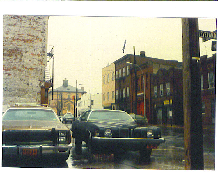
Also from 1982, Rod shot the southwest corner of Liberty and Warwick. The location was a "clubhouse" for a period from 1958-1960. | ||
 |
Liberty Avenue, east from Warwick Street, 1925 Another great early shot, looking towards Ashford Street in 1925. |
||
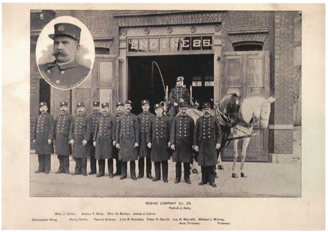  |
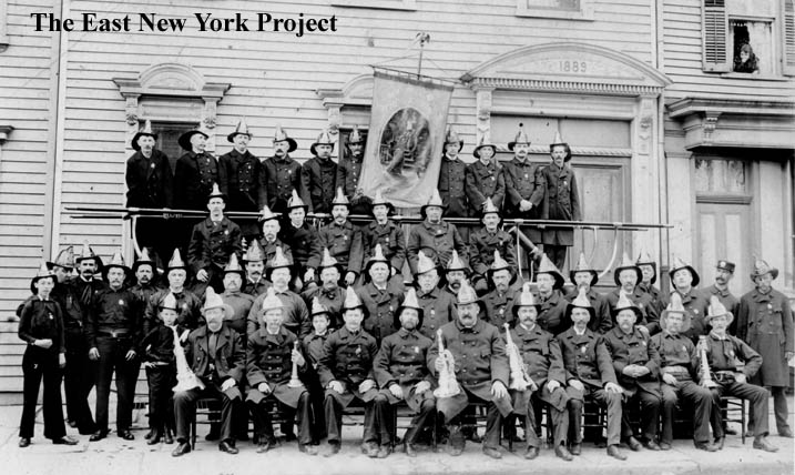
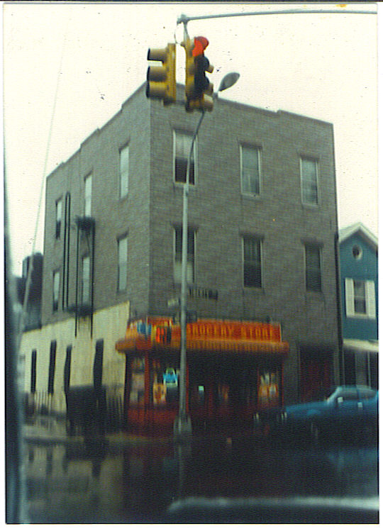
Engine 25, 1892 When the 26th Ward was incorporated into Brooklyn in 1886, the old volunteer fire departments were disbanded and the city of Brooklyn provided professional fire protection per the annexation agreement. The first company set up was Engine 25. In this photo they are standing in front of their permanent home, built in 1890, on the north side of Liberty between Ashford and Cleveland. Rod Maggio's 1982 pic of the north side of Liberty between Ashford and Cleveland shows the firehouse. According to Rod, it housed Ladder 225, which has since moved to Liberty and South Conduit. (Rick's note; Engine 25 became Engine 225 in 1913. No Ladder company served here, it was housed on New Jersey Avenue. Engine 225 moved to 799 Lincoln Ave. in 1970, where it remains today. Engine 332 took residence here in 1970 and moved to 165 Bradford Street in 1985.) Rod provides a lot more detail of the block under the "Stories" button. Google Books Digital archives. |
||
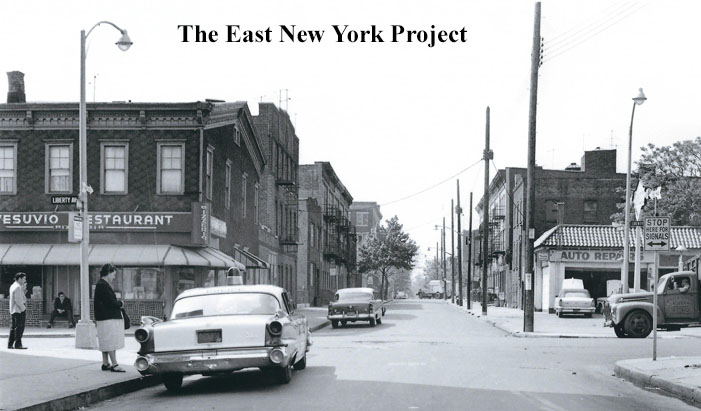 |
Looking south on Cleveland Street across Liberty Avenue, 1961 I truly regret I didn't obtain this image before Rod's passing. Now moving east between Cleveland and Elton- Rod Maggio:"(1) Don Peppe "Vesuvio" Restaurant, is actually his 2nd location, the 3rd in on Lefferts Blvd n-west corner 149 Ave, the 1st was on n-side liberty Linwood-Essex first building east of Blanda Funeral Home was three or 4 steps down from sidewalk exact time of moving to cleveland st can only be gotten from somebody "olda" than me... Along Cleveland side of building my friend John "Chutz" told me his uncle hadda poolroom there in the 30's............I only knew of a dress/clothing shop/factory there into the 60's.... |
||
 |
 |
Liberty Avenue, east across Cleveland Street, 1961 and 2022 Vinny and his cousin Phil Capasso adds some history to the buildings past Vesuvio's; "Next to Vesuvio's going east was a fruit store where "Stretch" sold fruit and vegetables out front. His mom and dad owned the building.The 3rd bldg from the restaurant was a garage (in the 30's) run by Al Alberti, (later) was Nappo Bakery, then a liquor store which prior to that was a bar. It had in the basement a passageway that came up into a house on Cleveland Street with an attached garage, and there was a pool hall next door. The house after the liquor store was occupied by Donna Speranza, the local Mid-Wife who by the way delivered cousin Phil!" The left (north side) of Liberty Avenue is now occupied by I.S. 302 and a playground. |
|
 |
 |
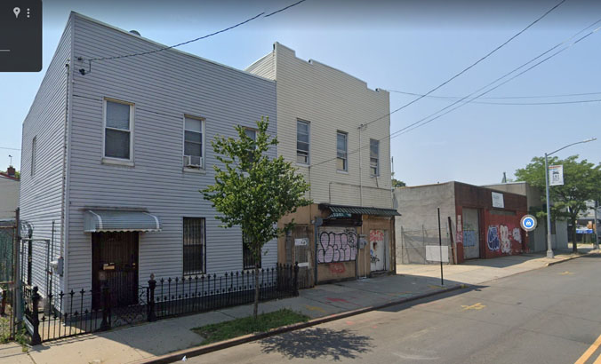
682 Liberty Avenue, Nappo's Bakery The 1940 tax photo gives us a better view of the garage later to become Nappo's bakery. Rose Hanley sent in this great pic of her grandparent's bakery; That's her grandmother Rose Nappo in the picture. She notes that the Vesuvio Restaurant was down the street and the Russos had a Lattecina across from the bakery. That brick building now serves a church today seen in the 2022 image above. |
|
 |
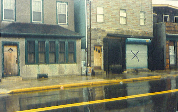 |
684 Liberty Avenue ENY legend, the late Rod Maggio, sent me this 1982 image years ago. It wasn't until I saw the tax photo that all the pieces came together. Rod wrote; "..(house with) the X in 1946 was Larry Rossi's Bar, his brother Mike ran it hadda kinda crippled guy Doxey working there. In the yard was a beer garden, and I think bocci court too? After it closed, became liquor store. Patty "Jug" Ardolino lived above it with his father Gaetano, his mother, olda sister and brother Freddie, and younger sister Madeline." You can see the Beer Garden sign in the tax photo and it likely had the bocce ball court as well. This building has since been demoilshed. |
|